
Shortcut to this blog post: https://tinyurl.com/cahokiacodes
Since I live right across the river from the ancient world heritage site Cahokia Mounds the place occasionally comes up in conversation. The two extensive articles below, with potential significance for many areas of reality, address subject matter not commonly propagated about the ancient earth works. I also toss in of couple of my visuals that are in no way associated with the authors work. I can’t stress enough to follow and support them. Please do so. If to relate Cahokia to subject matter on Integrating Presence, perhaps it’s an ease and heighten sense of body awareness, at least when when I visitWhat follows is for information, resource, research and original author support purposes only.
Please follow and support the author Wayne Herschel at The Hidden Records. I take zero credit for this article https://thehiddenrecords.com/cahokia-mounds-sioux-bird-man.php

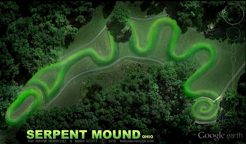
CAHOKIA MOUNDS STAR MAP ILLINOIS USA
No that’s not Johnny Depp above as Tonto in the latest Lone Ranger movie, its a real historical picture of the Cahokia/Sioux bird man spirit/deity/ancestor. Click the image to see the historical source picture that was a black and white image with colour added.
What is the connection? What is a ‘bird man’? I have spent over a decade researching the American Indian mound builders, especially right here at ground zero. Nothing quite gelled here in my attempts of recognising star patterns.
Only recently I found out why. A cataclysmic flood appears to have washed away two primary mounds down to their almost invisible bare foundations lost in the wild vegetation growth. That upset all star correlation permutations, until January 2014 when they were shown in the lidar radar photograph that experts sadly missed.
From here the first ‘snowball’ effect occurred… it solved all the other North American ancient site layout plans including the most famous site of them all… Serpent mound in Ohio. It records a genesis of the first people of North America encoded in a clear message. This will be the grand conclusion of the article here at the bottom of the page.
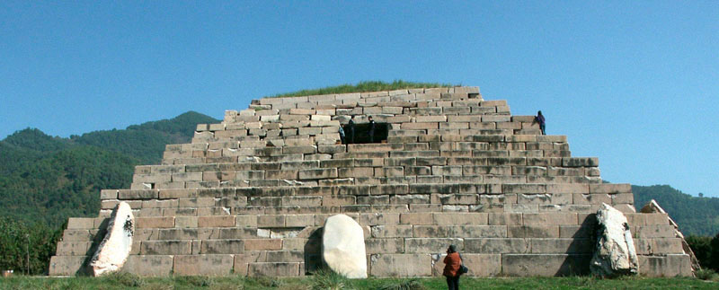
The first American Indian ‘pyramid’ city of Cahokia as shown below, is said by many scholars to be not just their first major city in North America but it was so massive 1000 years ago that it was one of the top 10 largest developed cities on the planet ref .
If this claim is true then it is here where all the secrets lie, with its mound layout plan and with the artifacts found here.

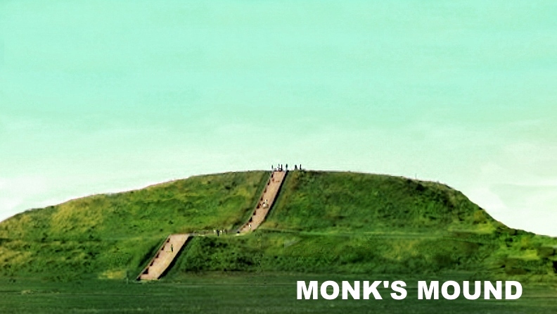
It was a ‘pyramid’ building mound culture like the Stonehenge Barrow builder types in the UK and the sizes of the mounds compare with many average sizes in Egypt. This view below Looks from the direction of the primary solar mound I propose matching all the other star maps around the world towards the largest ‘Monk’s Mound’ and its lost causeway. The causeway was magically partially visible in the Google Earth 2005 image (that follows later) Just like their earlier counterpart ‘brothers’ the Maya, they placed causeways between the main monuments.
THE MISSING MOUNDS AT CAHOKIA… APPEAR
My book The Hidden Records, only had a short one page summary on the Cahokia Mound history sadly as it had absolutely no visible correlation with any star constellation at all.
It already had the bird man cult, star obsession and ritual matches as per many other ancient civilisations that I propose as Pleiades ‘star visitor’ ancestor civilisations.
To start with, the research claims by scholars on Cahokia on the layout plan and the history was strangely so conflicting that it clearly suggested the area with the mounds was either badly flood damaged and hence no longer clearly possible to conclusively categorize each mound. But as the years passed I periodically checked Google Earth images to see if they had newer or older overlays available to look for missing mounds.
Then Early 2014 I went online and had a look. Clicked the time clock to look for earlier layers and suddenly realized there were a lot more time options. There was an old 2005 option in high resolution! This was the earliest period and fortunately it had both a low sun angle and in a dry winter time slot where foliage in the tree area had no leaves.
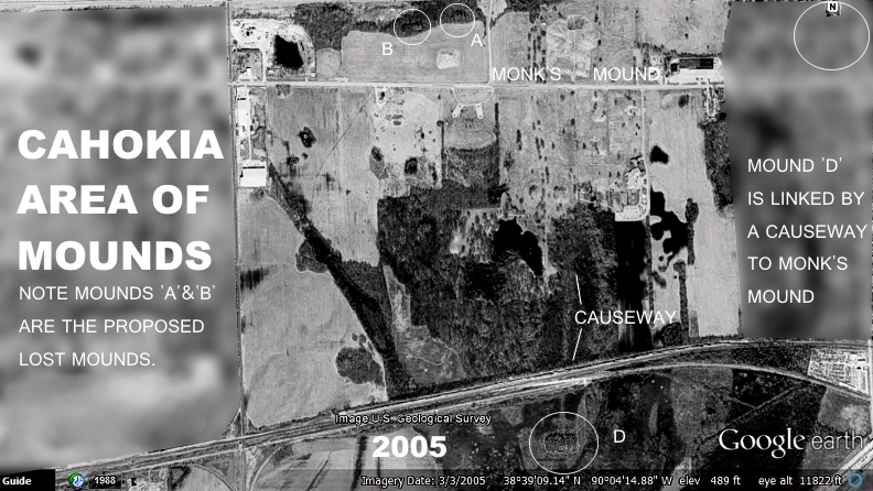
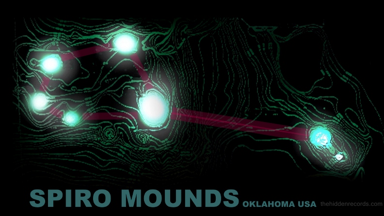
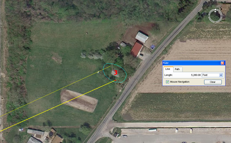
CAHOKIA MOUND CITY ILLINOIS USA 38°39’14 N, 90°3’52 W
The largest Mound is called Monk’s Mound and it was one I thought would be one of the three primary Sun stars in the star map if it fit the same world wide trend theme I have found so far. Ultimate monuments were the most grand in some ways and if not a sun star then it would possibly correlate with the largest star Alcyone if it were star correlating within the cluster I was looking for.
Something new suddenly caught my eye. The grass had obviously perished and the old causeway was now visible like a ghost! Scholars were right in one particular map here (see ref) that there truly was a causeway. This suggests right away that out of all the referencing maps maybe this map from here forward has the least number of errors. ref . But everything else seemed to look the same as before and I was about to close the Google Earth program. There was more… 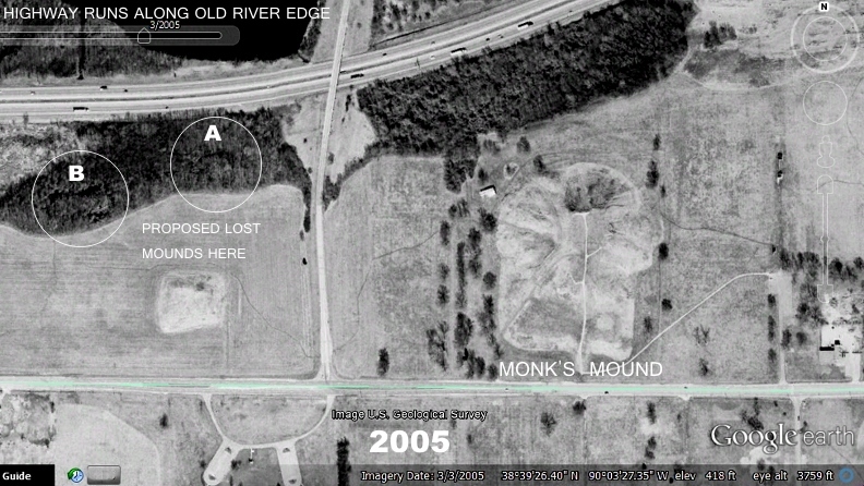
I nearly forgot to check the tree line are near the highway because the map just mentioned also proposed the Mississippi used to be right along this tree line in the North part of the site.
There were straight edged geometric profiles suddenly visible in the tree area!
I immediately computed these positions into my well trained mind in identifying the ‘Pleiades pattern’… and it set off all the bells and whistles. 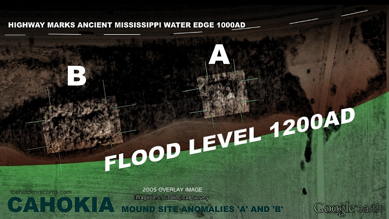
The image above has the two anomalies ‘A’ and ‘B’ placed into enhanced rectangles that have at least 5 meters distance from the faint fingerprint of the lost mounds edges. Lines are added as well to show the edges.
This was all very exciting but one needs to physically go and check out the site before making any grand revelation claims or at least get an experts views on the probability of it being likely to be lost mounds.
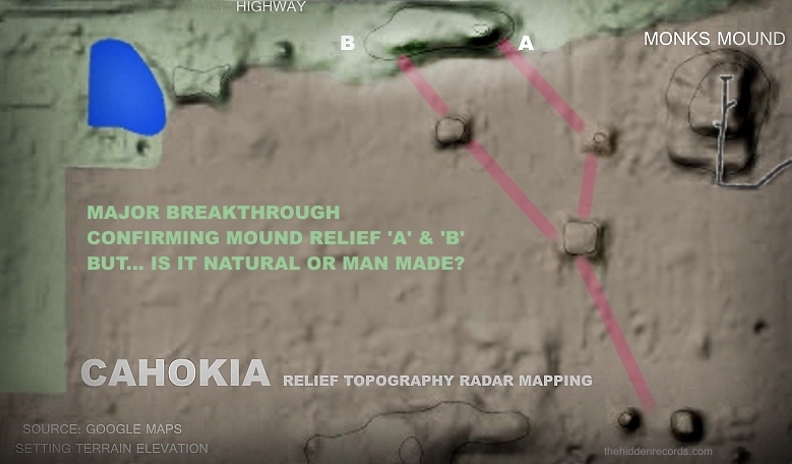
A group tied to my research have now visited the site but sadly due to the recent unexpected early rains at the end of winter it has become too overgrown and difficult to photograph in the tree line area for anomalies ‘A’ and ‘B’. I fortunately was contacted by a research colleague Márton Molnár-Göb and radar imaging. He asked if I knew that radar mapping of terrain topography is online for this area and did he know the mound signatures appear to basically correlate.
RADAR IMAGE CONFIRMS REMAINS OF MOUNDS?
The radar image is available on line. Click the image above for Cahokia area on Google maps [and Google Earth] and adjust setting to maps, then at the top left click option for terrain elevation. There are defined light mounds confirmed by the radar image. Note how the 3D effect is created for raised terrain where a slight shadow occurs as if it were in sunlight angle where the light source is from the top of the image. The radar signature shows a slight shadow correctly for this long ‘joined’ effect where anomaly ‘A’ has a better signature for an individual mound.
Márton has confirmed that the joined effect can be explained by the ancient water flow effect from a cataclysmic flood of Cahokia identified by National Geographic. He said the water flow would create this effect with something called an alluvium depost from the meander effect at the time.
An earlier mound ‘C’ (now removed in images) was proposed for correlation but shows as non existent in the radar so for now the correlation option for Secondary Sol star in the other ancient star maps here would fit conclusively for the position of the woodhenge construction position.
For now I propose mounds that are of slight proportions… BUT… are these natural or man made? This will need more research by hands on archaeology teams later on.
There is something else that occurred in history that raises the probability of the anomalies ‘A’ and ‘B’ being lost man made mounds. The fact that I was fortunate to figure out the last moments of this great city before it was destroyed in a cataclysmic flood and the set of events that would prove the removal of the proposed mounds.
NATIONAL GEOGRAPHIC STORY IDENTIFIES A FLOOD
Notice in the extreme close up image of proposed mounds ‘A’ and ‘B’ I have marked out two relief lines. One is along the highway today was the original Mississippi water edge and the reason this great city was built where it is. A perfect setting with water available. This is confirmed in the map here where it shows the water line was where mounds ‘A’ and ‘B’ have been proposed by the water edge ref .
But if the river once reached Cahokia as the experts confirm, then there must be evidence on Google Earth of the Mississippi’s old path if one zooms out again. What would be visible? Can anything more be concluded? Is there any other possible way these mounds can be concluded before a research party goes on site?
The answer is a resounding yes! This theory of the original pattern match with the Pleiades not only sits strong just proving the mounds were removed with a defined flood, but the revelations of new findings by I set off from here finds the same mound pattern and Pleiades depicted artifacts in other ancient American Indian sites to confirm all reasoning so far.
Therefore knowing how this story unfolds, it is fair to say in telling the story more sequentially that even if the lost mounds here are impossible to prove when experts go on site, it is the new barrage of findings that follow here that place this star map theory on solid ground. 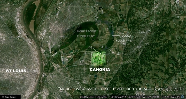

MESSIAH INSPIRES THE BUILDING OF CAHOKIA?
A recent historical interpretation by scholars has revealed that somewhere just before 1000AD the city was at its greatest. It seems to be inspired according to new evidence that some sort of Messianic visitor arrived. (more later) The reference from Examiner.com got the ball rolling for deeper research into this. Here is a great introduction to what is unfolding here. The records I show are about to prove here that the messenger who was titled “Sun deity” had nothing to do with our Sun at all who came from the cosmos. The messenger also gave seven commandments for living as well. See the article here ref
Before looking at all the controversial new findings and artifacts to substantiate this star map theory lets see how the anomalies appear in context with the other famous mounds and how I provide a possible measurable solution. The orientation of Cahokia park is now turned through 90 degrees simply to keep to the matching orientations of the other ancient star maps for comparison purposes.


STAR MAP CAHOKIA
The correlation probability now stands clear. Mounds that might be completely lost that might not even be possible to prove or disprove are about to stand incredibly strong as you read on here.
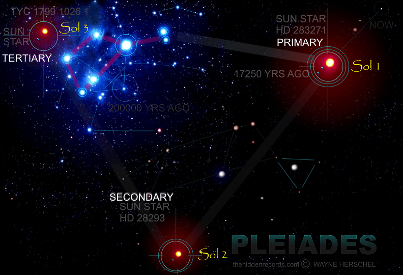
The overlay here has priority for the closest scale match for the Pleiades cluster size and position of the Primary Sol star position. This Primary Sol position of a real measurable Sun star correlates with the mound that has a causeway between itself and Monk’s Mound. The larger volume of Monk’s Mound suggests it favours this Tertiary Sol star as their ‘x’ priority monument that marks the spot place of the American Indian star ancestors.
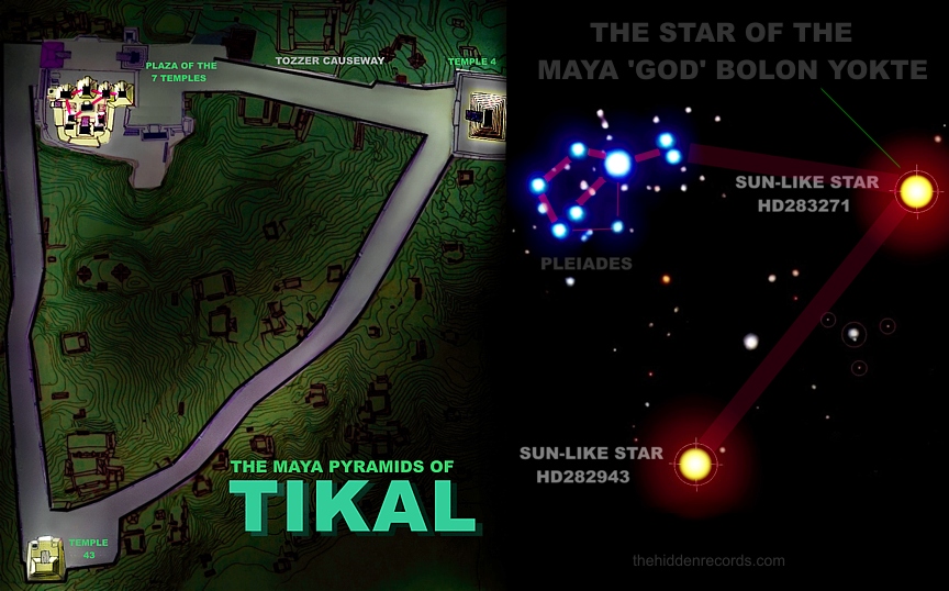
CAHOKIA MATCHES THE MAYAN CITY OF TIKAL
It is argued amongst many how close the civilisations of the American Indians are to the Maya. Many will say they are so close in history that they are virtually different tribes. Others say not just a different epoch but different in a big way. For me it appears close but for sure they are different parts of history.
But as per my star map theory I insist the whole human race is related to these star visitor ancestors so its hard to see differences when there are so many common historical ties globally.
The causeways are a big deal with the Maya ruins at Tikal Guatemala. The strange slight astronomical error in layout perhaps inspired by ritual of star measuring, the placement of Secondary star markers both seem similar in a 90 degree placement below Tertiary star marker. Perhaps the Tikal pyramid temple 43 also measured the rising of Pleiades in a similar way, but then why do they place a tiny little temple for Tertiary correlation? The tiny black dot is all that appears visible there for Tertiary star correlation. Tikal was obsessed with the Primary sol star correlation as per the world trend and in the lost ruins on Mars.
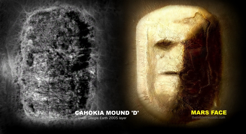
‘PRIMARY MOUND’- IS IT LIKE THE MARS FACE?
The Mars star map Face monument has a similar profile to the Primary Mound listed as anomaly ‘D’ in the 2005 images. Not just in how it looks from above but also by volume profile. It is covered in trees but there might be a little more detail that needs checking out. It seems to have detail like the Mars face. I reason probability as follows. This is the choice of monument given to the Primary sol star correlation I interpret as a message “This is the Sun star system of the star visitors place of origins which is also our ancestors place of origin” It is the same face monument as that found on the River Jordan bank of the Jacob biblical story, a real Earth face monument. See story here: ref
There are two other ancient civilisations that seem to prioritise the Tertiary Sol star as the most important correlating monument, and due to its size as Monk’s Mound, it has to be far more important than any of the other smaller mounds including Mound ‘D’.
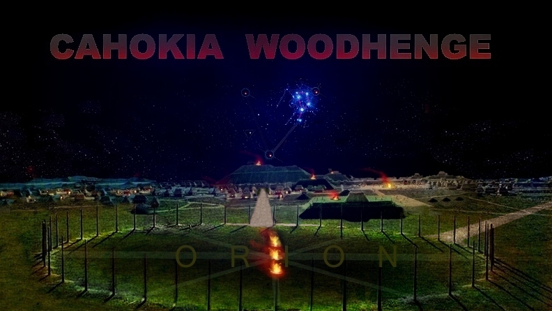
WOODHENGE CORRELATES WITH ‘SECONDARY SOL STAR’
The simple fact that the people of Cahokia built their own Woodhenge that duplicates the historical UK Woodhenge shouts out one thing and one thing only. There is some powerful inspiring connection here to the Stonehenge/Woodhenge builders as well. Impossible scholars will say and like the excuse for mound building and pyramid building obsession in history they will say it was just a part of human evolution like discovering the wheel.
Stonehenge ‘coincidently’ is another very high probable correlating Pleiades star map made from the same kind of mounds at Cahokia near the famous stone circle ref. The Cahokia were people that showed similar record of worshiping a sun according to scholars just like all the other ancient civilisations. But what is a Woodhenge and what is it used for?
A Woodhenge is a large circle with wooden posts (see below) placed as markers to watch the Stars movements in the heavens, or our Sun and their calender for planting and harvesting would depend on those who watch these changing positions. But why a large circle if the ancients were just watching our sun for the seasons? Here is where the star watching interpretation shines. It acts like a giant celestial globe and the ancients could measure the positions of the equatorial cosmic sign post of Orion in orientation with the stars in positions both north and south of equatorially placed Orion. Here is the best story reference on the Cahokia Woodhenge and its usage. ref.
DRINKING VESSEL DECODES WOODHENGE
There is another clue on the drinking vessel that decodes Woodhenge. It has the two lost causeways leading into the circle that complete the star map and match the Tikal layout plan with its well documented causeways. ref.

One of the most famous artifacts of Cahokia has a drinking vessel with the cross of Orion on it that I propose and where I agree with scholars that the markings around the Cross are the wooden posts of their Woodhenge. ref
In fact the Woodhenge position seen here, you will be looking East above Monks Mound and Orions belt would be seen rising here with the Pleiades as in the image. This is absolute perfect viewing for the moment when Tertiary Sol star rises to be positioned exactly above its correlating mound. When the Earth touches the ‘womb’ of the sky according to Egyptian myth.
THE MOST FAMOUS ARTIFACTS OF CAHOKIA
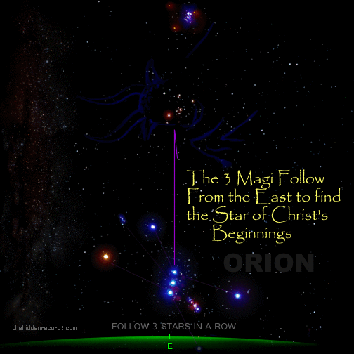
The drinking vessel with the Cross that I believe is Orion is second popularity only to one artifact ‘icon’, the birdman tablet. Orion is used by modern astronomers as a cosmic signpost due to its layout as a double cross formation and other stars located in reference to the lines of the spokes of this cross. But the reason it was chosen as the cosmic signpost is one I present with the article on the cross of the churches to locate the Bethlehem star ref and the cross on the ancient Freemasons referred to as Solomons Key and the star of David.
All ancient civilisations would use Orion as a key reference point especially to locate the Pleiades by following Orions belt to the celsetial Bull where the pleiades are found behind the bulls head.
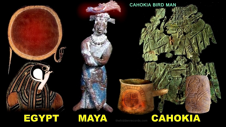
The next most spoken about artifacts are the bird man artifacts. The most frequent icon in google image search with Cahokia artifacts is the small rectangular tablet in the image below bottom right chosen for the unique birdman with his ‘beak’. Note here how the copper green artifact bird man has a cross in his one hand with symbol and how his nose also has a ‘beak’ like a bird. Was his nose really like this as shown also in the tablet at bottom right of the image or was there something else here creating the effect? A nose breathing device like I propose for the Maya? This is confirmed in the images that follow with the Gorget collections.
But here is one strange match to the Maya… the birdman of the Maya, note here Pakal as birdman has Quetzalcoatl ref on his head just like the Tonto character in the latest Hollywood film of the Lone Ranger seen at the top of this page. There are also depictions in the Quetzalcoatl story of the birdman holding the cross of the sky and directing alignment to the dove. Another symbol for the Pleiades. ref
But is it more than just a bird and flight teaching of the miracles of their star visiting ancestors? The Maya clearly depict that it involves a cosmic serpent wormhole and the star gods are seen coming in and out of the mouth of the cosmic serpent portal. A real Sioux birdman is the image at the top of the page. Note how the Egyptian birdman Horus has the Sun star on his head as a crown title and he too has a cosmic Serpent. The Cahokia claimed the cosmic serpent is part of the message here… identical to the other ancient civilisations.
THE FRANKE ARTIFACTS BREAKTHROUGH
The artifact seen here is one that is privately owned by the Franke family some sort of remains of a bird statue with no head and just its wings but since it has a hole going through the middle of it, it is referred to as a pipe. ref
It is remarkable for one main reason. It has inscribed on the bird not one but two star maps. The first one is upon its chest. Like the Birdman statues and artifacts that follow a star cluster is depicted on lower chest area. Look closely at the pattern. Not only a good Pleiades correlation it is correct orientation when it is viewed from woodhenge above Monks Mound when heaven and Earth meet. I have highlighted the pattern. See the original if clicking the image. The small tablet with the Franke pipe is the Kassly tablet which is also well documented and privately owned. I propose that it is of the Pleiades as seen on a Birdman depiction.
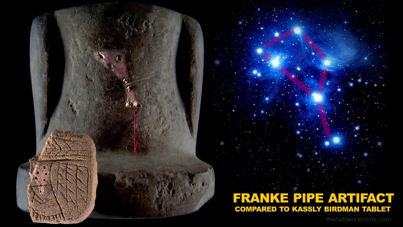
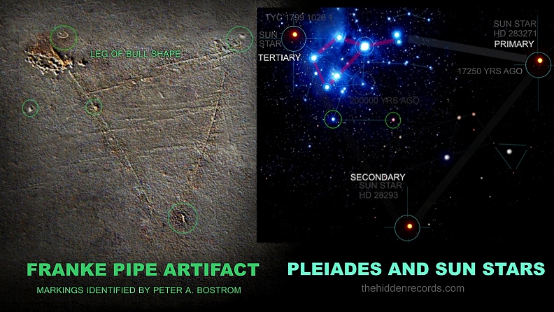
This depiction below is what is found on the base of the Franke artifact and the owner insists after speaking to experts that its important detail tied into the star obsessed history of the Cahokia people.
If this inscribed detail is not coincidental damage and scratches it presents a class A account of the star map. There is extra detail too that seems a bit too accurate to be a coincidence. Firstly orientation of the map is correct with the Pleiades star map. Secondly it has all 3 Sol stars (Sun-like stars) correlations with Primary sol star and Secondary sol star and the most important to the Cahokia people, Tertiary sol star. Here it is a ringed area. But here is the money shot. The Pleiades has two bright stars beneath it and just like in the Mars star map ref it is shown precisely as so.
THE MOST SACRED SYMBOLS WITH TEPEES
If there is a real Pleiades obsession by the ancient American Indians, then where else shold one look for their emotion expressions of such a thing?
There is one that stands as the largest collection of American Indian expressions and its their personal homes. Their Tepee’s. A Tepee is a tent like structure made by placing stitched animal hides as the tent material supported by a pyramid cone shape set of wooden poles. A Tepee is also called a wigwam by tradition.
Although very little is available online in original evidence, there is one early 1800 images of a Sioux Indian who were descendants of the Cahokia people standing next to his Tepee. Click the image for the source reference.
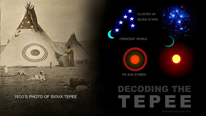
But is this just a ‘one off’ decoration situation here? What was the trend? Here are two online reference to the symbols often added to Tepee decorations. The common symbols are as follows
ref
ref
1) Stars
2) Crescents
3) Ra symbols or Suns
4) Crosses
5) Birdman
6) Bulls
The next type of artifacts that were special to the Cahokia and in fact most of the American Indian tribes were the carvings of flat portions of very large shells into a disc motif called a Gorget and these were worn as a sacred piece of jewelery for important people.
GORGET ARTIFACTS OF CAHOKIA
Here are the most famous examples and of a theme repeated as perhaps the most sacred story of their Star visitor Birdman. At last one can reason the beak like traditional nose of the entity. I believe this is a classic case of the ancients trying to interpret advanced technology. The entity if a star visitor teacher is from a world with different diseases and air-borne microbes. He would be at great risk breathing our microbe disease infested air, especially when talking to local people who would breathe on them.
The Birdman is adorned with a racoon belt it seems, and just like in the stone tablet versions seen earlier, here as a star cluster as well.
In his right hand he holds the Sun… or is it a Sun activated star gate I wonder. I reason this as follows. There seems to be a cosmic serpent or fish tailed sea serpent symbolism that I found common for interpreting cosmic wormholes. The Egyptians and people of India showed the opening wormhole more like a lotus flower however there were some showing the sea serpent analogy and the tail shape is how it opens. The far East of China and Japan prefered the cosmic serpent more dragon-like but its all one and the same thing. Click image for source ref.

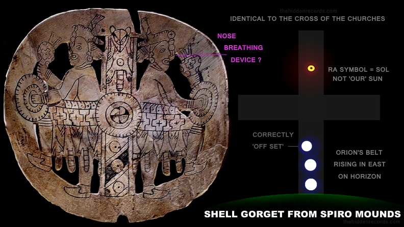
THE CROSS STAR MAP GORGET
One Gorget stands out far more importantly above all the others in context as a star map. It is of the American Indian Cross. It is identical in teaching to the cross of all the churches of Christianity. ref
It presents what I interpret as Orion’s Belt correctly orientated on the East horizon which was also an Egyptian tradition for measuring stars as they are reborn each day. It even has the top star of the three slightly smaller and offset. This is quite remarkable too.
But what makes this one a full presented star map is positioning of the Sol star of the Cahokia above it using the global common Ra symbol and within a racoon pelt. The racoon pelt seems also to match the tradition here with Gobekli Tepe in Turkey, an ancient civilisation measured as being as old as 17000 years old. ref
I now have all these easy to measure overwhelming clear ancient patterns of commonality here but be it as it appears, scholars are set at scorning it, other researchers set at twisting it, but worst of all, powerful society is set at attacking it and interfering and blocking publicity of it. Why you may ask? The answer is in the statement at the bottom of this page.
PLEIADES BLUEPRINT MIRRORED IN OTHER SITES
But if this star map theory is all true would it not be common in all the ancient mound builders, well… at least in the oldest examples before time would make the story so confusing that it got lost. The results are absolutlely astounding to say the least. Yes, the oldest mound sites duplicated the same cosmic template over and over. Click the images for their source records.
The Winterville Mounds that are positioned much higher up the Mississippi River are descendants of the Cahokia and it appears they carry similar artifacts too. After Cahokia was flooded ref
Google Earth location: 33° 29′ 9″ N, 91° 3′ 40″ W
Here is an amazing story where it seems this site had a similar flood and because the same mounds were placed near the river due to its important layout and river plan… similar mounds were destroyed in another less cataclysmic flood perhaps from a hurricane. Scholars did a radar scan of the area and found the slight mounds there too.

The Kincade mounds below are not too far from Cahokia in Massac County Southern Illinois ref . They are estimated as a time long after Cahokia and about 700 years old. It has the same largest mound correlation with Monks Mound but there is not much more at these early stages of research to say much more.

The Spiro Mounds have a similar layout plan and shape. The layout of the Pleaides each time from here forward starts distorting in each case. Not sure if there are Tertiary mound remains. But research has just started in these cases here so there will be updates.
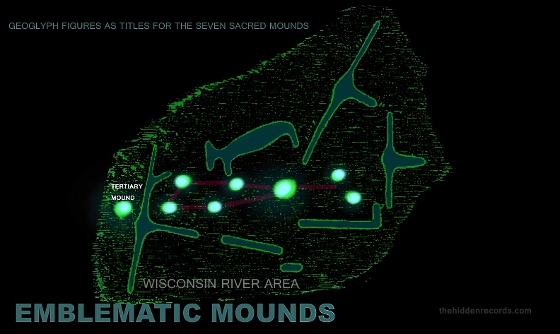
The Emblematic Mounds in Wisconsin are very difficult to relocate because this reference here originates in the Guntenburg data files and we only have a sketch of what was once carefully documented. Here is where a new type of Mound building becomes recognised. It seems since there are seven geoglyph characters here that each of the seven mounds for the Pleiades have character titles. Click the image for the source sketch.
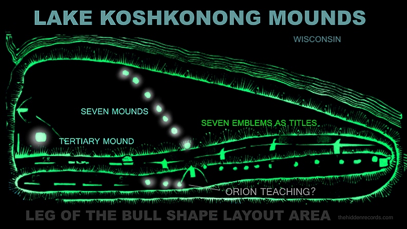
The Koshkonong Mounds take the emblem titles a little further but since these are perhaps not as old as all the others a little more change in the design plan developes. The title mounds of characters seem to begin to speak a little more pictographically about the history. The layout of the Pleiades now simplified to a row of seven stars. A being emblem mound holds three mounds in a row most likely celebrating how Orion is used to locate the Pleiades. The last detail here is the whole platform area might just be the last knowledge of the Pleiades symbol as the leg of the bull, but I think this might not quite fit this culture as it does the others. But too early in this research to conclude anything further. Click image for source.
DECODING SERPENT MOUND OHIO
Found in Ohio, the mound geoglyph known as Serpent Mound ref has just had its mystery cracked wide open.
Fellow researcher Mark Scott in the UK contacted me and said he had cracked the meaning of the Ohio Serpent mound as seen below. He was researching another ancient site of the Hindu legends at Phrathat Nong Khai in Thailand persuing the earlier evidence that Hungarian researcher Márton Molnár-Göb had deciphered with a serpent and seven heads represents the seven Pleiades star area found in both an ancient european Christian manuscript ref and in the Angkor statues ref .
But Mark found a Buddha depiction like this Hindu verion here that showed the Buddha sitting on the seven coils of the seven serpents ref and he realised something profound.
Not just that that logic has it pinned that the probablility and reasoning obviously associates the seven coils with the same Pleiades correlation/representation, he realised almost on the other side of the world in Ohio… another mystery serpent anomaly also has seven curls depicted in its design.
Mark proposed the solution to the seven curls of the Serpent mound represents seven stars of the Pleiades and he offered a sketch showing the correlation overlay which sort of fits.
I completely agree with the curls possibly representing Pleiades so I set out to test the correlation and how it might explain the spiral tail that was still unsolved. Hoping for a better correlation I turned the correlation orientation through 180 degrees to see if it was a better correlation and couldnt believe my eyes!
It fits like a glove and more…
The correlation revealed a match for the spiral as I found with the pueblo homolovi petroglyph near Chaco Canyon ref having a petroglyph of a spiral in another American Indian star map for the Sol 1 primary correlation also having a spiral.
The Spiral I can now confirm depicts the opening of a star gate for this cosmic serpent! ref .

The message I am now certain is a dual teaching method for both the human sperm and the cosmic conduit wormhole star gate teaching as one. The message as shown in a mouse over animation for the correlation says it all:
The ancestors of all American Indian lineage were very advanced and originated from an exoplanet in the solar system depicted as Sol 3 and colonised an exoplanet around Sol 1 which is the place they venerate like all other ancient sites around the world.
Compare how the Pleiades image below correlates very well in layout with Serpent Mound curls and the real positions of Sol 1 and Sol 3 as analysed at ref .
But why are there no mounds positioned in each curl of the serpent to prove the Pleiades correlation with the said coils/curls? The answer is simple. Important members of the tribe would have established residence in seven sacred dwellings protected with the curls winding around them. The thing is the dwellings leave no ruins… they were built without stone or mortar. They are called Tepees ref .
HISTORICAL MAP REVEALS ORION
I realsed the geometry and layout of this very elaborate mound was more than just another mound city. It was advanced and the image reference identifies the alignments of the curls in the serpent are advanced in its layout ref . Experts have measured the two main seasons alignments with the sun for planting and harvesting.
Realising the advanced intellect in the design I knew there had to be more star alignment representation here. The burning question here is there just had to be Orion.
What were the chance this site would depict Orion with mounds or ponds aligned ‘showing the way’ to the ‘x’ that marks the spot Sol 1 ancestor star? So I set out looking through historical maps since I favour early interpretation before the risks of erosion or flood damage.
I found an old 1920’s era map ref and could not believe what I was looking at…
It had anomalies depicting Orion’s Belt and it was in perfect position!
I prefer the ancient pond theory for the three large basins for 3 reasons:
1) The builders could have the advantage of water storage and fish breeding since it was only a small creek next to the site.
2) It would still complete a profound ‘As above So below’ design.
3) It would provide source of material for the Serpent Mound.
Any fish breeder will tell you one needs at least 3 ponds to be efficient in fish breeding… small for fry… medium for juveniles and large for main stock and spawning. 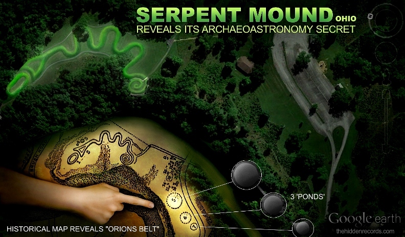

The star representation now is measurable and compare it to the star map animation here to identify the match and Sun star positions Sol 1 and Sol 2 found in 35 ancient sites ref around the world.

Let it be said this is early research and more updates will follow and it will complete the claims made here.
This story on its own is nowhere near complete without seeing other sites and trace back history of the American indigenous lineages. The best cases are:
1) Chaco Canyon .
Below are 11 short videos I shot at Cahokia Mounds in 2019 while investigating the proposed mounds ‘A’ and ‘B’ mentioned in the article above:
I take zero credit for my combining of and minimal format alterations and of this 11-part article itself http://www.celticnz.co.nz/Cahokia/Cahokia1.htm. Please follow and support the author Martin Doutré.
THE CAHOKIA MOUNDS COMPLEX
ANCIENT OPEN-AIR UNIVERSITY OF NORTH AMERICA – FOR TEACHING NAVIGATION & CYCLIC ASTRONOMY.
Huge Monk’s Mound at Collinsville, Illinois, is the biggest purpose-built ancient structure in North America, with base dimensions considerably larger than those of the Great Pyramid of Egypt. Standing away from Monk’s Mound at precise, pre-planned distances and angles, were about 120 smaller mounds. Each of these was a “classroom” in its own right and contained specialised codes-of-position, with these satellite mounds acting as repositories of mathematical information that ancient students of navigation would need to memorise.
In the 1880’s North American archaeology took a bad wrong-turn and has never been able to get back on track. Generations of people had looked with wonderment and awe at the huge mound groupings or geometric earth embankment complexes scattered across the length and breadth of North America and decided that these could not be the works of Indians. This conclusion was supported by the vast amount of skeletal evidence found in the mounds, sometimes in deep chambers far from the surface, of very large individuals achieving heights of seven to eight feet in stature. In a few instances, the skeletons had six fingers, six toes and double rows of teeth. Where hair was still present, it was often red or blond in colour.
John Wesley Powell, who had lived for many years amongst the Indians and had tremendous empathy for them and their plight, became the the first director of the U.S. Bureau of Ethnology at the Smithsonian Institute. Whereas the general consensus of opinion amongst Americans, based upon compelling evidence, was that an early-epoch civilisation with no links to the Indians had built the mounds, Powell decided otherwise. His works led to the hard-nosed concept of “Isolationism” (as opposed to “Diffusionism”) prevailing within the Smithsonian Institute, which, thereafter, religiously adhered to the policy that the Asiatic-Indians were the only people who had ever been in the Americas prior to Columbus and, as a consequence, they and they alone were responsible for the great earthworks of North America.
The concepts of Powell developed into the Ipse Dixit dogma that dominates North American archaeology today. This uncompromising-immovable dogma (based upon Powell being the final, never-to-be-questioned, authority) is forced to label tens of thousands of anomalous, contrary artefacts as “fakes” and will never consider the amazing evidence inherent within them.
At about the same time Powell was establishing his form of “isolationist religion” in the Americas, another individual called Franz Boas was radically revising American anthropology. For reasons best known to himself, Boas seemed to hate the idea of “race”. Despite the obvious fact that a diminutive African pygmy is very different in physiology to a tall Zulu or an Inuit Eskimo is physically very different to a Norwegian Caucasoid, Boas decided we’re all pretty much the same and the differences between us are negligible. His “cultural-relativism” theories went on to spawn modern-day “social-anthropology”, with its myriad of intrusive appendages, which has largely overshadowed the science of “physical-anthropology” and effectively nullified its ability to provide clinical analysis when skeletal remains are found in archaeological digs. The main focus of Franz Boas seems to have been to convince us all that everyone is as intelligent and able as everyone else. In essence, Boas, like Powell, was reacting against contemporary concepts of his time related to “beings of an inferior order”.
Regardless of how well-intentioned Powell’s or Boas’s motives might have been in according pride to or raising the profile of those relegated to second-class status within North American society, they did nothing useful towards answering the outstanding questions of who actually built the North American mounds and why. Powell and Boas, in their separate but related disciplines, only succeeded in diverting the argument away from the real issue.
As isolationism, along with evolving concepts of social-anthropology (laced with cultural Marxism and its great gift to the world, “political correctness”), took root in America, what followed was stifled or controlled archaeology, eternally locked into proving that “Native-Americans” were the only people who had ever occupied North America prior to about 1500 AD. This meant that anomalies had to be discounted or ignored in order to sidestep dealing with them.
In just one of a multitude of unwelcomed categories, there have been literally thousands of old world scripts found incised into boulders and stone surfaces across North America (some estimates range to 30,000 such artefacts). The scripts are in ancient forms of readable Minoan, Phoenician, Hebrew, Egyptian, Runic or Ogham, etc., but apparently they’re all the work of dastardly fellows bent upon deceiving the gullible public, or simply “plough mark” scratches. Vast quantities of evidence and artefacts were given, in good faith, to the Smithsonian Institute in the 1800’s and thereafter, never to be seen or heard of again.
The legacy of Powell & Boas, handed down to the rest of us, ensured that our archaeological evidence could never undergo proper scientific testing, lest it upset the apple cart.
These-days, cold, hard, clinical facts are not the preferred route to the formulation of theory, but the social implications of the evidence have to be weighed in the balance before it can enter the public arena. Everything is stringently controlled and “history” must comply to a pre-conceived and pre-written script. Tight “terms of reference” disallow “history” to drift outside of set parameters and everything in upper-academia has to be peer-reviewed to make sure potential fringe-dwellers and mavericks don’t threaten the acceptable paradigm.
We have fully documented, reliable accounts of Smithsonian Institute personnel traveling to 1800’s communities in middle-America to take possession of large skeletons exhumed from the mounds. In certain instances the handover of remains and artefacts was done with a degree of formal ceremony, with the town mayor, local minister or assorted dignitaries turning out, and the spectacle of speeches and handshakes reported in the local newspaper. Mound researchers like Patricia Mason of Newark, Ohio, in following up on these many reports, have applied to the Smithsonian Institute for information related to present-day whereabouts of those skeletons gifted to the museum’s collection, only to be told that the Smithsonian never received any such item.
In many other recorded instances the large bone and heavy skull, remains, found in the mounds, were so old that they disintegrated quite quickly after being exposed to air and, within a few days, had crumbled to powder. This clearly shows that some of the remains were of very great-age.
These giant skulls are stashed-away, somewhat “out-of-sight, out-of-mind”, at the Humbolt Museum in Nevada. They are the remains of the last of the “Red Headed Giants”of the area, who were trapped inside Lovelock Cave by the Paiute Indians, then suffocated to death by smoke from fires lit at the mouth of the cave. Some skulls of the large boned & tall stature people, recovered from the cave, had red hair. These very big people fit the more general recorded descriptions given of the physical-type found interred within the North American mounds during excavations of the 19th century, when many full skeletons were gifted to the Smithsonian Institute.
And the deception continues. In 1999 I was contacted by a friend who ran a bookstore, selling books on alternative science and archaeology, etc. A young lady had come into his store and they got to talking about archaeological anomalies. During the course of the conversation she gave an account of an experience she had while working for the U.S. Parks Service. The location was Canyon de Chelly National Monument, Chinle, Navajo Reservation, Arizona. A big washout had occurred in the canyon after torrential rains, and a number of skeletons were exposed at a few sites. All of the Parks Service personnel were pressed into service to gather up and box up the newly exposed bones. However, in a somewhat sinister twist, all of the work was overseen by personnel from both the Smithsonian Institute and the FBI. The Parks Service workers were forbidden to bring cameras to the site and were subjected to full body searches by the FBI when arriving in the morning or leaving at night. All of the skeletal remains and artefacts were carefully boxed up and taken away by the Smithsonian Institute. The Park’s Service workers were forced to sign secrecy agreements of non-disclosure of information related to their activities in the canyon.
Through the friend who had recounted the details, I tried to track the young lady down, but was unsuccessful. Later, I shared the second-hand account with Viewzone Magazine and this, surprisingly, caused quite a stir across the United States. I later received a fairly irate email from the young lady, who had been thrust under the public spotlight against her will. After tearing a few strips off me, she offered some corrections to what was now in the public arena, saying:
One grave- male, 7ft approx, 6 fingers/6 toes is right- but the teeth were like human, except they had no canines (eye) teeth, and extra large molars and incisors. The skull was large- heavy jaw and long/large cranium. Large eye sockets. Finger bones extra long, but small hands. Buried with beautiful pottery and baskets of fine weave- never seen anything similar. A necklace of fiber and feathers. He looked rather fresh for 6,000 year old, as the Smith [Smithsonian] people claimed. Clean bones- but not brittle …
The other things about the FBI, etc., are all correct, except about the U.S. hassling me when I left. It was when I came back to the U.S., after a month in NZ, that I was hassled by them, but let in after 4 hours of questions about my travel plans. I was also refused entry in to Canada- no explanation.
The Smithsonian is said to have a huge warehouse underground in New York City, with thousands of skeletons, objects and information.
On the one hand, I deeply regret that I put the young lady in jeopardy with the American authorities. Getting offside with the FBI is not something to trifle with. On the other hand, it’s appalling that the American people are so blatantly denied access to very important archaeological evidence, which would quickly clarify mysteries related to long-term regional history. Whereas North American archaeology has been stagnated or has gone backwards for 130-years, all of the essential evidence is in the hands of the authorities to rectify that abysmal situation, but is kept permanently under wraps and beyond the reach of the socially-engineered American public.
For insights into just how much archaeological information has been suppressed or destroyed by the Smithsonian, see: http://www.xpeditionsmagazine.com/magazine/articles/giants/holocaust.html
To see how insideous, draconian legislation attempts to stop Americans from ever learning the truth about their long-term history see:
http://www.youtube.com/watch?v=sgyoV9TD3kQ (The Kennewick Man Bill).
So, isn’t it amazing, when the police find a substantially complete skeleton under the local bridge, the coroner can quickly identify the “race” or mixture of “races” of the victim …along with sex, age or how death occurred, etc, etc. Likewise, after WWII, physical-anthropologist, Dr. Mildred Trotter and her colleagues identified and pieced together the (often) shattered skeletal remains of US servicemen, who had died in the Pacific theatre of conflict. Trotter was dealing with many racial types, including Caucasoid, Negroid, American Indian, Chinese, etc., along with some Japanese servicemen or others who were occasionally found in the jumbled mix of MIA bones. For some illuminating insights into Trotter’s tell-tale reading of the bones and more especially the craniums, see: http://beckerexhibits.wustl.edu/mowihsp/words/TrotterReport.htm

Mildred Trotter identifying remains of American MIA’s at The Central Identification Laboratory of the American Graves Registration Service, Schofield Barracks on Oahu in 1948-49.
When it suits the authorities, physical-anthropological analysis is deemed to be very useful tool and a fully-fledged science. However, when it doesn’t suit them, the science is relegated to the “racist” fringe and mere mention of the sub-category of “Craniology” as a legitimate science is sufficient to get one labeled a Nazi. And so we face the rather ridiculous dilemma wherein the science is fully available to criminologists and coroners, but only partially available to archaeologists … if the remains are clearly “indigenous” and the find in no way negatively impacts upon acceptable mainstream views.
North American Indian historian, Vine Deloria jr. wrote:
‘There’s no effort to ask the tribes what they remember of things that happened.
He goes on to say,
‘numerous tribes do say that strange people doing this or that came through our land, visited us, and so on. Or they remember that we came across the Atlantic as refugees from some struggle, then came down the St. Lawrence River and so forth. There’s a great reluctance among archaeologists and anthropologists to break centuries-old tradition and to take a look at something new … As for the history of this hemisphere from say, five thousand B.C. forward to our time, the mainstream scholars just don’t want to deal with that at all. Let me give you an example. Years ago I spoke at an academic archaeological conference, and at the end of my speech I asked, ‘Why don’t you guys just drop the blinders and get into this diffusionist stuff?’ My host, David Hurst Thomas, just about lost it and said, ‘Do you know how long and hard we’ve fought to get members of this profession to admit that Indians could have done some of these things? And now you’re saying it was Europeans!”’.
THE CAHOKIA MOUNDS.
Words are inadequate to describe the sheer immensity of work undertaken to build this complex of (an estimated) 120 mounds in Collinsville, Illinois (7-miles East of Old St. Louis) or the other 27 or so known to have existed across the Mississippi River in Missouri (Old St. Louis). Monk’s Mound alone could have, by some carefully arrived at estimates, taken up to a century or more to build. One writer describes the mammoth task like this:
Hard packed clay weighs around 100 pounds per cubic foot to 120 pounds per cubic foot. Taking the conservative amount of 100 pounds per cubic foot, the mound’s total weight equals approximately 2.16 billion pounds. If each basket of earth used to build the mound weighed fifty pounds, then it required 43.1 million baskets of earth to build.
A lot of time would be required to deposit a volume of 21,551,623 cubic feet that composes Monks mound. If a population of citizens lined up with baskets and deposited one basket every minute, it would take 82 years (Julian) to build Monks Mound. If one basket was deposited every second, it would take 1.3658 years. If Cahokia “accepted” population estimates are correct at 20,000 people at the peak of occupation, then each person would have to carry 2155 baskets (53.9 tons) to complete the mound. The combined volume of the other mounds on the site roughly equal the volume of earth used in monks mound. That means it is safe to double these estimates to consider the entire amount of work done at the Cahokia Mounds. Now consider that thousands of mounds were built all over the country. The sheer workforce used to build these mounds is a feat that cannot be matched by any ancient culture throughout the world.
Then, just when we think we’re off the hook and can relax again, the researcher throws in this curve ball:
The average distance of the nearest ten borrow pits to Monks Mound is 4624 feet (1541 yards). The total area of borrow pits at the Cahokia site is 2.01 million square feet. If the earthen construction materials used in monks mound came from these borrow pits, they would each have to be about eleven feet deep throughout the total area. However, the actual depth of the borrow pits today is around 2-5 feet deep. This could be attributed to erosion and flooding deposits in the low areas. When considering the total volume of the mounds at the Cahokia Site, if the earth for the mounds came from the local borrow pits, they would have to be around twenty feet deep. Non local colored soils found on Monks Mound indicates that it is likely that the earth used to build the mounds did not all come from local sources, but was instead brought in from larger distances.
http://www.freewebs.com/historyofmonksmound/index.htm
So, we’re beginning to gain some appreciation of just how huge this building commitment truly was. Basic logic tells us that no-one would have dedicated themselves to this task, spanning generations, without a very, very good reason that they fully believed in and supported unreservedly. Moreover, the Cahokia complex is not the only example of a vast group of inter-relating mounds in North America, so the impetus to undertake such a hair-brained scheme can’t be attributed to some lone, despotic, control-freak chief, wanting his own set of tailor-made, lofty hills to stand on. The fact of the matter is that the Cahokia complex is just one more batch of earthen pyramids and mounds, found clustered together in individual groupings, built over several continents between 5000-1500 BC.
Our archaeologists look at the mounds and see little more than big piles of dirt. Because they can’t find any rational explanation for going to that much effort, they proffer a few implausible possibilities and leave it at that (ceremonial purposes, status, etc.). But our experts aren’t looking hard enough. The humps themselves are not placed willy-nilly and erratically across the landscape. Each one was very carefully positioned, based upon a premeditated plan, pre-survey and careful marking of the intended layout over a vast tract of terrain, before the baskets of dirt began to arrive to erect each individual mound.
The Cahokia mounds themselves are fully-fledged surveying markers and, although no visually apparent symmetry is detectible in the overall pattern , each mound sits out from a central fulcrum or hub position at a carefully coded distance and degree angle around from North. If one then understands the ancient measurement standard used in the layout, as well as the ancient 360-degree angle system attributed to the Sumerians (but found to be present in other mound-marker complexes that predate that civilisation) then one has everything required to read the carefully in-built tutorials of each mound position.
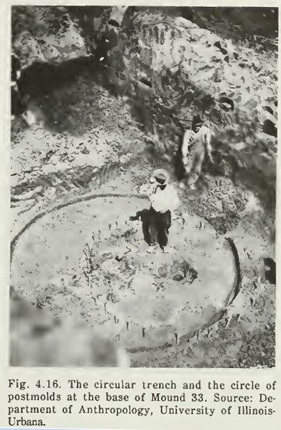
In the Spring of 1922, Moorhead began an excavation down through the centre beneath the summit of Mound 33. At a depth of 23 feet he located the base of the mound and also found ‘(1) A circular trench, nearly a true circle, 3 inches (7.6 centimeters) wide and 20 feet (6.1 meters) in diameter (Figure 4.16). There were no ashes or charcoal in the trench. (2) Crossing the center of this circular trench and extending slightly south of it was a circle of postmolds 2 to 3 inches (5.1 to 7.6 centimeters) in diameter (Figure 4.16). Many of these were preserved as charred stubs and charcoal’. See: The Cahokia Atlas, A Historical Atlas of Cahokia Archaeology, by Melvin Fowler, pg. 87.
What Moorhead had obviously encountered was the original survey marker (with a finalised, refinement circle overlaying it), put in place by ancient surveyors to determine the precise epicentre position for mound 33, prior to its construction.
And it all makes such perfect sense. Why have our archaeologists been standing around endlessly scratching their heads and wondering what the mounds were built for, but never advancing beyond the most rudimentary and implausible scenarios? Surely, a concept that would immediately spring to mind is that the mounds could have been made as some kind of layout based upon meaningful distances and angles between structures. One giant structure (Monk’s Mound) eclipses the rest in size, so that must be the centre-piece for the whole site … gee … I wonder if that could be acting as some kind of fulcrum position? … hmm … I wonder if there is anything repetitious in the distances and angles out to the satellite mounds or if any ratios can be found by comparing the vectors? … hmm … If I do some comparative analysis with similar mound sites overseas, I wonder if I’d find any duplication of the same distances and angles?
Then, to further exacerbate the situation, the archaeologists make their measurements in “metres”, which standard is a modern-day invention, a full step removed from old, traditional metrology. The metric system does nothing more than totally obscure the old numbers so that they are utterly unrecognisable. To see what’s happening on these sites one has to revert (& this will be surprising to some) to “feet & inches”, which have a long enduring pedigree back to the earliest civilisations of remote antiquity.
IT’S ALL ABOUT NUMBERS.
It was obviously realised in remote antiquity that if one is to enjoy the abundance and benefits of “CIVILISATION”, then there is a body of essential, prerequisite scientific knowledge that must first be gained. Once a civilisation has that knowledge, then they must religiously preserve it and hand it on intact to each ensuing generation. Failure to do so means that one has just cursed one’s children and to whatever degree the knowledge is lost, so too is lost one’s grasp on civilisation.
One truth that will come as a surprise to some is that the “so-called” British Standard “inch” and “foot” are very ancient and all of the cubits or feet of the great civilisations of recorded history were based upon the selfsame inch. Moreover, all of the measurement standards of one civilisation were either the same, or precise ratio expressions to the standards of the confederation of cousin civilisations. Everyone used the same integrated parcel of factorable numbers to describe their sciences and the way they eternally recorded those sciences was by incorporating those numbers into all of their public buildings or in the layout of marker-mound and standing-stone complexes. As we proceed we’ll extract the in-built codes of position for 104 mounds at Cahokia, plus others further to the West on the Mississippi Bluffs of Old St. Louis.
Patricia Mason, a leading authority on the geometric earth mound complexes and burial mounds of Ohio and Pennsylvania, etc., USA, made this researcher aware of the 19th century work of J. Ralston Skinner, who analysed survey results of Ohio’s geometric earth-embankments. Skinner’s conclusion was that the mound builders of the Ohio Valley had positively used the increment known as the British standard inch in the design and construction of the ancient geometric complexes. See: Skinner, J. Ralston. “Identification of the British Inch as the Unit of Measure of the Mound Builders of the Ohio Valley.” Journal of the Cincinnati Society of Natural History Vol. 9 (July 1886), pp. 51-63.
This journal can be accessed online by going to: Cincinnati Historical Society Digital Journals.
The finalised, big numbers that had to be remembered by ancient civilised society might look reasonably unfriendly. This is because nature has a bad habit of running cycles to its own schedule, without consulting accountants. A solar year is 365.2422-days and a lunar year is 354.3643519-days. The lunar nutation cycle, where the moon goes to a position called major standstill, returns to minor standstill, then returns to major standstill again, takes 6798.36-days or 18.61329277 solar years. The Earth is 24902.44523-miles in equatorial circumference. The polar circumference is 24816.55084-miles. The cycle of the Precession of the Equinoxes takes 25776-years to complete.
So, with these cumbersome, non-factorable numbers to contend with, how did ancient scientists turn this chaotic set of difficult values into an ordered, integrated and functional mathematical system?
- The solar year can be called 3651/4-days, which is a nice rounded number equating to 8766 hours.
- The lunar year can be called 3543/ 8-days, which is 8505 hours.
- If a calendar is produced that runs for 7 solar years, then that equates to 2556 3/4-days.
- If the lunar period within that calendar runs for 71/5 lunar years (one tenth of 72-years), then that equates to 2551 1/2-days.
- If a measurement rule is produced, based upon 51/4 feet, then 487 X 51/4 = 25563/4 feet/ days.
- The same measurement rule can be used for the moon and 486 X 51/4 = 25511/2 feet/ days.
- If an auspicious mistletoe culling ceremony is performed on the 6th day after the calendar commences at the Summer Solstice, then the solar and lunar cycles can end on the same day 7 solar years later.
- If the world is described as 12 X 12 X 12 X 12 X 11/5-miles (note: 11/5 is a tenth of 12), then that’s 248831/5-miles…only 18.8 miles short of the true equatorial circumference.
- If one wishes to navigate using a “6&7” series of numbers, those miles can be 5250′ each.
- If one wishes to navigate using an “11” series of numbers, those miles can be 5280′ each (for a world with a circumference of 24750-miles).
A wonderful little window of opportunity arises when a straight-line diameter, using an “11” number is converted to a “6” based circle using PI @ 314 2/11 ÷ 100 (1728/550). Therefore 550 X this rendition of PI = 1728, which is fluidly divisible by 360°.
A wonderful little window of opportunity arises when a straight-line diameter, using a “6&7” number is converted to an “11” based circle, using PI @ 22/7. Therefore 525 X 22/7 = 1650, which is divisible by 330, 660 or 360°.
A wonderful little window of opportunity arises when 1/7 of a 360° circle (513/7°) is multiplied by 1.75 = 90. A 630° compass will work very well using “7” series values.
If the cycle of the Precession of the Equinoxes is described as 25920-years, then that’s 72 X 360.
If the lunar nutation cycle is described as 6804-days, then that’s 191/5 lunar years, which is nicely divisible by “6&7”.
On the basis of these “big” numbers, which had been “factored” to be in very close tolerance to the true size of the Earth or duration of cycles, the ancient civilisations then produced their “Weights, Measures & Volume” standards in direct compliance to the highly factorable numbers generated.
Therefore:
What (much later) became known as a “Greek” foot has an overall lengthof 123/5 British standard inches (one tenth of 126″). A Greek foot is simply half of an Assyrian cubit or a tenth of a Hebrew Reed (101/2 British standard feet). Babylonian-Sumerian or Egyptian standards, as well as ancient Swedish, Germanic or many others preceding the fledgling Greek & Roman civilisations,comply to this same integrated system. All are in direct ratio to the standards of their cousin nations or more distant forebears of remote antiquity.
Everything built at Cahokia was a 3D mathematical model, which, by it’s dimensions, shape and orientation off north contained multiple tutorials. Each mound was its own separate classroom and this middle-America complex, as a whole, is where the brightest and the best of the nations children were gathered in to receive an intensive education in cyclic astronomy and mathematical principles of positional plotting at sea, for safely traversing the world’s oceans. The Cahokia mound complex was an open air university and a Bureau of Standards for the Americas, just like the Giza Plateau was a very ancient Bureau of Standards for Egypt and the Mediterranean, Durrington Walls Henge or Avebury Henge ring and mounds complex were schools for Southern England or Brodgar Ring and its satellite mounds was one for Northern Scotland and the Orkney Islands or the Chinese Pyramids at XI’an, Shaanxl, functioned as an open-air university for the people occupying that region, etc., etc., … over 5000-years ago.
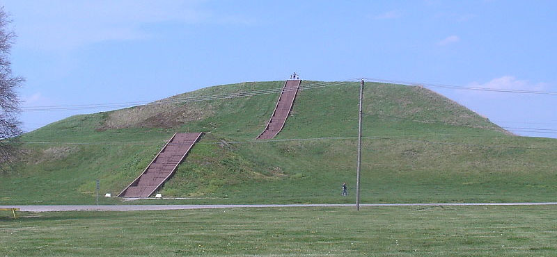
SO, LET’S START WITH THE DIMENSIONS OF MONK’S MOUND, THE LARGEST ANCIENT STRUCTURE IN NORTH AMERICA.
Over the years there have been many attempts to measure the base dimensions of Monk’s Mound and estimates or guesstimates range from 1050′ feet of length N-S down to 955′. The E-W length estimates range from 965′ down to 774′. In the 1968 report on solid-core drilling of Monk’s Mound, Reed et al. gave an approximate north-south dimension of 1,037 feet (316.1 meters), 790 feet (240.8 meters) east-west, and a height of 100 feet (30.5 meters).
In consideration of what occurs at similar complexes on other continents, the base dimensions, as well as side slope angles, will prove to be very important. With such a mammoth construction commitment, no opportunity would have been overlooked, and mathematical codes would have been built into every design feature of the entire edifice. In essence, these huge 3D structures were measurable props used in tutorials, in much the same way as 3D Platonic solids are used in modern classrooms to teach principles of geometry.
Some possible design-stage dimensions that were intended to be clearly measurable on (the now dilapidated) Monk’s Mound:
Using the 1966 University of Wisconsin, Milwaukee map’s 128-metre contour line, the North-South length of the mound was 1049.9′ (1050′). This length is dynamic and is encoded into multiple sites from Egypt, to Britain and all across North America. The Hebrew Reed is 10.5′ and the Great Pyramid is 72 Reeds in length. The sum of 1050′ is 1/5th of a “so-called” Greek mile (5250’… although the length is encoded into European sites built thousands of years before there was a Greek civilisation). At the Hopeton geometric earthworks, Ross County Ohio, Squire and Davis measured the Great Circle to have a diameter of 1050′.
The same holds true when measuring the great circle at the Octagon of Newark, Ohio, where the centre-crest to centre-crest diameter is 1050′ or 1/5th of a Greek mile. At Brodgar Ring in the Orkney Islands, the half-value (525′) extends from outlying cairns, through the SSW gate to the centre of the ring. That inbuilt coding was to tell ancient navigators the distance and angle (in miles of 5280′ & at 312.5-degrees) from Scapa Flow to Iceland
If 1050′ was the intended design length of Monk’s Mound, then one would be hard-pressed to find a number that was more important to trans-Atlantic navigation during the Bronze Age.
Monk’s mound is in a disheveled state, with significant slumping of its steep banks having occurred. It will now take a concerted scientific probe to determine the original base dimensions. Perhaps the closest anyone has come to truly determining those base limits is Reed in 1968, using solid core drilling to ascertain where the original ground ended and the artificial, built up mound-hill commenced. His estimate for the mound’s dimensions was 1037′ X 790′.
As it turns out, if the mound complies very closely to Reed’s estimate, then, again, the values generated are dynamic and based upon much repeated coding on ancient structures worldwide. The sought after values would have been very recognisable @ 1036.8′ N-S by 792′ E-W and both numbers are coding related to the size of the Earth, by way of both circumference and diameter. Here’s how ancient scientists described the Earth mathematically in factorable numbers:
1. The Earth was 12 X 12 X 12 X 12 X 1.2 miles in equatorial circumference = 24883.2-miles.
2. If one wished to use the Greek (so-called) “6&7” method of navigation, then those miles were 5250′ each.
3. If one wished to describe the Earth (in factorable numbers) very close to its”true” size, then those miles were 5280′ (based upon the “11” family of numbers). By this means the equatorial circumference was being described only 18.8-miles shorter than the value we officially use in modern times (24902-miles).
4. It must be added that when ancient navigators wished to navigate by the mile of 5280′, they used an equatorial circumference value of 24750-miles, which made positional-plotting (dead-reckoning) very simple (this popular method will be explained in detail as we proceed).
5. However, using the very factorable number of 24883.2-miles to describe the equatorial circumference, how fast does the Earth spin? The answer is of course 24883.2-miles ÷ 24-hours = 1036.8 MPH.
6. So, if Reed’s solid core drill samples have provided us with the correct or intended design length envisioned by the original architects, then the long side value is for mnemonic recall of the equatorial size of the Earth and its speed of rotation.
7. Stonehenge in Southern England is only an outer appendage site of Durrington Walls Henge and sits 10368′ out from the centre of Durrington Henge.
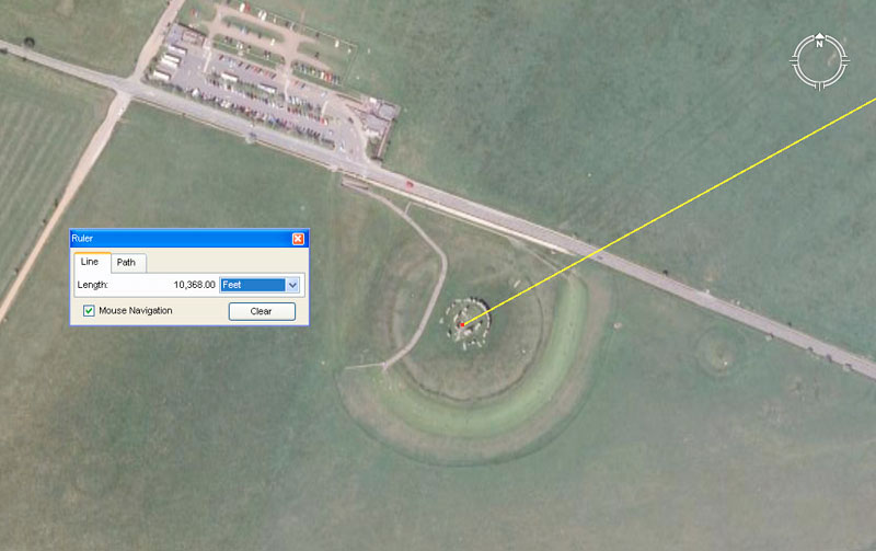
The coding contained within the ancient number 10368 relates to the equatorial size of the Earth and also the speed at which the Earth rotates. This is one of the most important values of antiquity, thus Stonehenge, as the preeminent site standing off from Durrington Walls Henge, was awarded the honour of carrying this number in terms of its distance from Durrington’s centre.
This very impressive stepped stone pyramid is called variously the Gaogouli Pyramid or the Tomb of the General. It is situated to the North of Korea at Ji’an, Jlin, China at coordinates Lat: 41.157650, Long: 126.226400.
This Chinese-Korean Pyramid is officially said to have a square base measurement of 31.58 metres per side. It also has a series of obelisk stones leaning against the base, the tallest of which has been measured at 4.5 metres .X 2.7 metres. The pyramid’s square base is offset from the cardinal points of the compass and its eastern side appears to orientate towards north at an intended azimuth angle of 314.16-degrees (coding PI @ 3.1416).
8.This length is equivalent to 60 of the largest of the Egyptian Royal Cubits @ 1.728′ (20.736″ … 2092125ths) … 103.68′. Sir William Flinders Petrie identified usage of this particular cubit in his measurement of the coffer in the Khafre Pyramid, wherein it was 5 of these cubits long or 103.68-inches. Note: A cubic foot (12 X 12 X 12 inches) = 1728 cubic inches. Also the circumference of Silbury Hill in England is 1728′, based upon a diameter of 550′.
9. The “Cab” volume,within the Jerusalem liquid volume standard was 103.68 cubic inches.
10. The old standard “Stirling Jug” volume of Scotland was a duplication of the old Jerusalem liquid volume @ 103.68 cubic inches.
The width of Monk’s Mound,
Reed’s value for the width of Monk’s Mound hovered very close to 792′ and the Earth is, very literally, 7920-miles in diameter. Under the ancient mathematical system, there were various renditions of PI, depending on what number family was being calculated. This meant that, say, a diameter value in the “11” family of navigational numbers would translate to a factorable value on the circumference, divisible by 360-degrees if the correct rendition of PI was used. The value 792 is part of the “11” family and the rendition of PI used for most “11”-family conversions was 1728/550ths. Therefore: 7920 miles (the Earth’s diameter) X 1728/550ths (3.141818182) = 24883.2-miles circumference. Alternatively, 7920 miles X 3.125 = 24750.
So, in lieu of anything better, this side of a full scale scientific investigation, let’s go with Reed’s dimensions as a very real possibility of what the original architects of Monk’s Mound intended.
The orientation of Monk’s Mound.
Most publications on the subject say that Monk’s Mound is orientated to the 4 cardinal points of N-S-E-W, but the visual evidence, either on old maps or in Google Earth, show it skewed off North. Rather than the long sides running 0 to 180-degrees, the edifice is rotated slightly clockwise, with the sides running to something very close to 182.625-degrees (1825/8ths). Again, if this proves to be true once the original corner positions of the structure are verified by a future scientific investigation, then this orientation contains very important coding to do with the duration of the solar year. The period of time between equinoxes is 182.625-days (half of 365.25-days… the length of the solar year). This coding is further suggested by the distance from the fulcrum or hub position atop monk’s Mound to the centre post of Woodhenge nearby (3652.5′). Also, the rise postion of the equinoctial sun on Monk’s Mound, as seen from the observer’s position aside Woodhenge’s centre post is 91.3125-degrees … the number of days in 3-months or 1/4th of a solar year.
At ancient mound-marker complexes across the world, there was always one preeminent mound, henge ring or marker that functioned as the fulcrum position for all outliers. The refined position of the fulcrum was the epicentre of that preeminent structure. This holds true at Avebury Henge, Durrington Walls Henge, Ring o’ Brodgar or a multitude of other sites. It’s therefore safe to assume that the original “hub” marker for Monk’s Mound sat at it’s epicentre, up on its top plateau. By this means, if the marker was ever eradicated by enemies or disappeared due to long-term abandonment, a few measurements and calculations of the greater edifice would be sufficient to reestablish the hub position. It is known that a small mound once sat atop Monk’s Mound on the SE corner of the top plateau, but it seems to have acted in another capacity and certainly not as the hub.
On some drawn contour maps of Monk’s mound, the fulcrum position seems to show up as a depression and hump in the central region of the top plateau and we might be looking at it here in a photo taken by a sightseer.
At a position that would very closely approximate the top plateau epicentre of Monk’s mound there appears to be humped ground surrounded by a depression. The same feature sometimes appears on drawn contour maps of Monk’s Mound and this disturbed or shaped ground seems, convincingly, to have been where the ancient “hub” was established, from which all outlying mounds were carefully positioned. This somewhat meandering but reasonably circular spot shows up on drawn contour plans of Monk’s Mound as the highest point of the long, top southern terrace.
There is marginally higher ground at the northern top end of the mound.
THE TUTORIALS CONTAINED WITHIN THE OUTLYING MOUND POSITIONS.
Of the 120 or so mounds counted by early settlers, the former positions of only 104 are now known. In addition to the “lost” mounds of the Cahokia complex, there was another large batch on the banks of the Mississippi River in Old St. Louis, Missouri. Technically, these other 27 or so mounds were associated outliers or yet another expansive set of classrooms. The giant mound over in St. Louis was dubbed “Big Mound” and it related back, by way of a coded distance and angle, directly to the centre of Monk’s Mound.
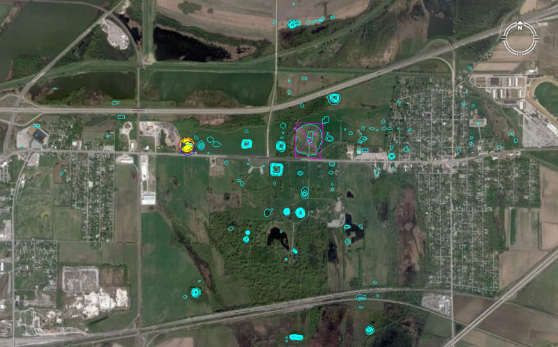
In this picture the Google Earth image of Collinsville, Illinois is overlain with an electronic map, showing the known positions of 104 mounds of the Cahokia group. A yellow spoked circle shows the position of Woodhenge and Monk’s Mound is encased within a slightly offset purple rectangle. The dimensions of that rectangle are based upon Reed’s 1968 solid core survey to determine the exact (original or intended) design dimensions of Monk’s Mound. Each outlying mound, standing at a measured distance and angle from the hub position atop Monk’s Mound, was a classroom in its own right and contained very important codes of position, essential to the knowledge-base of students of navigation and cyclic astronomy, learning their craft at Cahokia.
The exact positions of mounds 1 & 2 have been determined after a very careful AutoCAD overdraw of the University of Wisconsin, Milwaukee map of mound positions. The process involves inclusion of roads, rivers, buildings and all prominent landmarks that appeared on the UWM map. After very careful scaling and marginal rotating of the electronic map in AutoCAD, it is then superimposed over the Google Earth image and tiny refinements made to ensure that everything is fitting perfectly.
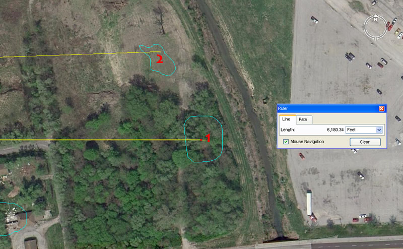
Mound 1. This mound has the distinction of being a due East marker for Monk’s Mound. It sits at a coded distance of 6180.34′ at an azimuth angle of 90-degrees.
It’s obligatory that the 6180.34 (or a ratio expression of the same) value will be found at a site as immense and mathematically sophisticated as the Cahokia Mounds. The dynamic tutorial contained within this distance value relates to PHI and more especially to the PHI reciprocal, which ratios were essential knowledge to ancient civilisations and much used, for very practical applications, on a daily basis. Here’s an example:
The American capacity for dry-goods called a “bushel” is a very ancient volume that has it’s origins in Babylon and Britain. The ancient Sumerians-Babylonians had a volume called a Homer, which was exactly 21600 cubic inches. This survived in Britain as a lesser capacity “bushel”, which was 2160 cubic inches or one tenth of a Homer. As the years wearied on and people (mostly because the unwelcome interference of the church and forced-Christianisatian) began to forget the significance and required precision of the old numbers, a bushel began to be described as “any round measure with a plain and even bottom, being 18.5 inches wide throughout and 8 inches deep”. This description of a bushel tub, from the old English Winchester Standard, was later adopted by the new colony in North America and that is why the American bushel is the strange, shortfall value of 2150.42 cubic inches.
So what went wrong and caused the capacity to drift slightly off the highly factorable value of 2160 cubic inches?
All of the great cousin civilisations of antiquity used the PHI reciprocal formula in order to fabricate their “round” tubs of capacity used in the market place. Every volume within a tub had to carry codes that related to some aspect of ancient sciences. Each capacity, whether large or small, had to generate a number related to say, the cycle of the Moon or the Precession of the Equinoxes or, perhaps, the equatorial circumference of the Earth, etc. If everyone was using the numbers everyday, then they could never be lost.
The American bushel is supposed to relate to the duration of Precession of the Equinoxes. In the 25920-year cycle of Precession, the Sun spends 2160-years in each house of the Zodiac. The true (ancient) formula for building an American bushel barrel is:
10-inches ÷ 1.6180339 (PHI) = 6.18034″. In order to then fabricate the flat, round base of the bushel tub one used 3 of these increments or 18.54102″. So, the old English Winchester Standard had “drifted” and had been “rounded” downwards very slightly, but really needed that extra 1/25th of an inch in order achieve precise results.
Therefore: Old era carpenters would join 3 six inch planks together and then, using a string attached to a nail hammered in at the centre, draw a circle that was 18.54102″ (very close to 187/13ths) in diameter. They would then cut the round base for their tub and, because they had used the PHI reciprocal as their formula, the base was exactly 270 square inches of surface area. They now added sides that extended exactly 8-inches above the flat base, giving a capacity of 270″ X 8″ = 2160 cubic inches.
The widespread use of PHI and especially the PHI reciprocal meant that there could be peace in the marketplaces of the ancient cousin nations and that there was no excuse for “short-measures”, leading to disputes between grain vendors and purchasers. If a dispute arose, the capacity of the vendor’s measuring tub could be checked by the marketplace judge and, in ancient times, anyone caught-out trying to defraud was generally dealt with very severely (in Scandinavian marketplaces it could mean the death penalty). It was essential to maintain stringent standards in weights, measures & volumes in order to maintain the public peace.
With this mound sitting exactly due east of the centre of Monk’s Mound, navigational students atop Monk’s mound could set the compass disk on their manual theodolites (alidade sighting rules) by this marker, then read the exact angle to any other target around the horizon.
Mound 2. This mound is quite wrecked, but complies to a distance of 6075′ from Monk’s Mound centre @ an azimuth angle of 88-degrees. The distance onto the mound could likewise be read as 6048′ (1-minute of equatorial arc under the “6 &7” navigational system using a mile of 5250′) or 6050′ (1-minute of equatorial arc under the “11” navigational system using a mile of 5280′) and all of these tutorials would have been included.
- The 6075 value is a part of a mathematical progression that generates many useful lunar numbers. For example, there would be 42 intervals of 60.75-days in the 2551.5-days (7.2 lunar years) monitored alongside 2556.75-days (7-solar years) in the lunisolar Sabbatical Calendar.
- There would be 112 intervals of 60.75-days in the 6804-day lunar nutation cycle.
There are two geodetic, Earth navigational systems built into the base dimensions of the Great Pyramid of Egypt. The first is founded upon a side length of 756′. Therefore, if one circumnavigates the Great Pyramid 2-times, one has traveled 6048′ and this is one minute of arc under that navigational system. Therefore 6048′ X 60 = 362880′ or 1-degree of arc and 362880′ X 360 = 130636800′ for the full equatorial circumference of 12 X 12 X 12 X 12 X 1.2 Greek miles (24883.2-miles).
The second system uses an “11” progression of numbers. The Great Pyramid is considered to be 756.25′ in length and if one circumnavigates the Great Pyramid 2-times one has covered 6050′ for 1-minute of equatorial arc under that navigational system. Therefore, 6050′ X 60 = 363000′ for 1-degree of arc and 363000 X 360 = 130680000′ for a full equatorial circumference of 24750 miles of 5280′ each.
The angle from Monk’s Mound to mound 2 is 88-degrees. This value is a part of the “11” family of numbers used in navigation and 88′ is 1/60th of a mile of 5280′.
Mound 3 has a house built on it and sits exactly 1-mile (5280′) from the centre of Monk’s Mound at an angle of 66-degrees.
The “11” series mile of 5280′ is very ancient and is found marked into the landscapes of all of the ancient open-air universities used in remote antiquity. Generally this increment will be marked alongside the “6&7” series mile of 5250′ and mound number 3 sits within reach of the shorter “Greek” mile as well.
The azimuth angle to this mound from Monk’s Mound is 66-degrees and the 66 value is also a part of the “11” series mile, with a chain of 66′ and a furlong (furrowlong) of 660′. The sum of 66′ is 1/80th of a mile. In fact, an acre is 1 chain X 1 furlong = 43560 square feet and this is an ancient form of mnemonic coding for remembering the equatorial circumference of the Earth under the “11” system. This value X 3000 = 130680000′ or 24750-miles.
The mound would also accommodate a vector coming in from Monk’s Mound @ 65.34-degrees. This value also relates to the equatorial size of the Earth and the sum of 130680000 ÷ 2 = 65340000.
It is by associations such as this that the numbers of navigation and cyclic astronomy were memorised in ancient times.
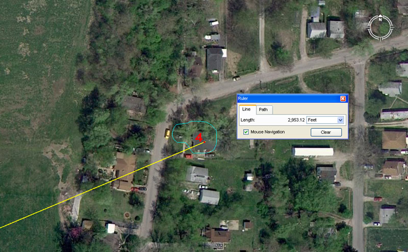
Mound 4 sits a coded distance of 2953.125′ from the centre of Monk’s Mound on an angle of 67.2-degrees.
The distance coding to this mound is lunar and the sum of 29.53125-days (2917/32nds) is the duration of a lunar month to a tolerance of under 1-minute.
The angle coding is navigational and a mathematical progression based on this value generates very useful numbers to do with the “6&7” equatorial circumference. For example, there would be 9 intervals of 672′ in 1-minute of equatorial arc (6048′). Likewise, the ancient Irish mile was 6720′.
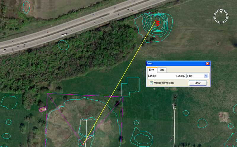
Mound 5 is large and, when first completed, would have functioned as a very symmetrical, multi-coded, 3D geometric model. It is now quite dilapidated, but future archaeological investigations should confirm its coded base dimensions and the additional tutorials built into the mound’s dimensions, angles and orientation could then be understood and extracted.
One of the obvious codes related to mound 5 is that its top plateau sits 1512′ from the hub position atop Monk’s Mound at an azimuth angle of 30.24 (or 30.25) degrees. The tutorial contained within this distance and angle reading is navigational.
The Great Pyramid of Egypt was once part of a sprawling “Bureau of Standards” that served ancient nations of the Mediterranean and Continental Europe (or any of their colonies around the globe). It’s side length is 756′ and 2 side lengths equals 1512′, for a full circumnavigation (4-sides) of 3024′. The sum of 3024′ was half a minute of arc in a world configured to be (for fluid navigational purposes) 24883.2 so-called Greek miles (of 5250′) in equatorial circumference.
As stated, there were two major mathematical methods used for positional plotting and dead-reakoning at sea, one based upon the “6&7” number families combined and another based upon the “11” number family. By the second ancient method (which has survived, in part in the United States), one minute of equatorial arc was 6050′ for a world configured to be 24750-miles (of 5280′) in circumference. The incremental values of length used under the “11” method of navigation were: a league of 16500′; a mile of 5280′; an alternative mile (ancient Scottish) of 5940′; a furlong or furrowlong of 660′; a chain of 66′; a rod or perch of 16.5′; a fathom of 5.5′ (the original fathom or Merchant Navy fathom … still used in Britain at the beginning of the 20th Century); the link of 7.92″.
THE KUNNEMAN GROUP.
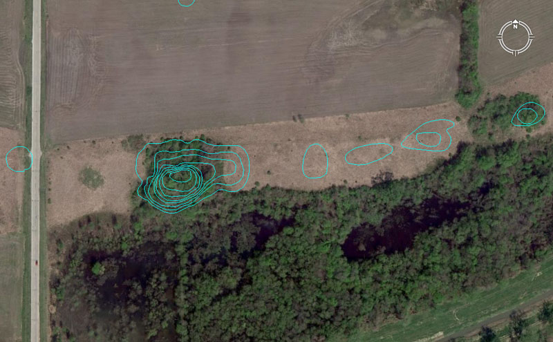
North of Monk’s Mound is a set of 7 mounds known as the Kunneman Group, with the largest structure in the group designated as two mounds side-by-side. This batch is numbered as mounds 6-12 on the UWM map.
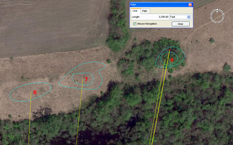
Mound 6 contains several distance and angle codes across its girth, including 3780′ distance from Monk’s Mound hub @ 10.66666-degrees (102/3rds). The sum of 3780′ equates to 5/8ths of 1-minute of equatorial arc under the Great Pyramid’s “6&7″ navigational method. The Great Pyramid of Egypt @ 756′ per side had a half-side value of 378′. The old French foot was 1.066666″ (12.8”) and ancient civilisations used many kinds of foot & cubit rules simultaneously, depending upon what kind of calculation the astronomer-mathematicians were doing at any one time. In this vein, there were 3 major types of Egyptian Royal Cubits alone.
Another distance code (tutorial) to Mound 6 was 3750′ @ 10.5-degrees. The 375 value generates a mathematical progression much used in navigational and 360-degree compass readings. The sum of 375′ is 1/14th of a 5250′ mile and the sum of 3.75-degrees is 1/96th of a 360-degree circle.
The 10.5-degree angle sets up yet another mathematical progression that was very exploitable. The ancient Hebrew reed was 10.5′ and the sum of 1050′ was 1/5th of a Greek mile. In an age where there was no great availability of paper to write books and make them generally available, students memorised numbers (as well as number associations & applications) by grueling rote and repetition exercises. Navigators of the early epochs were required to do quite complex calculations in their heads or with the aid of abacus devices. Training in the manipulation of numbers required a very alert mind.
Another degree angle associated with this mound would have been 10.8-degrees (navigational coding). Note: All decimalised value mentioned here are also simple fractions.
Mound 7 is shown to be 3628.8′ from the Monk’s Mound hub position @ 5.76-degrees azimuth. The sum of 362880′ was 1-degree of arc in a world configured to be 24883.2 Greek miles in circumference. Alternatively, the sum of 363000′ would be 1-degree of arc in a world configured to be 24750-miles (of 5280′) in equatorial circumference. The 576 mathematical progression generates dynamic numbers used copiously in ancient navigation. There would be 432 (216 X 2) segments of 57.6-miles in the 24883.2-mile equatorial circumference.
Another tutorial would be a reading of 3652.5′ resolving upon this mound. There are, of course 365.25-days in the solar year.
A distance reading of 3600′ would also be achievable to the northern side of the mound.
Mound 8 sits 3564′ from the Monk’s Mound hub at an angle of 2.625-degrees.
The 3564 value is navigational, using the “11” family of increments. So, the distance is 5400 links, 648 ancient fathoms, 216 rods or perches, 54 chains, 5.4 furlongs or furrowlongs or .6 of a Scottish mile of 5940′. Note: The centre hub of Big Mound in Old St. Louis sits 35640′ (6.75-miles) from the centre hub of Monk’s Mound at an azimuth angle of 260-degrees.
The degree angle out from Monk’s Mound centre hub is 2.625-degrees (strong lunar and navigational coding). The Greek mile @ 5250′ is 2625′ X 2.
The return degree angle from mound 8 to the the hub on Monk’s Mound is, therefore, 182.625-degrees and the sum of 182.625-days is exactly half of the 365.25-day solar year. Monk’s Mound itself appears to lie on an azimuth angle N-S of 182.625-degrees.
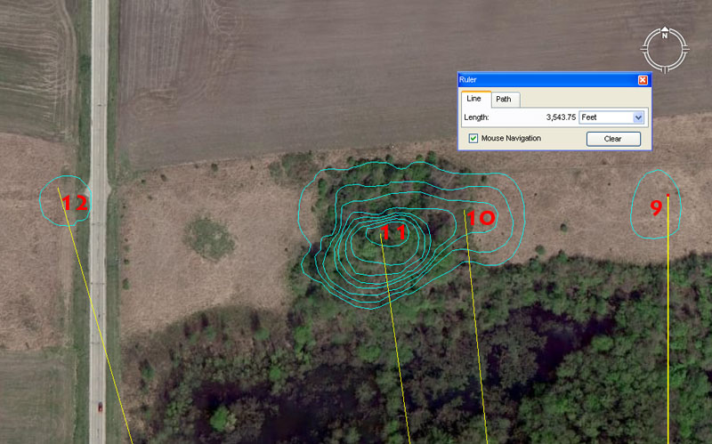
Mounds 9 to 12 contain cleverly encoded distances and angles.
Mound 9 sits due North of Monk’s Mound hub at a distance of 3543.75′. For ancient students setting up their manual theodolites (alidade sighting tables and rules) at the fulcrum position of Monk’s Mound, then Mound 9 provided orientation onto true North.
The distance value is very dynamic and one of the big numbers of antiquity, related to the 354.375-day lunar year. It is obligatory that this value be found on the large open-air-university sites and at Avebury Henge in Southern England it was cleverly encoded into the distance from the giant obelisk within the Henge to the doorway of West Kennet Longbarrow. The distance in that case was 7087.5′ (2 X 3543.75′) for a return angle of 354.375-degrees.
Mound 10 at Cahokia sits 3543.75′ from the Monk’s Mound hub at 354.375-degrees, which so closely parallels the Avebury Henge methodology as to suggest a direct link between the design-architects of both sites.
And in similar fashion, very “in-your-face” coding has been built into the next mound in the lineup:
Mound 11 sits 3520′ from the Monk’s Mound hub at 352-degrees. The sum of 3520′ is 2/3rds of a mile of 5280′. The 352 value sets up a mathematical progression much used in calculations within the “11” navigational system and 352′ is 1/15th of an English mile.
Mound 12 sits 3712.5′ from Monk’s Mound hub at an azimuth angle of 343.75-degrees. This distance at Cahokia is 5/8th of a ancient Scottish mile of 5940′ (11 series). The sum of 371.25′ would be 1/16th of a Scottish mile.
The 343.75-degrees azimuth angle is coding erlated to the equatorial circumfernce of the Earth under the “11” system of navigation. By that system 1-degree of arc was 68.75-miles or 34.375-miles X 2.
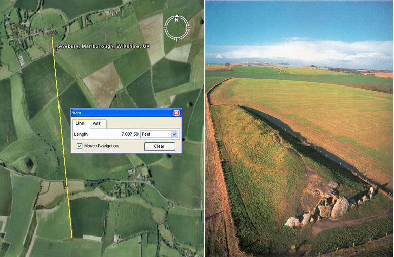
The very important codes related to the lunar year and Khafre Pyramid base dimensions are found in the distance and angle relationship existing between Avebury Henge’s centre obelisk position and the doorway into West Kennet longbarrow (Southern England). The distance was set to 7087.5′ and the return angle from the doorway to the obelisk was set to 354.375-degrees. Very similar coding was incorporated into positions at Cahokia with the distance and angle between Monk’s Mound hub and Mound 10 … 3543.75′ @ 354.375-degrees.
CLOSER TO MONK’S MOUND.
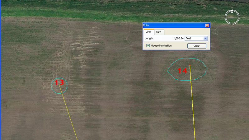
There is now some question about the existence of Mound 13. Melvin L. Fowler writes:
‘These four mounds, as numbered on the Patrick Map and followed by Moorehead, must be considered as a group (Figure 4.10). There are major discrepancies between the Patrick locations of these mounds and indications on current aerial photographs and contour maps of the area. Patrick shows these basically as two pairs (13-14 and 15-16) just north of Monks Mound. Mound 14 is a large, oval-shaped mound, and 13 is a small, apparently conical mound. Mound 16 is a large oval with a platform top, and Mound 15 is a large (compared to 13) conical mound. Recent maps and field studies indicate, however, that there are remnants of two mounds in the positions Patrick numbers Mounds 14 and 16, and another mound to the west, approximately halfway between what Patrick labels Mounds 13 and 15. 1 can identify only three mounds in this group, not the four that Patrick has numbered’.
See: THE CAHOKIA ATLAS- A Historical Atlas of Cahokia Archaeology, by Melvin L. Fowler, 1989, pg.74.
Despite this reservation on Fowler’s part, the location marked on the UWM map to indicate Mound 13’s position seems to comply favourably to ancient coding. The marked position sits 1890′ out from Monk’s Mound hub @ a return angle of 161.8034-degrees (PHI coding).
The Great Pyramid, with a side value of 756′, is 189′ X 4. The value 1890 was highly important for solar month and lunar month counts on the ancient Druidic brass plaque called the Calendar of Coligny (a lunisolar Sabbatical Calendar). The huge panel was divided into 128 boxes of half months, with 2 CIALLOS intercalary months that could be pressed into service as required. To do the solar count the calculation went: 1890-days ÷ 63 = 30-days per month. To do the lunar count the calculation was 1890-days ÷ 64 = 29.53125-days per lunar month.
The sum of 189′ would be 1/32nd of 1-minute of equatorial arc and the sum of 1890′ would be 5/16ths of 1-minute of arc.
The return angle to Monk’s Mound hub codes the PHI ratio @ 1: 1.6180339. It was very common to code this ratio on the open-air-university sites in expanded values such as PHI X 100, as in this case. There was also a huge amount of usage of 1.62 or 16.2 or 162 and this “rounded” expression of the PHI ratio is an essential value in ancient metrology.
Mound 14 sits a coded distance of 1866.24′ from the hub of Monk’s Mound @ 176-degrees return and in both distance and angle the coding is navigational. With the Earth’s equatorial circumference set to 24883.2 Greek miles of 5250′ each, the total tally of feet is 130636800 or 186624′ X 7.
The degree angle coding relates to the English mile of 5280′ (1760 yds).
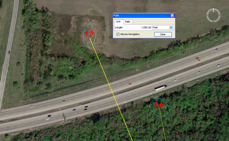
Mound 15 sits out from Monk’s Mound hub 1555.2′ @ 337.5-degrees.
The distance aspect of Mound 15 codes the equatorial size of the Earth in a dynamic way. With the Earth configured to be 24883.2 miles in circumference, the sum of 1555.2-miles would be 1/16th of that circuit or 22.5-degrees of arc.
A mathematical progression based upon 337.5 will produce strings of very useful and essential lunar and navigational values. Also, this degree angle constitutes one of the very important fix-points of the compass:
0 (N), 22.5 (NNE), 45 (NE), 67.5 (ENE), 90 (E), 112.5 (ESE), 135 (SE), 157.5 (SSE), 180 (S), 202.5 (SSW), 225 (SW), 247.5 (WSW), 270 (W), 292.5 (WNW), 315 (NW), 337.5 (NNW), 360 (N).
Mound 16 sits 1066.6666′ out from Monk’s Mound hub @ 168.75-degrees return. This distance value (1/3rd of 3200) or lesser expressions of the same, were much used in navigational calculations. The old French foot was 1.066666′ or 12.8″. Distance readings onto this mound would also have included tutorials related to the merits of 1050′ (100 reeds) and 1080′ (strong navigational value).
The return degree angle from Mound 16 is, essentially, the same kind of coding as is contained within the 337.5-degree outrunning angle to Mound 15 and 168.75 X 2 = 337.5.
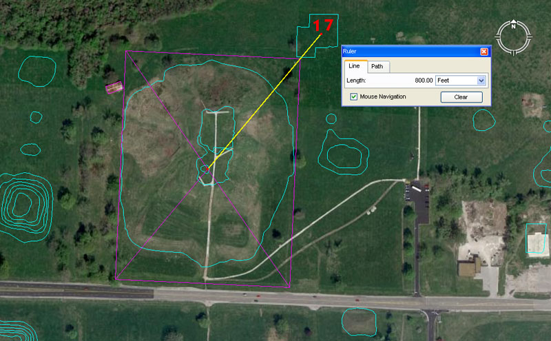
Mound 17 sits very close to Monk’s Mound and the centre-to-centre distance is 800′ @ 40-degrees azimuth.
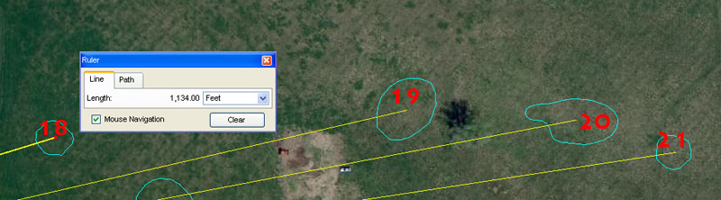
Mound 18 sits a coded distance of 1134′ from the hub centre of Monk’s Mound @ an azimuth angle of 72.9-degrees. Both the distance and angle readings are dynamic lunar coding.
Herodotus, Greek Historian was told by Egyptian priests that the Great Pyramid was 800′ long. The foot they were referring to was 11.34″ (756′ ÷ 800 = 11.34″). Three sides of the Great Pyramid @ 756′ per side = 2268′ (1134′ X 2). The design width of the Station Stone’s rectangle at Stonehenge is 113.4′.
The 6804-day duration of lunar nutation cycle (where the Moon goes from Lunar Major Standstill to Lunar Minor Standstill, then returns to Lunar Major Standstill again is 6 periods of 1134-days. In the 2551.5-days (lunar period of 7.2 lunar years) monitored alongside 2556.75-days (7 solar years) in the ancient lunisolar Sabbatical Calendar, there were 22.5 intervals of 113.4-days. This meant that the lunar period was easily tracked within a 360-degree environment (22.5-degrees is 1/16th of 360-degrees). There would be 3.125 (31/8th) intervals of 113.4-days in a lunar year.
This value was multi-use and featured very strongly in ancient lunar or navigational computations. For example, the sum of 1134′ would be 11.25 seconds of equatorial arc (100.8′ per second) for the Earth and the sum of 11.25-degrees is 1/32nd of 360-degrees. It was by mathematical associations like this that everything was calibrated and tracked within various circuits during ancient times. Let’s look at some ancient tracking and computing stone discs excavated from the North American mounds.
The ancient Moundbuilder mathematician-navigator-astronomers of North America were doing many kinds of counts and calculations, using all of the number families. For this exercise they fabricated many variations of stone disks, with calibration notches or pattern segments around the perimeter. These discs could then act as mnenonic devices or aids in remembering the “times-table” progression of numbers associated with particular cyclic counts. Let’s review how the above stone discs would have been used:
a. This disc has 15 segments and 15 notches. A dot on one of the segments probably relates to alternative counts using progressions of, say, 1512 (Earth’s equatorial circumference), etc., The 15 segments work fluidly in a 360-degree environment, where each segment represents 24-degrees of arc.
b. This calibration (15) duplicates disc a.
c. This disc has 13 segments and notches and would have been used for calendar computations. Under a Sabbatical Calendar count, used by many ancient civilisations, there were 13 months of 28-days each in a year (364-days). This count ran for 7 solar years, wherein the missing 9-days (8.75 actual) were added back in during a festival and the count (now fully corrected) recommenced.
d. This disc has 22 segments and notches and would have been used for counts within the “11” family of navigational values, like the 5280′ mile (22 X 240). The disc would have been useful for remembering the 24750-mile circumference of the Earth as 22 X 1125-miles.
e. This disc has 17 segments and notches and would have been used for lunar counts within the 6804-day lunar nutation cycle (1701-days X 4). The use of intertwined dual snakes in the design or the “all-seeing eye” is very reminiscent of ancient Egyptian cultural symbolism or that of Scandinavia.
f. This disc has 23 segments and pointers and would have been used to remember the 24883.2 Greek mile equatorial circumference of the Earth (130636800′). One of the very important mathematical progressions of antiquity is the 1152 one, which goes 1152, 2304, 3456, 4608, 5760, 6912, 8064, 9216, 10368, etc. At Stonehenge the outer rim of the Sarsen Circle measures 345.6′ or 11.52 feet (average length) per lintel stone (30 overhead lintel stones) or 23.04′ per two lintel stones. The disc would have been used on the basis of 23.04 X 5670000 (half of 11340000) = 130636800′.
g. This disc also has 23 segments and notches and works to 23.04.
h. This disc has 20 segments and notches, each representing 18-degrees of arc. It could also have served as an aid in calculating minutes of arc if configured to work to the value 20.16. Note: 2016′ is 1/3rd of 6048′ (1-minute of equatorial arc).
i. This disc is septimal, with seven segments and notches. It would have been used for calendar and navigational computations and especially for computing the lunar cycles by assigning various values to the segments.
j. This disc has 13 segments and notches and would have been used in calendar computations.
k. This disc is another “open-eye” design, like the “all seeing eye of Horus”, as found on other of the North American mound discs.
l. This disc is yet another that works to progressions of 23.04.
See: Vol. XII, American Antiquity, July 1946, No 1, pg. 9, Article title: Stone Disks As Treaty Suns.
Mound 18 continued:
The angle out to Mound 18 is 72.9-degrees and this is strong navigational coding and lunar coding simultaneously. The Bush Barrow Lozenge artefact recovered near Stonehenge is 7.29″ long or 1/8th of a Roman Pace of 58.32″ (but dates to 3000 BC, which is over 2500-years before there was a thriving and robust Roman civilisation). The Roman foot was 11.664″ and 7.29″ is 5/8ths of their foot. The ancient Egyptian Theban volume was 11664 cubic inches or 729 cubic inches X 16.
TO THE EAST.
Mound 19 sits 1666.66666′ from Monk’s Mound hub at an azimuth angle of 77-degrees. In any 3,4,5 triangle the shortest side will be in a ratio of 1 : 1.666666 to the longest or hypotenuse side. A mathematical progression based upon 1.66666 (12/3rds or 5 ÷ 3) will produce many useful navigational and lunar numbers. The same mound position would have been dual read as 1650′ (100 rods) or 1/10th of a league.
The azimuth angle @ 77-degrees relates to the “11” system of navigation and the sum of 77′ would be 14 fathoms of 5.5′ each.
Mound 20 sits 1920′ from the hub position on Monk’s Mound at an azimuth angle of 79.2-degrees. A mathematical progression based upon 192 will generate a string of very important navigational, lunar and precessional numbers. There would be 135 intervals of 1920-years in the 25920-year duration of the Precession of the Equinoxes. The East to West width of the Stonehenge site is 384′ (192′ X 2). The sum of 1.92 Greek miles (10080′) = 1/36th of 1-degree of arc for a world configured to be 12 X 12 X 12 X 12 X 1.2 Greek miles in circumference. Therefore 1.92-miles X 36 X 360 = 24883.2.
The degree angle to Mound 20 relates to the diameter of the Earth (7920-miles).
It must be reiterated: Ancient mathematicians & navigators, etc., had to rely on memory, with everything learned by rote, repetition, cadence rhythms& poetry, stories containing countable elements, etc. Even Julius Caesar, in writing about the late-era Druidic teachers of his day said:
‘They do not think it proper to commit these utterances to writing, although in all other matters and in their public and private accounts they make use of Greek characters. I believe that they have adopted the practice for two reasons- that they do not wish the rule to become common property, nor those who learn the rule to rely on writing and so neglect the cultivation of memory; and, in fact, it does usually happen that the assistance of writing tends to relax the diligence of the student and the action of memory…They also lecture on the stars in their motion, the magnitude of the Earth and its divisions, on natural history, on the power and government of God; and instruct the youth in these subjects’
(see De Ballo Gallico, VII, 15, 16.).
Mound 21 sits 2062.5′ from Monk’s Mound hub at an azimuth angle of 81-degrees. In a second reading, the return angle was 261.36-degrees and related to the equatorial circumference of the Earth.
This distance is 24750″ or 1200 Egyptian Royal Cubits of 20.625″ each. The distance would also have been read according to two other types of Egyptian Royal Cubits as well. The Egyptian Royal Cubits were used universally by the cousin nations of antiquity as mnemonic devices for remembering the equatorial circumference of the Earth under three number families or readings.
1. To find the true design length of the “6&7″ ERC, simple divide the length of the Great Pyramid of Egypt by 440. Therefore: 756′ (9072″) ÷ 440 = 20.61818182” (2034/55ths). An example of this exact ERC can be found in the Turin Museum. To find the exact circumference of the Earth that this cubit referred to, simply multiply its length by 1200 and read the result in miles of 5280′. Therefore: 20.61818182 X 1200 = 24741.8181818 miles of 5280′ each or 130636800′. If this distance is read as Greek miles of 5250′, then the result is 12 X 12 X 12 X 12 X 1.2 (24883.2 Greek miles). This was the literal geodetic, Earth navigational system built into the base dimensions of the Great Pyramid.
2. But another, very close proximity navigational system (based upon increases of the number 11) was also built into the base dimensions of the Great Pyramid and, undoubtedly, marked in the stone slab paving at the corners of the pyramid. All that ancient mathematicians-navigators had to do was increase the base lengths of the pyramid from 756′ to 756.25′ (3″) and they had at their disposal a whole new, very easy to manipulate way of navigating and doing positional plotting calculations at sea.
Under this system the ERC was calculated as 756.25′ (9075″) ÷ 440 = 20.625″ (205/8ths). To find the exact circumference of the Earth that this cubit referred to, simply multiply its length by 1200 and read the result in miles of 5280′. Therefore: 20.625 X 1200 = 24750. The existence of the 20.625 inch Royal Cubit is confirmed by the careful measurements of Sir William Flinders Petrie in the King’s Chamber of the Great Pyramid. Petrie concluded that the room was built according to a cubit of 20.620 inches, plus or minus .005 of an inch. The upper scale of his estimate is, therefore, 20.625 inches (see The Pyramids and Temples of Gizeh, by Sir William Flinders Petrie).
3. But the ancient scientists knew the Earth was marginally larger that these two very convenient navigational systems configured it to be, so devised an ERC that better described (in factorable numbers) the Earth’s true equatorial circumference. The existence of the 20.736 inch cubit is confirmed by the paving slab widths at the base of the Great Pyramid, which comply to 20 X 1.728 feet (20.736″) or 34.56 feet overall. Sir William Flinders Petrie also identified this particular cubit in his measurement of the coffer in the Khafre Pyramid, wherein it was 5 X 20.736″ long or 103.68-inches overall.
To find the “true” circumference of the Earth, as referred to by this cubit, simply multiply its length by 1200 and read the result in miles of 5280′. Therefore 20.736 inches X 1200 = 24883.2 (only 18.8-miles short of the official value we use today).
The primary function of Mound 21 was to encode mathematical principles that related to the size of the Earth under three geodetic systems.
The angle to the mound is 81-degrees and this was a highly important value in ancient calculations (9 X 9). The 6804-day lunar nutation cycle endures for 84 X 81-days. The value (in double form as 162) was used as a rounded form of the PHI ratio (1: 1.62). The Great Pyramid @ 9072″ long was 5600 “rounded PHI” inches in length. This meant that the Great Pyramid’s dimensions could be symbolically read according to the PHI formula or in PHI inches (1″ X 1.6180339). The half-PHI value (.80901695) was often used in calculations on the British standing stone circles especially, where rings diminish in size according to a PHI or half-PHI ratio reduction.
A return angle from this mound could be read as 261.36-degrees. In the 130680000′ navigational reading of the Earth’s circumference, the sum of 26136′ would be 1/5000th part.
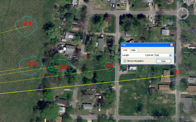
The very sad situation about the Cahokia Mounds is that, what wasn’t eradicated by ploughing and the mining of soil to fill holes, finally gave way to bulldozers flattening land for subdivisions and housing. These are the known, former spots where mounds 22-26 once stood in all their glory, each a repository of special scientific information that had great value to ancient society which laboriously built these sentinels of codes.
Mound 22. This mound sits 2268′ from the hub position atop Monk’s Mound at an azimuth angle of 80.901695-degrees. The distance equates to 3-side lengths of the Great Pyramid and is 3/8ths of 1-minute (6048′) of equatorial arc.
The degree angle is in homage to the half value of the PHI ratio (.80901695). The PHI ratio, its reciprocal value and half value were essential knowledge to ancient civilisations and PHI relationships were built into many ancient edifices, like the Great Pyramid of Egypt:
If one uses simple trigonometry to work out the diagonal side length of the full pyramid, including the theoretical, non-existent capstone, the length to the centre apex would be (Adj. ÷ 51.84 Cos.) = 611.7894615 feet.
Alternatively, if one used a PHI method of Adj. (378 feet) X PHI (1.6180339) = 611.6168142 feet.
It will be observed that the calculated PHI length is only about 2 inches less than the length achieved by straight trigonometry. The ancient astronomer/ mathematicians were coding a PHI related angle for the Great Pyramid simultaneously to the standard angle of 51.84-degrees. The whole edifice was designed to clearly code PHI relationships. For example:
Let’s consider the Great Pyramid on the basis of PHI and the ratio relationship (in Egyptian pyramid acres identified from the writings of Herodotus) between the 4 faces, compared to the ground area that the Great Pyramid covers.
The surface area of each face of the theoretical full pyramid, complete with a (symbolic) pointed capstone, = 611.6168142 feet of side length X 378 feet (1/2 the base length) = 231191.11558 square feet.
Because there are 4 faces, their combined square footage amounts to 924764.6231 square feet.
The base area measured 756 feet X 756 feet or 571536 square feet. A perfect PHI relationship exists between this (symbolic capstone included) total side area and that of the base area: 924764.6231 sq. feet ÷ 571536 sq. feet = 1.6180339 (PHI).
Mound 23 sits a coded distance of 2304′ out from the hub position atop Monk’s Mound at an azimuth angle of 75.6-degrees. Both in distance and angle the coding is navigational. As mentioned, the distance of 2304′ would equate to 1/56700th (strong lunar value) of the Earth’s circumference and 2304 is a part of the much used 1152 mathematical progression. The angle of 75.6-degrees is in homage to the 756′ length of the Great Pyramid and a mathematical progression based on this will generate all of the essential navigational numbers for the “6&7” geodetic system of navigation.
Mound 24 sits 2430′ from the hub position atop Monk’s Mound at a return angle of 261.36-degrees. A mathematical progression based upon 243 will generate many very useful lunar and navigational numbers. For example, the 6804-day lunar nutation cycle is 28 periods of 243-days. The 2551.5-days (7.2 lunar years) tracked alongside 2556.75-days (7-solar years) in the lunisolar Sabbatical calendar is 10.5 periods of 243-days. The Roman mile @ 4860′ (5000 Roman feet of 11.664″) = 2430′ X 2 … in other words this distance at Cahokia in Illinois is half a (so-called) Roman mile, although the length crops up time & time again between markers in Britain, laid out in circa 3000 BC.
The return angle, as mentioned, relates to the equatorial circumference of the Earth.
Mound 25 contains dynamic codes of position in both its distance out from Monk’s Mound hub and its angle. It sits 2688′ out at 82.5-degrees for a return angle of 262.5-degrees. The sum of 2688′ would be 1/48600th of the 130636800′ circumference of the Earth. In other words, under this calibration, the world would be either 24883.2-Greek miles or 26880 Roman miles in circumference.
The outrunning angle of 82.5-degrees is navigational coding in the “11” system and 8250′ would be half a league of 16500′. Similarly, the sum of 82.5′ (15 ancient fathoms) would be 1/64th of a mile of 5280′. In a clever switching of roles, the same angle, 180-degrees opposed, equals 262.5-degrees and this relates directly to the Greek mile of 5250′. Half a Greek mile is 2625′. The value 262.5 is tremendously useful in lunar cycle counts and the 2551.5-day lunar period counted within the lunisolar Sabbatical Calendar was set to 486 X 5.25-days or 972 X 2.625-days (63-hours).
Again, ancient astronomer-surveyor-navigators memorised and understood how to manipulate many mathematical progressions and could, obviously, do calculations very easily in their heads. Ancient navigators on ships were watching the tension in the sails, how well the boat was lifting and planing, how much wind drift, side slap or current drag the hull was subjected to, then calculating speed through the water and distance covered on that degree angle, before assigning the helmsman a new heading across the leyline. At the end of each sea leg, the navigator would then mark on the chart the boat’s position in the ocean, based upon a few devices like sand clocks, a loadstone float, instruments to measure star angles …. and a lot of mental arithmetic.
Mound 26 sits 3024′ out from the centre hub position of Monk’s Mound at an azimuth angle of 84-degrees. The Great Pyramid @ 756′ per side is 3024′ for one complete circumnavigation (half a minute of equatorial arc). The degree angle value is dynamic and a mathematical progression founded upon 84 will generate all of the important navigational numbers for the “6&7” system (84 is 2 X 42 or 2 X 6 X 7). For example: 1-minute of equatorial arc (6048′) = 84 X 72′, etc.
The 180-degrees opposed angle is 264-degrees and this is a dynamic value related to the 5280′ (11 system) mile (2640′ X 2 = 5280′). Again, a mathematical progression based upon 264 generates the essential values of the “11” geodetic system.
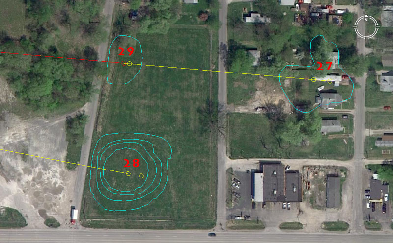
Mound 27 sits within a residential area, with 3 houses occupying parts of its position, whereas mounds 28 & 29 sit in an adjacent field. Two codes of distance (marked by small circles) are shown for each mound.
Mound 27 is centrally coded to sit 2916′ from Monk’s Mound hub @ a return angle of 275-degrees. The 2916′ coding is navigational and also equates to 3000 Roman feet of 11.664″ each or 600 Roman Paces of 58.32″ each. This distance would also be 3/5ths of a Roman mile of 4860′. The 2916 value, placed in a mathematical progression, will ultimately lead to the number 130636800 … the number of feet in the 24883.2 Greek mile equatorial circumference. Along the way, the mathematical progression will generate values like 11664 (the number of cubic inches in an Egyptian Theban volume) or 933120, the number of grains in the Sumerian-Babylonian Royal Double Talent of weight. This progression, stemming from 2916 or divisions thereof, is incredibly old and features amongst the most ancient “Weights Measures & Volumes” standards of antiquity.
A second reading slightly beyond the mound’s centre is 2953.125′. This coding related to the 29.53125-days in a lunar month. Ancient astronomers generated this accurate figure for describing the lunar month (to within 1-minute of time) as 1890 ÷ 64 = 29.53125 (2917/32nds).
The return angle of 275-degrees is navigational and the sum of 2750′ would be 1/6th of an ancient English league of 16500′, whereas 2750-miles would be 1/9th of the 24750-mile equatorial circumference under the “11” navigational system.
Mound 28 sits 2520′ from the hub atop Monk’s Mound at an azimuth angle of 100.8-degrees. This distance is 2400 Greek feet of 12.6″ each or 1200 Assyrian cubits of 25.2″ each. The Great Pyramid, with a base side length of 756′, was 252′ X 3 long. The distance of 2520′ is 25 seconds of arc (100.8′) for a world configured to be 24883.2 Greek miles in circumference and so the degree angle in this coding is a perfect reflection of the length.
A second reading of the length onto a position just forward of centre of mound 28 would generate a distance of 2551.5′. Counts within the lunisolar Sabbatical Calendar monitored 7.2 lunar years (2551.5-days) alongside 7 solar years (2556.75-days). When the solar count began at the Summer Solstice and full Moon conjunction, ancient priests waited until the 6th day thereafter to commence the lunar count, such that both counts would end on the same day 2551.5-days thereafter. In Druidic times, the lunar count started when mistletoe was culled from a venerable Oak tree using a golden sickle.
Mound 29 sits 2475′ from the hub position atop Monk’s Mound and shares the same azimuth angle as mound 27 (275-degrees return). The distance is in homage to the 24750-mile equatorial circumference, of which 275-miles (reflected in the degree angle) would be a 1/90th division.
Just slightly forward of the foregoing position, the length is 2488.32′ and this falls comfortably onto the mound. The coding is, of course, in homage to the 24883.2-mile circumference of the Earth. Mound 29 would have been used for major tutorials related to the equatorial circumference of the Earth under 3 systems (“6&7”. “11” & “true”).
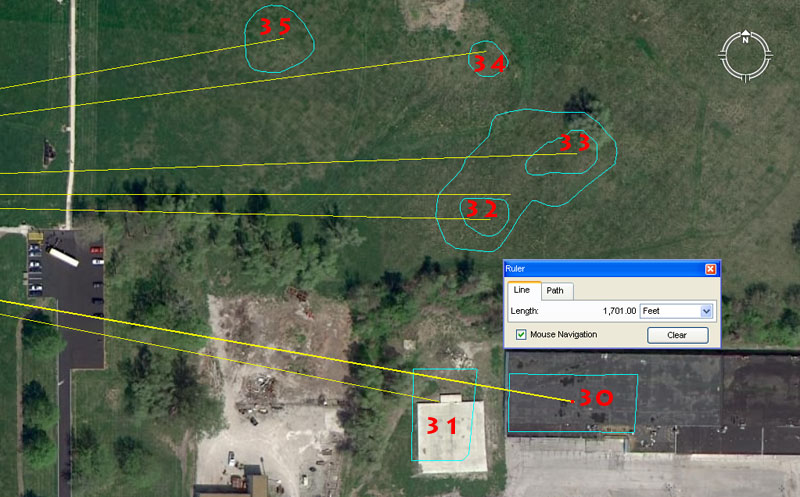
Mound 30 has disappeared under a large industrial complex, but its former position has been accurately logged on the UWM map. Its centre region sat a coded distance of 1701′ from the hub position atop Monk’s Mound @ an azimuth angle of 100-degrees.
Mound 30 codes the quarter period of the 6804-day lunar nutation cycle. This particular lunar cycle was very important to ancient societies, as the Moon, with its immense gravitational tug on the Earth’s atmosphere is the greatest single determinant of weather. This cycle of the Moon is comparable to the Sun’s annual cycle, where it moves down the horizon between Winter Solstice to Summer Solstice. With the Moon, however, moving to the extreme North and South positions takes much longer (6804-days). Ancient mariners had to remain aware of how the Moon sat in comparison to the rotating Earth, as the Earth made its annual journey around the Sun. If the Moon was badly positioned (a bad Moon), then severe storms could be expected and certain seas were too dangerous to venture into. Farmers had to be equally aware of the Moon’s position and it’s ability to bring heavy seasonal rains, late & early frosts (that destroyed newly planted crops or the final harvest) or droughts, etc. It is for this reason that ancient astronomers maintained very accurate lunisolar calendars, tracking the positions of both the Sun & Moon on a daily basis.
Stone disc (e) in the above picture (found at Moundsville, Alabama) was calibrated to follow the 1701-day quarter period of the lunar nutation cycle in 100-day increments (+ 1-day). The half cycle @ 3402-days is encoded into Khafre Pyramid of Egypt, the diameter of the southern ring at Avebury Henge in England and the diameter of Ring o’ Brodgar in the Orkney Islands of Scotland.
The 100-degrees azimuth angle to this position is self-explanatory, but an angle of 100.8-degrees (coding 1-second of equatorial arc in feet) would also have been included in tutorials associated with this mound’s position.
Mound 31 has suffered much the same indignity as mound 30 and has disappeared under an industrial complex. It’s centre position sits 1512′ from the hub on Monk’s Mound at an azimuth angle of 101.25-degrees. In the above picture of stone discs located in the North American mounds, discs a & b could have been read as 15 X 100.8′ = 1512′ or 1/4th of 1-minute of equatorial arc. In an age when there were no electronic calculators, memory devices like the stone discs were valuable and useful tools for remembering and practicing one’s cyclic “times-tables”.
The degree angle to this mound is strong lunar coding and there would be 35 periods of 10.125-days (101/8th) in a lunar year of 354.375-days. Stone disc (i) in the above picture would have been useful for following the lunar cycles in “7” based progressions and a lunar year could be read as 7 X 50.625-days.
Mound 32 sits 1555.2′ from the hub position on Monk’s mound at an azimuth angle of 91.3125-degrees (915/16ths). The distance aspect is navigational and the sum of 1555.2-miles would be 1/16th of the 24883.2-mile equatorial circumference.
The degree angle relates to the duration of the solar year, of which 91.3125-days is the quarter period.
The ancient moundbuilders seem to have created a “V” trough between mounds 32 & 33, which gave them a perfect gunsight-type fix on true East (90-degrees). The base of the trough sits 1584′ from the hub position atop Monk’s Mound and the sum of 1584-miles would be 1/5th of the 7920-mile diameter of the Earth.
Mound 33 sits 1680′ from the hub on Monk’s Mound @ an azimuth angle of 88-degrees.
The value of 168 is strong navigational coding and the sum of 168′ would be 1/36th of 1-minute of equatorial arc (6048′). A mathematical progression based upon 168 will generate essential navigational numbers. This distance at Cahokia (1680′) is 1/4th of an ancient Irish mile (6720′).
The 88-degrees azimuth is navigational coding according to the “11” system and 88′ is 1/60th of a mile.
Mound 34 sits 1562.5′ from the hub atop Monk’s Mound @ 82.5-degrees. A mathematical progression based upon 156.25 will generate many useful navigational numbers in the “11” series. For example: The division of 1-degree of arc for a world configured to be 24750-miles (of 5280′) in circumference is 68.75-miles. A 1/44th division of 68.75-miles is 1.5626-miles or 8250′. Remember the degree angle out to this mound is 82.5-degrees. The return angle (180-degrees opposed) is 262.5-degrees, which is strong navigational coding and lunar coding simultaneously. A Greek mile of 5250′ is 2 X 2625′.
Mound 35 sits 1280′ from the hub atop Monk’s Mound @ an azimuth angle of 80-degrees. The value 128 (64 X 2) had strong-use applications in calendar and compass readings. The ancient Druidic brass plaque called the Calendar of Coligny (a parapegma board for tracking both the Sun and Moon on a daily basis) is made up of 128 divisions or boxes. The 360-degree compass reduces in 8ths, 16ths, 32nds, etc. The degree angle out to this mound (80-degrees) accentuates this use of 8. The ancient chessboard of Egypt (64 squares or 8 X 8) appears to have originally been a calculation matrix.
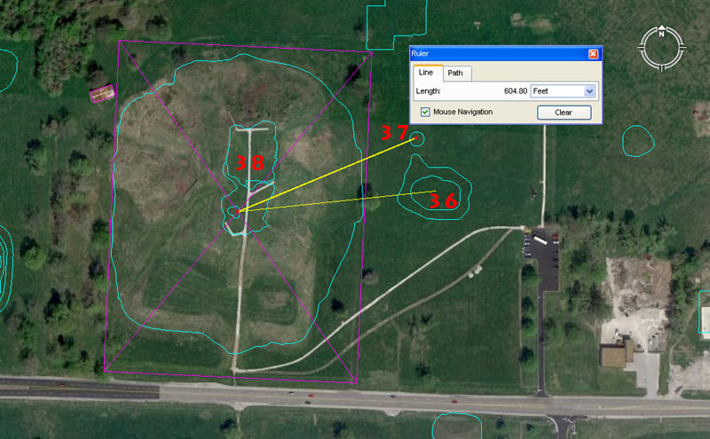
Mounds 36 & 37 sit right alongside and to the East of Monk’s Mound (38).
Mound 36 is ideally situated to teach a range of values that hover around 600′. One of these is the Greek stadia (stadium) of 630′ (60 Hebrew reeds of 10.5′ or 600 Greek feet of 12.6″). Alternatively, the value 625′ sets up a mathematical progression much used in navigation and lunar calculations. The sum of 6.25-miles (33000′) is 1/11th of 1-degree of arc in a world configured to be 24750-miles in equatorial circumference. Another value that would have been taught is 622.08′ as the sum of 622.08-miles is 1/40th of the 24883.2-mile equatorial circumference.
The azimuth angle to the crown of mound 36 is 84-degrees (half of 168).
Mound 37 sits 604.8′ from the hub atop Monk’s Mound @ an azimuth angle of 67.5-degrees. The sum of 604.8′ is, of course, 1/10th of 1-minute of equatorial arc under the “6&7” navigational system. The merits of 605′ (1/10th of 1-minute of arc under the “11” navigational system) would also have been taught.
The azimuth angle to this mound is 67.5-degrees and this represents one of the secondary fix points in a 360-degree compass, with 67.5-degrees representing ENE.
Mound 38 is Monk’s Mound or the primary hub mound for the Cahokia complex of mounds, as well as an additional set of 27 or so mounds that were built across the Mississippi River in Old St. Louis Missouri. These other, outer-satellite mounds sat on the high-ground bluffs about 7-miles from Monk’s Mound and related back to Monk’s Mound by way of coded distances and angles.
An interesting historical detail concerning Monk’s Mound is that : Parish in 1906 said: A Mr. Hill, who once lived upon it, while making excavation near the northwest extremity uncovered human bones and white pottery in considerable quantities. The bones, which instantly crumbled to dust on exposure to the air, appeared larger than ordinary, while the teeth were double in front as well as behind. [Parish, 1906: 22].
Also: G. W. Featherstonhaugh visited the mounds at about the same time. He was greatly impressed with Monks Mound and included a drawing with his description (see Figure 5.1). He visited the owner, Amos Hill, who had constructed a house and garden plot on top of the mound. Hill had laid the foundation of his house on an eminence he found on the summit of his elevated territory, and according to Featherstonhaugh, “upon digging into it found large human bones, with Indian pottery, stone axes and tomahawks” (Featherstonhaugh 1844: 264-272).
This kind of testimony related to “large human bones” is consistent with what was found all over North American in the early 1800’s when many of the mounds were excavated and the skeletons interred within carefully examined and measured. See: http://www.xpeditionsmagazine.com/magazine/articles/giants/holocaust.htm
TO THE WEST.
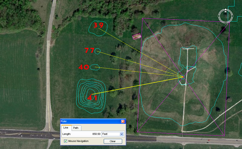
Mounds 39, 40 & 41 sit on the western side of Monk’s Mound, but so does mound 77. Page 155 of The Cahokia Atlas, A Historical Atlas of Cahokia Archaeology, by Melvin Fowler states: ‘On Moorehead’s 1929 map, four mounds—39, 77, 40, and 41—form a line paralleling the west edge of Monks Mound (Figure 6.1). Mound 77 is Moorehead’s addition to this alignment, with 39, 40, and 41 previously noted clearly on the Patrick and other maps.’
Mound 39 sits 891′ from the hub of Monk’s Mound at an azimuth angle of 300-degrees. This seemingly strange mathematical coding recurs on ancient open-air-university sites from Avebury and Durrington Walls henges in England to Ring o’ Brodgar in Scotland to Nazca in Peru to Easter Island and, thus, had very obvious importance to ancient navigators. It is part of an “11” progression (11 X 9 X 9 = 891) and 24750 (the value used to describe the equatorial circumference under the “11” system) X 36 = 891000. Also, the Scottish mile @ 5940′ X 15 = 89100.
The 300-degrees angle out to this mound is 5/6ths of 360-degrees.
Mound 77, which is a part of this group, sits 816.75′ from the hub position on Monk’s mound at a return angle of 106.66666-degrees. In the 130680000′ circumference (“11” system) of the Earth the sum of 8167500′ would be 1/16th part. A much used value in mathematical progressions for coding the equatorial circumference is based upon the value 6534 of which 816.75 is 1/8th part.
The sum of 106.66666 is 1/3rd of 400. As mentioned the old French foot was 1.066666′ or 12.8″ and the mathematical progression had very obvious importance to ancient mathematicians.
Mound 40 sits a coded or intended distance of 809.01695′ @ 276.48-degrees from the hub position atop Monk’s Mound. This position would have been equally read as 810′. The tutorials here would have been about the calculating merits of PHI (1: 1.6180339 and rounded PHI 1: 1.62), which were also used as half values (.80901696 & .81). At English sites, like Stonehenge, there are multiple concentric circles of posts or standing stones. The post circles would reduce in diameter by PHI. Nevertheless, ancient mathematicians would overlay a circle with a square and the square would be a half-PHI reduction on the diameter of the circle. This occurred at Stonehenge.
The red arrow points to a marker situated on the Avenue at Stonehenge, which sits 233.28′ (also read as 233.3333′) from the centre of Stonehenge. From this position the main circles of Stonehenge (with exception to “Z” Holes and the inner rim of the Sarsen Circle …shown in red) reduce by the PHI ratio of 1: 1.6180339. It can be observed that a half-PHI (.80901695) reduced square overlaying the 466.56 diameter circle contains the Stonehenge site’s circular perimeter (378′ wide… East to West), with only some Avenue markers (like the Heel Stone) jutting beyond. Therefore, at Stonehenge the PHI reduction (slightly rounded) for the circles go: 466.56′ to 288′ (Aubrey Circle) to 178.2 (“Y” Holes) to 110′ (outer rim of the Sarsen Circle). Each of these numbers is highly coded and factorable and recur in ancient European/Mediterranean Weights, Measures & Volumes standards. The slightly rounded PHI reducing numbers can also be represented as 466 – 288 = 178; 288 – 178 = 110.
The point is that, at Cahokia Mounds, the tutorials were the same as elsewhere at open-air-universities across the world and the PHI ratio, its half value and reciprocal value were taught. The PHI reciprocal was especially important to know when fabricating round volume vessels for dispensing exact cubic inch volumes in the marketplace. In a sense, the PHI reciprocal allowed ancient merchants to “square the circle”.
The angle out to mound 40 is 276.48-degrees and 276.48-miles is 1/90th of the 24883.2-mile equatorial circumference.
Mound 41 has dynamic coding to do with the duration of the lunar nutation cycle and the Precession of the Equinoxes. It sits a coded distance of 850.5′ from the Monk’s Mound hub @ 259.2-degrees.
With the lunar nutation cycle enduring for 6804-days, 1/8th of that period is 850.5-days. Mound 41 sits half the distance out as mound 30 (1701′) and a mathematical progression based upon 850.5 carries the same lunar cycle information.
The angle relates to the Precession of the Equinoxes, which ancient mathematicians calculated (in factorable numbers) to move 1-degree each 72 years. Therefore 72 X 360 = 25920-years for the full cycle of Precession. It is obligatory to find expressions of 2592 encoded into the major, ancient open-air-universities.
Mound 42 sits 1875′ from the hub on Monk’s Mound at an azimuth angle of 86.4-degrees return. Nearby is mound 76 and it is convenient to include its coding at the same time.
Mound 42 is very substantial and, up until recent decades, had large buildings on top of it and to its eastern side. The number 1875, placed in a mathematical progression, will generate multiple values that were very useful in navigation, the compass, lunar calculations. The sum of 187.5′ would be 1/28th of a Greek mile and 1/88th of an English league of 16500′.
The 86.4-degrees angle value is part of a very important multi-use mathematical progression that goes 864 (the Sun is 864,000-miles in diameter), 1728 (note a cubic foot @ 12 X 12 X 12″ is 1728 cubic inches). Note also that Silbury Hill of Southern England has a circumference of 1728′, based upon a diameter of 550′ and this relationship between an “11” series number converting to a circumference that was perfectly divisible within a 360-degree environment, was the mathematical basis of positional-plotting at sea. The rendition of PI used for converting “11” series diameters into perfect circumferences was 1728/550ths. (3.141818182). The progression continues with: 2592 (Precession), 3456 (note: the outer rim of the Sarsen Circle at Stonehenge measured 345.6′), 4320 (note: The Great Pyramid is 756′ per side or 432 Celtic / Hebrew cubits of 21″ each), 5184 (note the slope angle of the Great Pyramid is 51.84-degrees – 5184-years is 1/5th of the 25920-year Precessional cycle – The Great Pyramid @ 756′ per side is 72 Reed of 10.5′ each per side and covers an area of 5184 square reeds- An English league diameter @ 16500′ converts to a circumference of 51840′ using PI @ 1728/550ths) etc.
This is the kind of information that prospective navigators in training had to memorise in order to develop minds that worked like calculators. The sea does not abide fools well and insufficiently trained navigators were probably going to die, along with the crew under their uncertain guidance.
Mound 76 sits 1890′ out from Monk’s Mound hub @ 98.4375-degrees (987/16ths) return. The Great Pyramid @ 756′ long is 189′ X 4. The day count on the ancient Druidic Calendar of Coligny parapegma brass calculator was 1890. The count was either 63 solar months X 30 = 1890-days or 64 lunar months (29.53125-days) = 1890-days. The return degree angle is lunar and 9.84375-days would be 1/3rd of a lunar month or 1/36th of a lunar year.
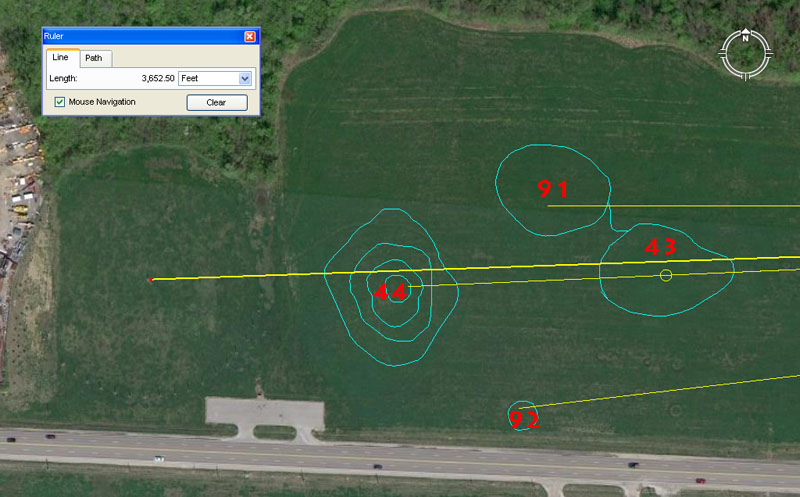
Again, because of the somewhat erratic numbering system assigned to the Cahokia Mounds, numbers 91 & 92 are included here with mounds 43 & 44. Also, to the left side of the picture the circular aspect of Cahokia’s Woodhenge post circle can be vaguely detected.
Mound 43 sits 2750′ from the hub atop Monk’s Mound @ a return angle of 87.5-degrees. The sum of 2750′ is 1/6th of an ancient English league of 16500′ (3.125-miles), whereas the sum of 875′ (based upon the coded degree angle) would be 1/6th of a Greek mile of 5250′.
The sum of 2750-miles would be 1/9th of the 24750-mile equatorial circumference (“11” system of navigation).
Mound 91 sits a coded distance of 2953.125′ from the Monk’s Mound hub @ an azimuth angle of 270-degrees (due West). The 2953.125′ distance is, of course, in homage to the 29.53125-days in a lunar month. There would also have been a reading of 2600′ to accentuate “26” or 13 X 2. Under the Sabbatical Calendar system there were either 13 months in the year or 52 weeks of 28-days each, with a half year of 26-weeks (the period between equinoxes).
A post marker atop mound 91 would, undoubtedly, have marked due West, such that student navigators at the hub position on Monk’s Mound could set their manual theodolites to get perfect angle readings onto all other targets around the horizon.
Mound 92 sits 3024′ out at a return azimuth angle of 83.33333-degrees. The distance is, of course, half a minute of equatorial arc (6048′) under the 24883.2 Greek mile navigational system encoded, very literally, into the base dimensions of the Great Pyramid and founded upon the “6&7″number families combined. The tutorial would also have included the value 3025′ for teaching the “11” family system of navigation and positional plotting at sea. Under that system the Earth was configured to be 24750-miles in equatorial circumference and half a minute of arc was 3025′.
The return angle of 83.33333 sets up a mathematical progression that goes: 83.33333, 166.66666, 250, etc. As mentioned,, in a 3,4,5, triangle the short side will be 1.66666 less that the hypotenuse side. The 1.66666 value (12/3rds) appears to have been used copiously in ancient calculations.
Mound 44 sits 3200′ out at the same azimuth angle as mound 43. The 360-degree calendar is read in both 36 & 32 divisions simultaneously, with the 32 division reading providing the primary and secondary points of the compass. The coded distance to the crown position of mound 44 would also have included a tutorial about 3240′, as a mathematical progression based upon this number provides very important multi-use values.
Woodhenge’s centre post sits 3652.5′ from the hub position atop Monk’s Mound at a return azimuth angle of 88-degrees. The distance is in homage to the 365.25-days in a solar year. The very clever way in which the ancient astronomers set the centre post of Cahokia’s Woodhenge circle, meant that first glint of the equinoctial sunrise would be observed where the base of the 3rd terrace met the top of the 2nd terrace. This notch on Monk’s Mound sat very close to 91.3125-degrees and the sum of 91.3125-days is 1/4th of a solar year of 365.25-days or 1/2 of 182.625-days (the number of days between equinoxes).
From the centre post of Cahokia’s Woodhenge. the Sunrise on the day of the equinox was coded to represent 91.3125-degrees azimuth as the rise position. (Photo by Scott McNealy).
CIRCUITING AROUND FROM THE WEST.
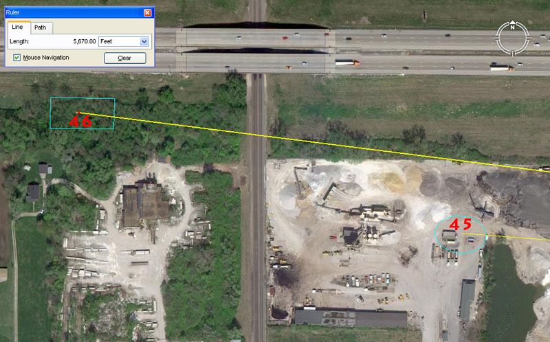
The University of Wisconsin, Milwaukee, map of the mound positions omits inclusion of mound 45, which has been thoroughly eradicated without trace. However, it appears clearly on the Patrick map and others and a very good approximation of it’s former position can, therefore, be made by triangulations from other known mound positions. It sat within what is now a “sand & gravel” processing yard.
Melvin Fowler writes:
Mound 45 (N206W1138)
See:The Cahokia Atlas, A Historical Atlas of Cahokia Archaeology, pp. 115 – 116.
One of the rectangular mounds at the Cahokia site is Mound 45, shown on the Patrick Map with its longer axis east-west. Mound 45 is located northwest of Mound 44 and directly west of Mound 40 (see Figure 3.10). McAdams shows Mound 45 as a 10- foot-high (3.05-meter) conical mound. Thomas, however, indicates that the mound was in the northern one third of the west side of a large borrow pit situated between Mound 44 and the railroad tracks. This borrow pit was excavated in advance of a planned interstate highway over the area of Tract ISA. Examination of aerial photos provides no clue as to the location and condition of Mound 45. By 1933, when the Dache Reeves photos were made, all of Section 34 had been disturbed by construction of both a canal that straightened Cahokia Creek and a dog-racing track which probably intersected or cut into Mound 45. The photos do show an interesting soil disturbance east of the track, apparently where topsoil had been removed. There is no record of excavations in Mound 45.
A “best-guess” estimate of Mound 45’s former position would indicate that it probably sat 4500′ out from the hub of Monk’s Mound @ an azimuth angle of 94.5-degrees return. The sum of 45-degrees is, of course, 1/8th of a 360-degree circle, so mathematical progressions base upon 45 or lesser divisions of the same, were very important to ancient calculations.
With the mound sitting in the near vicinity of 4500′ out, it appears obligatory that it would also have carried the coded distance of 4536′, as this is one of the truly dynamic navigational numbers of antiquity. The Great Pyramid was built as a truncated pyramid, with a flat floor “altar” on top of it. The vertical height to that floor position is 453.6′. Sir William Flinders Petrie measured the heights of each tier of the pyramid up to the, now, somewhat jumbled stonework on the top. His final measurement for overall height was 5451.8″, which is about 6-inches in excess of 453.6′. It appears that the intended height to the top of the altar floor was 264 Egyptian Royal Cubits of 20.61818182″ each (453.6′). This cubit duplicates the length of the one in the Turin Museum and relates to calculating the equatorial size of the Earth according to the “6&7″ navigational method. Remember, the length of the Great Pyramid @ 756′ is 9072″ or 4536” X 2.
It’s possible that the ancient architects of the Great Pyramid used the 20.625″ ERC (“11″ family navigational method) for the height to the top of the altar floor. Therefore: 264 X 20.625” = 453.75′. Remember, the Great Pyramid, under its “11” navigational assignment, was 756.25′ long or 9075″ (4537.5″ X 2). By either reading (453.6′ or 453.75′) the pyramid’s height coded the equatorial circumference of the Earth, as did its slope angle of each face (51.84-degrees). Therefore: the 24883.2-mile equatorial circumference ÷ 51.84 (miles) = 480.
The 94.5 return azimuth angle from mound 45 to Monk’s Mound is very strong navigational and lunar coding simultaneously. The Great Pyramid @ 756′ per side was 94.5′ X 8. The sum of 94.5′ is 1/64th of 1-minute of equatorial arc (6048′).
Mound 46 sits 5670′ out at 97.2-degrees return azimuth angle. The distance aspect is strong lunar coding and the 6804-day lunar nutation cycle is 12-periods of 567-days (19.2 lunar months of 29.53125-days each). The 2551.5-days (7.2 lunar years) monitored within the lunisolar Sabbatical Calendar, is 45 periods of 56.7-days. A lunar year is 6.25 periods of 56.7-days.
The return angle is navigational coding and 97.2-miles would be 1/256th of the Earth’s 24883.2-mile equatorial circumference. This segmentation is equivalent to dividing a circle, the outer perimeter of which represented the 24883.2-mile circumference, into 2, 4, 8, 16, 32, 64, 128 & 256 divisions.
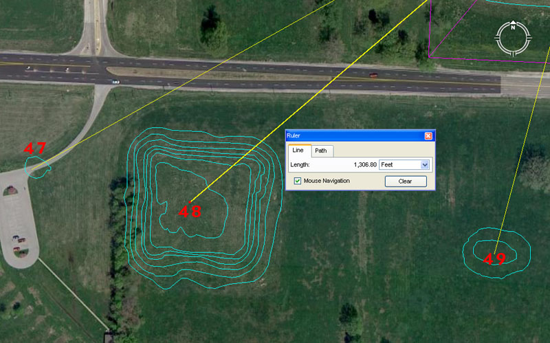
Mounds 47,48 & 49 are situated to the southwest of Monk’s Mound.
Mound 47 sits 1575′ from the centre hub position atop Monk’s Mound @ 60.75-degrees return. The distance of 1575′ is primarily lunar coding and a mathematical progression based upon this value will generate very useful values for tracking the lunar cycles. For example, there would be 432 periods of 15.75-days in the 6804-day lunar nutation cycle; 162 periods in the 2551.5-day lunar period monitored within the lunisolar Sabbatical Calendar or 22.5 periods of 15.75-days in the 354.375-day lunar year. Inasmuch as there are 16 X 22.5-degrees in a 360-degree circle, a calibrated stone disc, based upon increments of 15.75-days (378-hours) would work perfectly for tracking 3 lunar cycles separately. Note: The half-value length for the Great Pyramid is 378′. The sum of 157.5′ would equate to 1/4th of a Greek stadia (stadium) length.
Simultaneously to mound 47 carrying tutorials based upon 1575′, the merits of 1562.5′ would also have been taught. This value generates very useful numbers used in navigation and lunar calculations.
The 60.75-degrees return angle from the crown of mound 47 to the hub on Monk’s Mound is strong lunar coding. There would be 112 periods of 60.75-days in the 6804-day lunar nutation cycle and 42 periods in the 2551.5-day count (7.2 lunar years).
Mound 48 sits 1306.8′ from the hub atop Monk’s Mound @ a return angle of 49.5-degrees. This very important mound was for teaching student navigators the equatorial circumference of the Earth under 3 systems.
1. The Earth is 24883.2 Greek miles in circumference = 130636800′. This is the literal system built into the base dimensions of the Great Pyramid and, although a small amount of known error existed in consideration of the true equatorial circumference (about 160.2-miles shortfall) the system was very fluid and easy to manipulate for positional plotting at sea. Also, all of the lunar cycle values could be integrated within the same system. This “6&7” system was dynamic.
2. The Earth is 24750 English miles in circumference = 130680000′. This is the second system built into the base dimensions of the Great Pyramid and, although it too accepted a small amount of known error (152-miles), the system was excellent for very fluid positional plotting at sea. This system would convert “11” based sea legs into sexagesimal circumferences, for easy calculations of degree angles back to the point of departure or onwards to the destination, despite many course changes when tacking with the wind (zigs & zags across the ocean).
3. The Earth is 24883.2 English miles in circumference = 131383296′. This third system used highly factorable numbers to represent the “true” equatorial circumference, for a shortfall of only 18.8-miles. Although the system was factorable, it was unsuitable for positional plotting, as it generated cumbersome values when converting linear sea legs into circumferences for precise angle determinations.
Most voyages were regional (say within the Mediterranean or across the Atlantic) so the “6&7” or “11” systems of navigation were more than sufficiently accurate for grid referencing the Earth into latitudinal or longitudinal sectors.
The 49.5-degrees return angle from mound 48 to Monk’s mound is navigational coding under the “11” system of navigation and 4950-miles would be 1/5th of the 24750-mile equatorial circumference.
Mound 49 sits 1008′ from the hub position atop Monk’s Mound @ a return azimuth angle of 15-degrees. The distance is 10-seconds of equatorial arc of 100.8′ each. In other words, 100.8′ (1-second of arc) X 60 = 6048′ (1-minute of arc) X 60 = 362880′ (1-degree of arc) X 360 = 130636800 (the equatorial circumference). Again, tutorials at this mound would have included 10-seconds of arc readings in the other systems.
The return azimuth angle from this mound is 15-degrees, which is 1/24th of 360-degrees.
RECONSTRUCTION OF ERADICATED MOUNDS AFTER 1981.
It’s important to realise that within sections of Cahokia Mounds State Historic Park, considerable reconstruction has occurred since 1981 to create the park that presently exists. The State had to buy up many privately owned homes in a subdivision and remove both the buildings and the roads. When the subdivision was first put in, several mounds had been flattened to create level ground upon which to build the houses and roads. After 1981, some effort was expended to recreate the old mound positions at approximately original locations and dimensions. This was, of course, to give visitors to the park a feeling and spectacle of what the complex would have looked like in its heyday. See: http://www.nps.gov/oia/topics/Cahokia.pdf
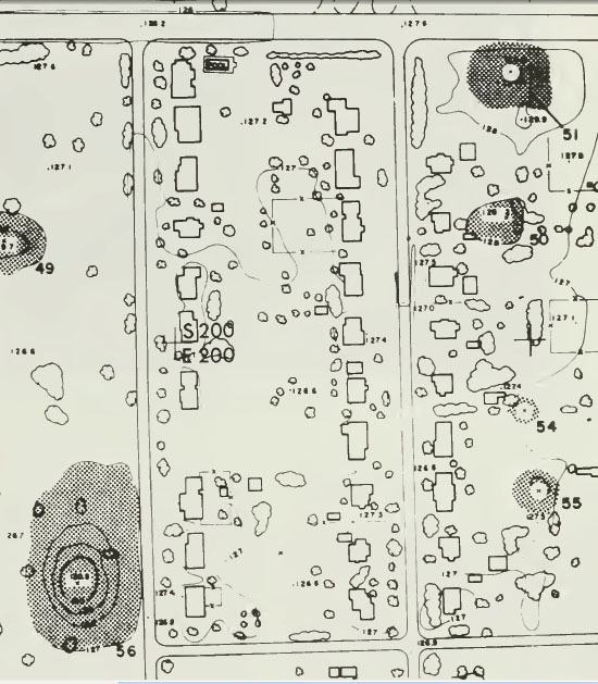
Since 1981, the following changes have occurred:
a) The State of Illinois transferred the site out of the State Park system and established the property as a State Historic Site, establishing its primary function as site protection and public interpretation; consequently most recreation areas were concentrated or removed.
b) New 33,000 sq. ft. (3066 sq. m) Interpretive Center and parking lot; old museum and parking lot removed.
c) The Woodhenge was reconstructed.
d) The state now owns over 2100 acres (850 hectares) of the site, including nearly all of the northern, central, and southern areas – a 60% increase in state ownership over the 1300 acres (540 hectares) owned at the time of the inscription in 1982. The state now owns over half of the site as defined by the US National Historic Landmark boundary, including 70 mounds.
e) One entire 40-acre housing subdivision consisting of 68 houses acquired and restored as Grand Plaza area. Six mounds along the east side of the plaza that were destroyed during construction of the subdivision were recreated to approximate original dimensions.
f) As more property was acquired and protected, old park and subdivision roads and buildings were removed and landscape restored: trees and buildings blocking landscape view of mound layout and site organization were removed from central part of site; small and remote mounds were removed from agricultural production; trees were removed from other mounds – dense erosion resistant grasses were planted on the mounds; and 40 hectares (100 acres) were taken out of cultivation and established in native prairie plants and grasses. Interpretive and hiking trails were established.
We now move into a large area where a subdivision was systematically removed after 1981. For the purposes of this study, the former positions of all mounds are fixed according to the University of Wisconsin, Milwaukee map, which remains the most authoritative study. The map, a section of which is shown above, was the result of very careful analysis by UWM, which collated all historical information that existed related to the mounds, before recording the positions. The subdivision shown above in the UWM map is now completely gone and this land, situated just SE of Monk’s Mound, has been absorbed into the newly extended park.
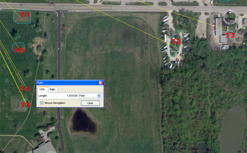
Mounds 50, 51, 54 & 55 were mostly eradicated when a subdivision was built in that section. Mound 53 partially survived in a trailer park and whatever was left of mound 53 was removed to make way for an industrial site. Prior to the encroachment of urban sprawl and industrialisation, farmer’s ploughs or mound mining (selling soil for fill) had severely diminished many mound in size and all but obscured their presence.
Mound 50 sits 1166.4′ from the hub position on Monk’s Mound @ an azimuth angle of 145.8-degrees. This distance would equate to 1200 so-called Roman feet, although the length is found within ancient open-air university sites that preceded the Romans by 2500-years or so. This incremental value was important for remembering the equatorial circumference of the Earth and the sum of 1166400′ would be 1/112th of the 130636800′ equatorial circumference. This calibration was equivalent to dividing the Earth into 56 & 112 divisions. There were 56 posts on the Aubrey post circle at Stonehenge for various kinds of lunar or navigational-based counts, as well as triangulation fixes onto ascending or alighting star positions, as stars hovered just above the top of the circumnavigating henge embankment. The henge embankment acted as a false horizon, similar to what a navigator would see in the middle of a featureless ocean at night.
The degree angle is similar coding and a mathematical progression based upon 1458 will generate many if the same values as one based upon 11664. The fact of the matter is that 1458 X 8 = 11664. The Egyptian Theban volume was 11664 cubic inches.
Mound 51 sits 972′ from the hub position on Monk’s Mound @ 136.08-degrees. This mound carries, essentially, the same coding in both distance out and angle away from Monk’s Mound hub. The values generate mathematical progressions that relate to navigation and the cycles of the Moon. The sum of 97.2-miles would be 1/256th of the 24883.2-mile equatorial circumference, which is equivalent to dividing up the Earth by 4, 8, 16, 32, 64, 128 & 256, etc.
The 136.08-degrees azimuth angle homes-in on a much-used value to describe the rate of speed that the Earth spins in a 24-hr period. Therefore 24883.2-miles ÷ 24 = 1036.8 MPH. This value, or lesser divisions thereof, was used by several ancient nations in “cubic capacities” of goods sold in the marketplace. It’s probable that the side length of Monk’s Mound was intended to be 1306.8′, based upon Reed’s 1968 core-drill survey.
In this case, related to distance and angle, the sum of 13068 ÷ 972 = 14.
Mound 52 sits 2250′ from the hub atop Monk’s Mound @ an azimuth angle of 115.2-degrees. The value 2250 would have been taught in homage to the 22.5-degrees that represents 1/16th of 360-degrees. The same mound crown would have carried a tutorial for 2268′ which would equate to 3 side lengths of the Great Pyramid @ 756′ per side. The value is both strong lunar and navigational coding simultaneously and the sum of 2268′ is 1/160th of 1-degree of equatorial arc.
The angle value of 115.2 is a strong, multi-use, navigational number and 115.2-miles is 1/216th of the 24883.2-mile circumference. The sum of 216′ (108 X 2) is 1/28th of 1-minute of arc (6048′). Both the English and American “bushel” volumes derive from very ancient volume measures and are supposed to be exactly 2160 cubic inches (coding the number of years the Sun spends in each of the 12 Houses of the Zodiac during the 25920-year cycle of Precession).
There were 30 lintel stones lying horizontally atop the Sarsen uprights at the Sarsen Circle of Stonehenge, each averaging 11.52′.
Mound 53 sits 2640′ from the hub position on Monk’s Mound @ an azimuth angle of 108-degrees. The distance of 2640′ is half a mile of 5280′. The value carried by the angle out from the hub atop Monk’s Mound (108-degrees) is half of 216 and the sum of 108′ would be 1/56th of 1-minute of arc (6048′).
Mound 54 sits 1485′ from the hub atop Monk’s Mound @ an azimuth angle of 151.875-degrees. This distance is 1/4th of an ancient Scottish mile of 5940′. The angle is navigational & lunar coding simultaneously. The sum of 151.875′ (1517/8ths) is 1/32nd of a Roman mile (4860′). The angle onto this mound would also have been read as 151.2-degrees (two sides lengths of the Great Pyramid @ 756′ per side = 1512′ or 1/4th of 1-minute of equatorial arc).
Mound 55 sits 1618.04′ from the hub position on Monk’s Mound @ an azimuth angle of 153.6-degrees. The UWM map shows a small residual mound configuration amongst the housing subdivision, whereas nowadays a whole new and substantial mound has been rebuilt within the park. Although the UWM position still touches down on the new mound, the new epicentre is more to the West.
The UWM position carries a dynamic code related to the PHI ratio (1: 1.6180339) and sits a coded distance of 1618.04′ out at an azimuth angle of 153.6-degrees. The distance would also have been read according to “rounded” PHI and represent 1620′.
The 153.6 value is navigational and 153.6-miles X 162 = 24883.2-miles.
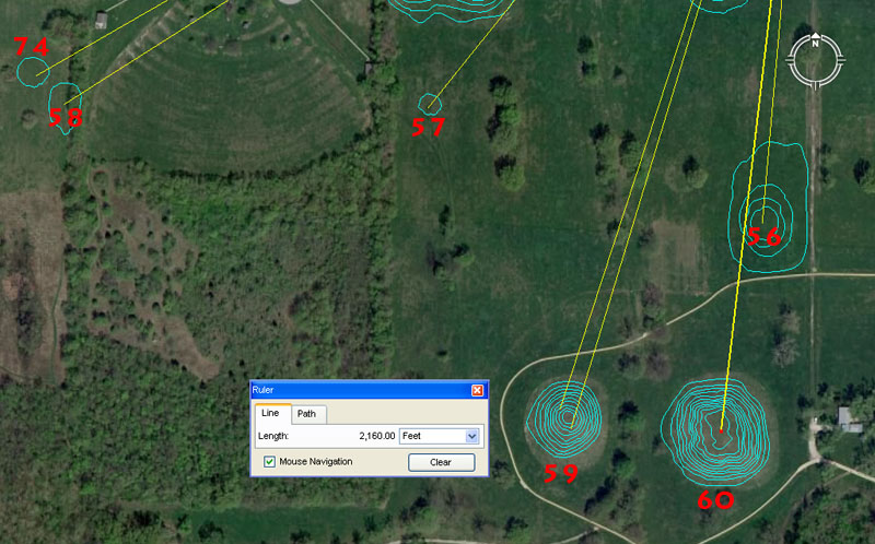
Mounds 56, 57, 58, 59& 60, with an out of sequence mound 74 sitting alongside mound 58.
Mound 56 sits 1600′ out from the hub position atop Monk’s Mound @ a return azimuth angle of 15-degrees. The 360-degree compass was divided up into divisions of 8, 16 or 32 and this “octal” method of dividing the circle often shows up in North American Indian designs. Also, some North American Indian tribes counted in divisions of eight, by counting the spaces between the fingers, rather than the fingers themselves. Simultaneously, the 360-degree compass was divided up according to the ancient Babylonian sexagesimal system (base 60) and 15-degrees is 1/24th of 360-degrees.
Mound 57 sits 1650′ out @ an azimuth angle of 218.75-degrees. The distance is 300 ancient fathoms, 100 rods or perches or 1/10th of an ancient league (16500′ or 3.125-miles). The 218.75-degree angle, used in a mathematical progression generates navigational and lunar numbers and the sum of 218.75′ is 1/24th of a 5250′ Greek mile.
Mound 58 sits 2376′ out @ 237.6-degrees. Generally, ancient architects of the open-air-universities would design the layout of markers in such a way as to generate unrelated values of distance and angle onto an outlying marker. This was, obviously, so that “working out the maze” didn’t become too easy and there were always two values to find through precise surveying. In a few cases, however, the wily architects made both the distance and angle an expression of the same dynamic value, as in this instance.
The value 2376 is navigational and the sum of 237.6′ would be 1/25th of an ancient Scottish mile of 5940′. This distance at Cahokia Mounds would be 1/55000th of the 24750-mile equatorial circumference.
Mound 74 sits 2400′ out @ an azimuth angle of 240-degrees. The architects who designed the layout have, again, made the distance and angle coding hit upon the same value.
Mound 59 sits 2240′ out at an azimuth angle of 196.875-degrees. The coding would also have included 2200′ (navigation) @ 198-degrees (198-miles would be 1/40th of the diameter of the Earth).
The sum of 2240 lbs became the English ton (20 cwt of 112 lbs each) and this use of “14” & “16” based values has a pedigree back to ancient Egypt and other civilisations of antiquity. For example, the ancient Egyptian Sep, Deben & Kite weights system was based upon the (traditional) pound of 7000 grains and the English pound derives directly from that. There was a Deben of 700 grains (1.6 ounces) and a Kite of 70 grains (.16 of an ounce).
Similarly, the degree angle, in this case, (196.875) was strongly represented as a weight in ancient Egypt for measuring out quantities of gold. The Beqa weight was 196.875 grains and this same gold standard was adopted by the latter Greeks and Romans. The Greeks called their 196.875-grain weight a Tridrachm and the Romans called theirs a Semuncia. The coding contained within this value is primarily lunar, but also navigational. The sum of 19.6875-days (1911/16ths … 472.5 hours) would be 1/18th of a lunar year (354.375-days). Equally, the sum of 19.6875′ would be 1/32nd of a Greek stadia of 630′.
Mound 60 sits 2160′ out @ an azimuth angle of 186.624-degrees.
The sum of 2160-years is, of course, the number of years the Sun spends in each House of the Zodiac during the cycle of Precession. The Moon is 2160-miles in diameter. The degree angle relates to the equatorial circumference of the Earth and 186624′ would be 1/700th of the 24883.2 Greek mile distance around the Earth.
DOWN SOUTH.
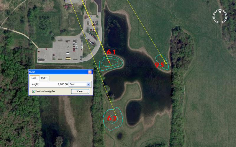
Mounds 61, 62 and an out of sequence mound 95 sit around one of the flooded “borrow-pits” from which earth was taken to build the mounds.
Mound 61 sits 2800′ out from the hub position on Monk’s Mound @ 156.25-degrees. A second reading would have been 2835′.
A mathematical progression based upon 7 generates values used in calendar calculations or navigation, including 2800. A second tutorial that would have been included is 2835′. The Khafre Pyramid of Egypt has a base perimeter value of 2835′ or 708.75′ per side. The sum of 2835-days would equate to 8 lunar years of 354.375-days each.
A mathematical progression based upon 1.5625 will generate many useful values including 2 X 1.5625 = 3.125 (used as a form of PI in certain types of ancient calculations). The ancient English league @ 16500′ was 3.125-miles. Also, the diameter of the Earth @ 7920-miles X 3.125 = 24750-miles (the equatorial circumference of the Earth under the “11” family of numbers, navigational system).
Mound 62 sits 3240′ out @ an azimuth angle of 158.4-degrees.
The value 3240, used in a mathematical progression, generates many useful values for readings within the equatorial circumference of the Earth, the Precession of the Equinoxes and the lunar nutation cycle. For example, the sum of 324-years would equate to 1/80th of the 25920-year cycle of Precession and 324-days would be 1/21st part of the 6804-day lunar nutation cycle.
The degree angle codes the diameter of the Earth, of which 1584-miles would be 1/5th part.
Mound 95 sits 3000′ out @ 148.5-degrees, Other distance readings would have included 2953.125′ & 3024′.
Various readings which hover close to 3000′ would have been taught at this mound, including the merits of 2953.125′ (lunar) and 3024′ (half of 1-minute of equatorial arc).
The angle of 148.5-degrees is navigational and the sum of 1485′ equates to 1/4th of the 5940′ Scottish mile.
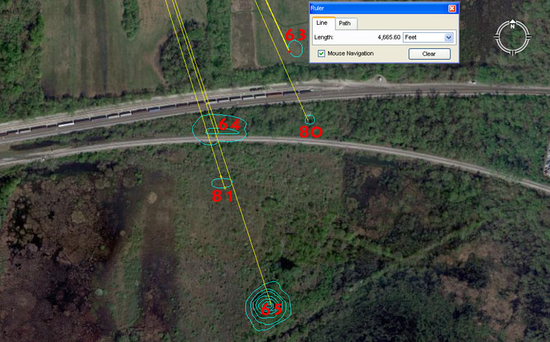
Mounds 63, 64 & 65 sit within a cluster that includes mounds 80 & 81. The location is beyond the railway tracks in scrub (regenerating forest) country SSE of the park.
Mound 63 seems to carry a dynamic distance code of 4665.6′ @ 155.52-degrees and both of these values are, essentially, a part of the same mathematical progression that relates to the equatorial circumference of the Earth. At Stonehenge, a marker on the Avenue sits a coded distance of 233.28′ from site centre to indicate a circle 466.56′ in diameter. The sum of 46656′ would be 1/2800th of the 130636800′ (24883.2-Greek mile) equatorial circumference. Similarly, the sum of 1555.2-miles = 1/16th of the 24883.2-mile equatorial circumference.
These numbers recur constantly in ancient weights and volumes. For example:
THE SUMERIAN-BABYLONIAN ROYAL STANDARD.
This slightly heavier standard was for payments to the royal treasury and some Babylonian weights of this type bear the inscription, “of the King”.
| BABYLONIAN ROYAL SINGLE STANDARD. 1 Talent……… 466560 grains, equals: 60 Mina……… @ 7776 grains, or: 3600 Shekel….. @ 129.6 grains. | BABYLONIAN ROYAL DOUBLE STANDARD. 1 Talent………933120 grains, equals: 60 Mina…….. @ 15552 grains, or: 3600 Shekel… @ 259.2 grains. |
Mound 80 sits 5062.5′ out @ 156.25-degrees. The distance figure is lunar coding and the sum of 50.625-days X 7 = 354.375-days or 1 lunar year.
The angle coding is the same as that of mound 61.
Mound 64 sits 4950′ out @ 161.8034-degrees.
A distance of 495-miles would be 1/16th of the 7920-mile diameter of the Earth and 4950-miles would be 1/5th of the 24750-mile (of 5280′) equatorial. circumference.
The degree angle is, of course, coding the PHI ratio X 100.
Mound 81 sits 5250′ (1 Greek mile) from the hub position atop Monk’s Mound @ 162.5-degrees. Other length readings onto this mound would have included 5184′ (navigation, Precession) and 5200′ (calendar).
The 1.625 value had some usage within calendar year calculations and is a division of 13, 26 & 52 (as in months, bi-weeks and weeks in a year).
Mound 65 sits 5940′ out @ 162-degrees. This distance is 1-Scottish mile, which was 1-furlong or furrowlong greater that the English mile of 5280′. The sum of 5940′ would be 1/22000th of the 24750-mile (130680000′) equatorial circumference.
The 162-degrees azimuth angle is coding “rounded PHI” (1.62) which was one of the most used values of antiquity. The Great Pyramid @ 756′ (9072″) of length is 5600 rounded PHI inches of 1.62″ each. The 6804-day lunar nutation cycle is 42 periods of 162-days. The sum of 162′ would be 1/2240th of 1-degree of equatorial arc (362880′) under the 24883.2 Greek mile system.
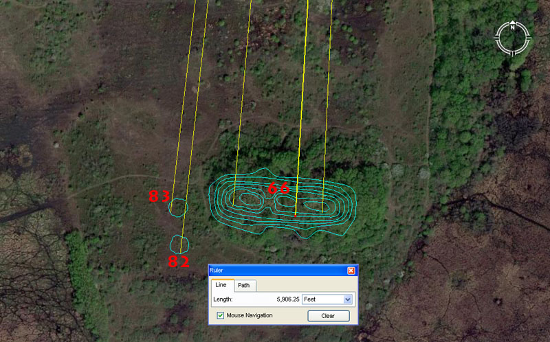
Again, this cluster of mounds sitting almost due south of Monk’s Mound hub are numbered out of sequence. The most substantial of the batch is mound 66.
Mound 66 sits a coded distance of 5906.25′ from Monk’s Mound hub and, because of its elongated configuration, carried several angle codes over its length. An eastwards angle code was 182.625-degrees (the number of days between equinoxes or half of 365.25 … the number of days in a solar year). More centrally it sat 183.33333-degrees from the Monk’s Mound hub and this value is a third of 550. Further west a return angle of 5-degrees works well.
The distance code is very important and is coding directly off the Khafre Pyramid of Egypt (Egypt’s pyramid of the Moon). This is how one locates the lunar numbers mathematically and recognises them, by first going back to the Giza Plateau Bureau of Standards:
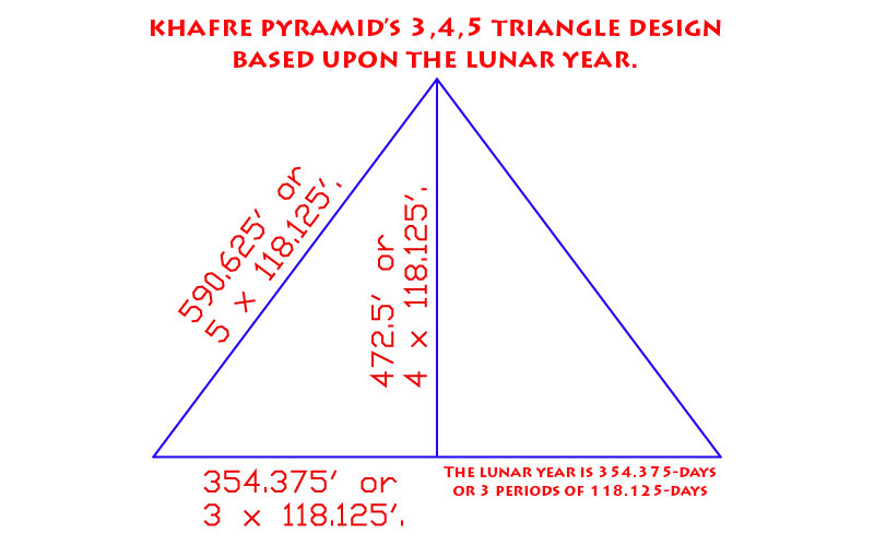
The Khafre Pyramid of the Giza Plateau is 15/16ths the base length of the Great Pyramid. Therefore: 756′ ÷ 16 = 47.25′ X 15 = 708.75′. Half of the Khafre Pyramid’s base length is 354.375′ and the length of the lunar year (about 11-days shorter than the solar year) is 354.375-days.
1. Whereas the Great Pyramid, in its base length and slope angle (51.84-degrees), accentuates the mathematical principles related to the size of the Earth and how to grid reference the Earth for successful navigation, the Khafre Pyramid is all about the Moon.
2. The Khafre Pyramid has a design slope angle of 53.13010235-degrees and this angle occurs naturally in all 3-4-5 triangles. Therefore, half the base length is 354.375′ (lunar year coding), the vertical height was designed to be 472.5′ and the length of the sloping face was designed to be 590.625′.
3. With each base length of the pyramid equating to 708.75′, a full circumnavigation was 2835′ or 34020″. This value gave mnemonic reference to the 6804-day lunar nutation cycle, the half value of which was 3402-days.
Mound 82 sits 6048′ out @ 6.25-degrees return to Monk’s Mound. This distance is, of course, 1-minute of equatorial arc under the “6&7” navigational system. The distance would also have been read as 6050′ for a tutorial about 1-minute of arc under the “11” navigational system.
The return angle of 6.25-degrees is navigational coding and 6.25-miles would be 1/11th of 1-degree of arc (68.75-miles) under the “11” navigational system.
Mound 83 sits 5940′ out @ 186.624-degrees. The distance is 1 ancient Scottish mile. The degree angle is navigational coding and 186624′ would be 1/700th of the 24883.2 Greek mile equatorial circumference.
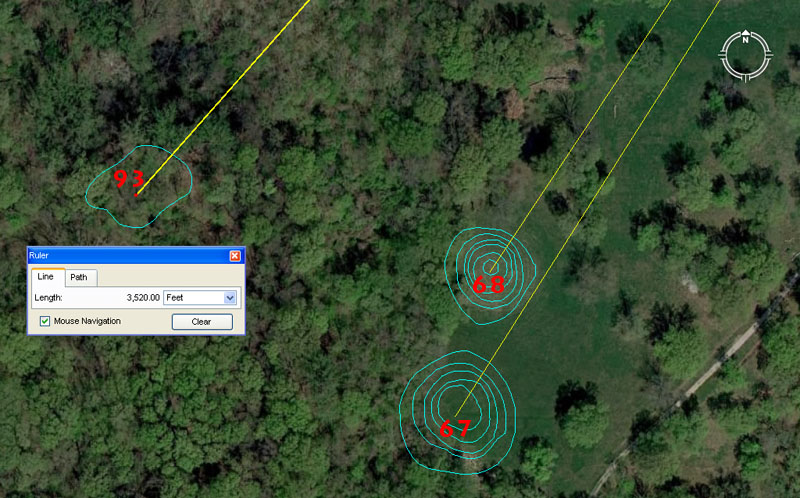
Again, mound 93 sits out of numbering sequence but closeby mounds 67 & 68 to the SSW of Monk’s Mound.
Mound 67 sits 3300′ from the hub position atop Monk’s Mound @ 33.6-degrees return. This length is 600 ancient fathoms, 50 chains (66′) or 5 furlongs-furrowlongs (660′). It is also 1/5th of a league (16500′).
The angle reading is also navigational coding and a mathematical progression based upon 336 will generate very exploitable divisions within the 24883.2 Greek mile circumference. The sum of 336′ is 1/18th of 1-minute of arc (6048′). The ancient Irish mile @ 6720′ is 3360′ X 2.
Mound 68 sits 3500′ out @ 32.4-degrees return. This distance is 2/3rds of a Greek mile. It is also 1/10th of an ancient Swedish Mil of 35000 English feet of 12″. The ancient Swedish Mil was 6000 famn (fathoms) of 70″ each (5.83333′). The Roman foot was 11.664″ and their pace was 58.32″, nevertheless, the evidence would suggest that these increments were limited to volume measures and lunar calculations. It’s apparent that the Roman overland foot was the very simple to use 11.66666″ (112/3rds) and that their overland pace or fathom was 58.333333″ (581/3rd) in line with the ancient Swedish system.
The return angle of 32.4-degrees is a multi-use value and a mathematical progression based upon 324 generates numbers used in navigation, lunar cycle and Precession of the Equinoxes divisions and calculations. There would be 21 periods of 324-days in the 6804-day lunar nutation cycle and 80 periods of 324-years in the 25920-year duration of Precession.
Mound 93 sits 3520′ out @ 41.472-degrees return. The distance is 640 ancient English fathoms of 5.5′. The sum of 352′ would be 1/15th of a mile of 5280′ and 3520′ equates to2/3rds of a mile.
The degree angle is a dynamic value used in a mathematical progression that relates to the equatorial size of the Earth and the sum of 4147.2-miles is 1/6th of the 24883.2-mile equatorial circumference.
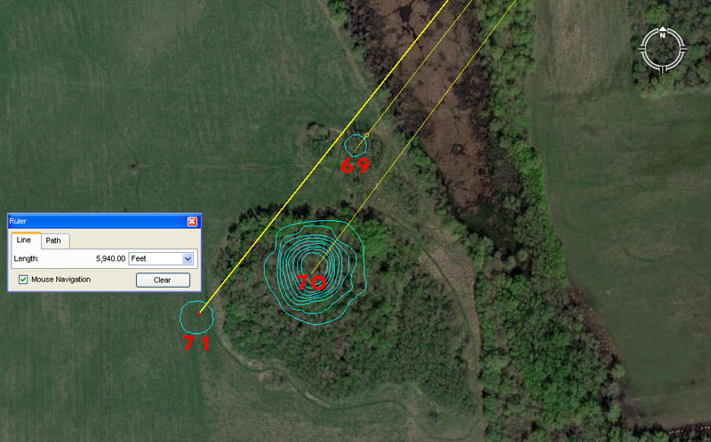
Mounds 69, 70 and 71 sit a mile or so away to the SW of Monk’s Mound.
Mound 69 sits exactly 1-mile (5280′) out to its NE edge @ 217.8-degrees azimuth (37.8-degrees return to Monk’s Mound). More centrally, the distance onto the remains of mound 69 is 5333.3333′ (53331/3rd).
Yet again the 5280′ increment is recorded into the position of a mound outer marker, just as with mound 3 of the Cahokia group. The more central distance is 5333.3333′ and a mathematical progression, based up this value, generates 16000, 32000, 64000 increases and 5333.3333 is simply 1/3rd of 16000.
The 37.8-degrees return angle to Monk’s Mound is in homage to the value 378 and the Great Pyramid @ 756′ per side is 378′ X 2. The sum of 378′ would be 1/16th of 1-minute of equatorial arc.
Mound 70 sits 5670′ out from the hub position atop Monk’s Mound @ 36.666666-degrees (362/3rds). The distance is strong lunar coding and 567-days is 1/12th of the 6804-day lunar nutation cycle. The value was also used in navigational calculations and the sum of 5670′ would be 1/64th of 1-degree of equatorial arc under the 24883.2 Greek mile circumference.
The return angle @ 36.66666-degrees is simply 1/3rd of 110. The sum of 36.66666′ would equate to 1/144th of a 5280′ mile. This kind of incremental value was essential to know when doing positional plotting at sea. For example:
If one uses Greek miles in sea legs of travel, the 5250′ converts to a circumference of 16500′ (1 English league) when 5250′ is multiplied by PI @ 22/7ths. This means that the circumference generated from a 5250′ diameter is in an “11” family of numbers and each degree of arc is 45.8333333′ or 550″. Therefore, if one chooses to divide the 16500′ circuit up into half, quarter, eighth, sixteenth and thirty-second parts, etc., to get the primary and secondary points of the compass, then an increment of 366.6666′ will divide the circle into 45 parts. Each 366.6666′ will then equate to 8-degrees of arc or 550″ X 8.
This kind of mental manipulation of, what is in reality, whole numbers and fractions, is exactly what the navigator had to be very adept at doing when calculating how far one had traveled in a straight line sea leg before a course change. Making one’s way across the vast featureless ocean depended upon both the wind’s direction and force, and voyages were made in a series of tacks on the breeze, zigzagging across a leyline towards a destination. Oftimes those angles of tack, back and forth, were quite severe. but the navigator had to stay constantly aware of exactly where the ship sat in the ocean at all times. Sea legs were completed to a whole value of, say, 5 Greek miles or 7 Greek miles (whatever was practicable and achievable without getting too far off course) before a new heading back across the leyline. The length of a leg (in whole Greek miles) was then used as a “diameter” on a plotting board, slate or papyrus map roll and turned into a calibrated “circle”. Because the very experienced navigator, knew the boat speed, distance traveled and angle, he was able to accurately plot the latest completed sea leg information in perfect scale, then work out the exact degree angle (using the calibrated circle generated) back to the point of departure and onwards to the destination.
All of the positional plotting maths and increments used in sea legs are encoded into the Cahokia mound’s landscape. For those of us who learnt our “times-tables” at elementary school by rote and repetition, that exercise pales into insignificance compared to what was happening amongst the mounds. This is where students came to learn the “times-table from hell”, which included many strings of mathematical progressions. This school was only for the “brightest and the best” or most gifted children. Dunces and dullards or foot-dragging slackers had no place here and would not survive the grueling demands of the school … in developing mental skills that allowed one to do complex calculations instantaneously in one’s head …or memorise many star positions and just how much the rise & set changed seasonally around the horizon…or how to use surveying devices to read angles accurately …or how to toughen up to be equal with and endure the rigours and demands of the open sea, etc., etc.
Mound 71 sits 5940′ out @ a return angle of 38.4-degrees.
Again, yet another mound encoded to sit 1 Scottish mile from the hub position atop Monk’s Mound.
The 38.4 return degree angle is both lunar and navigational coding simultaneously and the value 384 is simply 96 X 4. The slightly elliptical Stonehenge site is 384′ wide from North to South, but 378′ wide from East to West (with the Avenue jutting out a bit further). Amongst the many uses for the number 384 is the fact that the inch value around the full perimeter of the Khafre Pyramid of Egypt (708.75′ per side …. 2835′ for 4 sides or 30420″) X 3840 = 130636800, which, in feet, equates to the 24883.2 Greek mile circumference of the Earth.
Alternatively, the inch value around the full perimeter of Great Pyramid (756′ per side …. 3024′ for 4-sides or 36288″) X 3600 = 130636800.
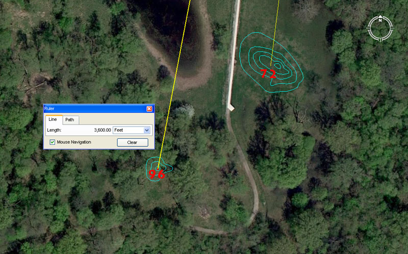
Mound 72 sits 3333.33333′ from the Monk’s Mound hub at a return angle of 7.2-degrees. The length of 3360 would also have been included as a tutorial within the confines of this mound.
The 3333.33333 value is simply 1/3rd of 10,000. The return angle of 7.2-degrees is 1/50th of 360-degrees.
Another tutorial would have related to half an Irish mile @ 3360′ (full mile was 6720′), which would have resolved comfortably to the central section of this mound.
Mound 96 sits 3600′ from the hub position atop Monk’s Mound @ 10.8-degrees. The value 3628.8 would also have been included in this mound’s tutorials.
The compass is, of course, set out to 360-degrees and was anciently read to as many as 7200 calibrations or to 1/20th of a degree (See Ptolemy’s Almagest of circa 150 AD, which was, undoubtedly, based upon much more ancient, traditional mathematical knowledge).
A mathematical progression based upon 54 or 108 will generate a string of very useful lunar and navigational numbers. For example, the 6804-day lunar nutation cycle is 63 periods of 108-days. Alternatively, the 24883.2-mile equatorial circumference is 1080-miles X 23.04 (part of the 11.52 progression). It will be remembered that some of the stone discs found in the North American mounds were calibrated to 23 segments and obviously worked to the 23.04 progression, which is found encoded into open-air-university sites over several continents.
As stated, another tutorial that would have been covered on this mound relates to the value 3628.8′. In the 24883.2 Greek mile reading of the Earth’s equatorial circumference, 1-degree of arc was 362880′ whereas half a minute of arc (3024′ … the distance around the Great Pyramid @ 756′ per side) was 36288″ (9072″ per side). The sum of 1-degree of arc is, of course, 24883.2 Greek miles (130636800′) ÷ 360-degrees.
BACK TO THE WEST.
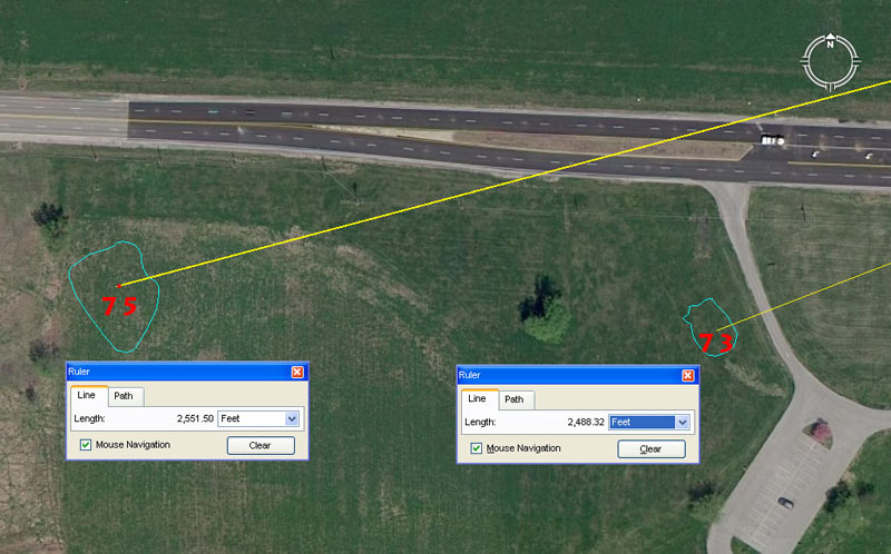
We now come to an area of the site where the ancient architects placed the mounds so that the distance out from the hub atop Monk’s Mound was a direct reflection of the angle out from the hub. This kind of coding is reasonably rare at ancient British open-air-universities, but occurs at the Cahokia site within a grouping of 4 close proximity mounds.
Mound 73 sits a coded distance of 2488.32′ from the hub position on Monk’s Mound @ an intended azimuth angle of 248.832-degrees.
This mirroring of distance and angle is in homage to the 24883.2 mile equatorial circumference, which is 12 X 12 X 12 X 12 X 1.2 miles.
Mound 75 sits a coded distance of 2551.5′ out from the hub atop Monk’s Mound @ 255.15-degrees.
This mirroring of distance and angle accentuates the 2551.5-day period (7.2 lunar years of 354.375-days each) monitored alongside 2556.75-days (7 solar years of 365.25-days) in the ancient lunisolar Sabbatical calendar.
Ancient astronomers needed a calendar system that followed the periods of the Sun & Moon on a daily basis, but there was a major problem to overcome. With the solar year @ 365.25-days and the lunar year @ 354.375-days, the discrepancy was almost 11-days. Trying to create a mathematical system that could fluidly and easily accommodate both cyclic periods posed considerable difficulty. It was observed, however, that 7 solar years was almost the same as 7.2 lunar years. The difference was only 5.25-days, so ancient mathematicians then devised measurement increments based upon 5.25 to deal with this. They created a reed of 10.5′ (2 X 5.25′), a short stadia of 525′ and a mile of 5250′.
Under their system the solar and lunar periods could then be counted off in increments of 5.25-days. The sum of 486 X 5.25-days was 7.2 lunar years or 2551.5-days, whereas 487 X 5.25-days was 2556.75-days or 7 solar years. The astronomer-mathematicians then devised a system wherein, on the sixth day (5.25-days is into the sixth day) after starting the solar count, they would have an auspicious ceremony and start the lunar count (culling sprigs of mistletoe from a venerable old oak tree, while other savant-astronomers danced around the tree singling “Hey Derry-Derry Down”, etc.). Thus by starting the lunar count 5.25-days after the solar count the periods for both Sun & Moon ended on the same day 2551.5-days later. This was the very successful and accurate Sabbatical Calendar system.
We see here at mound 75 site just how important the value 2551.5 was to ancient astronomers, who double-coded it into a dedicated site so that the value could never be forgotten.
Mound 74 has already been dealt with in the grouping of mounds 56 to 59. It sits beside mound 58 and the same kind of dual coding of distance and angle occurs, with mound 74 sitting at 2400′ from the Monk’s mound hub @ 240-degrees azimuth and mound 58 sitting out 2376′ @ 237.6-degrees.
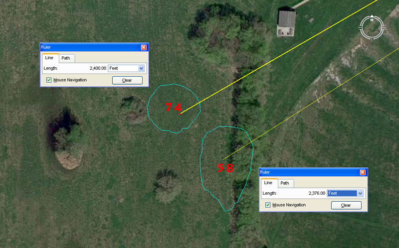
The UWM map places mounds 74 & 58 at exactly these locations above and notes on the map the tufts of trees or bush situated to their west.
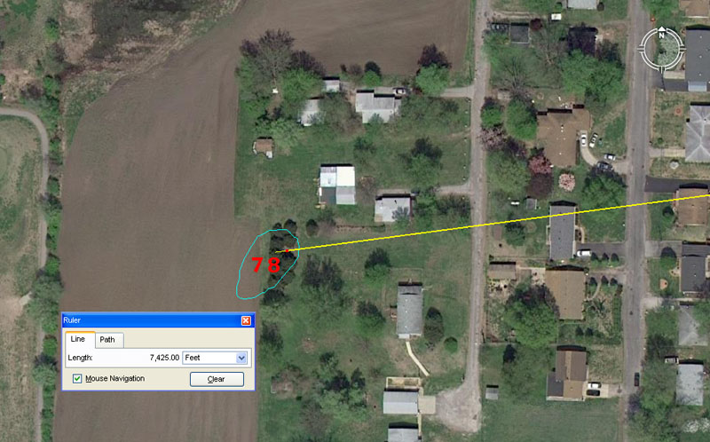
Mound 78 sits 7425′ from the hub position atop Monk’s Mound at an azimuth angle of 262.5-degrees, for a return angle of 82.5-degrees.
Mound 78 is situated just a bit too far away from other mounds to be included within a group. The nearest cluster, mounds 84, 86, 87 & 88 were long-since destroyed and their locations obliterated, with the former positions sitting under the tar-seal of a car parking lot. Mound 78 has been ploughed down to virtually nothing, but some evidence remains. It sits 1.25 Scottish miles from the hub position atop Monk’s Mound.
The outwards running angle from Monk’s Mound is strong lunar and navigational coding simultaneously. A Greek mile @ 5250′ is 2 X 2625′. There would be 135 intervals of 2.625-days (63 hours) in a lunar year of 354.375-days or 972 in the 2551.5-days monitored within the ancient calendar. There would be 2592 (36 X 72) such occurrences in the 6804-day lunar nutation cycle.
The inwards running angle relates to the “11” navigational system and 8250′ is half an ancient English league of 16500′. Alternatively, 8250-miles is 1/3rd of the 24750-mile equatorial circumference.
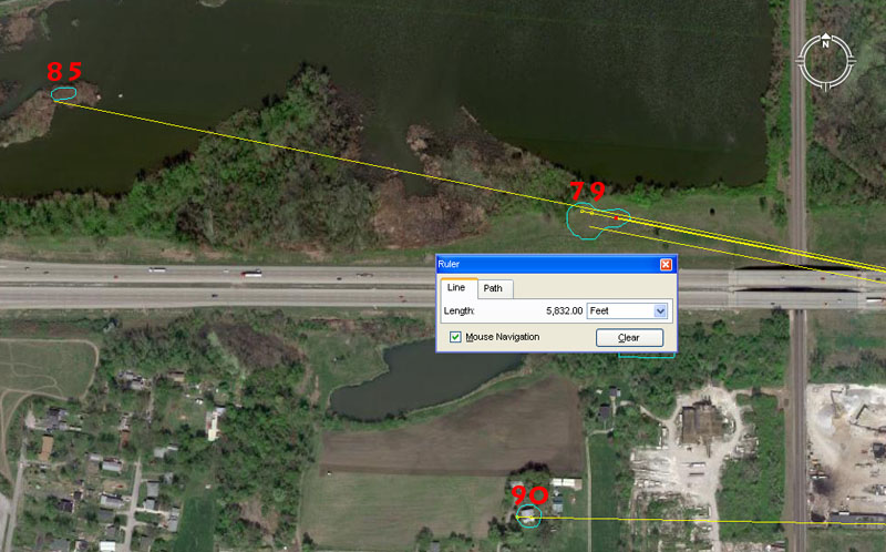
Mound 79 sits in reasonably close proximity to mounds 46 (covered by the Google Earth measurement panel), 85 & 90.
Mound 79 carries at least 3 length codes and 3 angle codes. The first of these is 5832′ out from Monk’s Mound hub @ 281.25-degrees, for a return angle of 101.25-degrees.
The distance of 5832′ is 1200 Roman paces or 6000 Roman feet of 11.664″ each. These so-called Roman measurements recur all over Britain on sites that predate the Romans by 2500-years and more. This same distance would equate to 1.2 Roman miles of 4860′ each (5000 Roman feet). The outrunning angle of 281.25-degrees is lunar and navigational coding and a mathematical progression based on this value will generate useful increments for compass calculations of lunar cycle determinations. The sum of 2.8125-degrees (213/16ths) would be 1/128th of 360-degrees … or 1/8th of 22.5-degrees. There would be 126 intervals of 2.8125-days (67.5-hours) in the 354.375-day lunar year. Note: Big Mound in old St. Louis Missouri sits exactly 6.75-miles from the hub atop Monk’s Mound (@ 260-degrees azimuth) and Sugarloaf Mound in Old St. Louis sits 28125′ from Big Mound (@ 207.36-degrees).
The return angle from mound 79 to Monk’s Mound, in this instance, is 101.25-degrees and this is very strong lunar coding. There would be 35 intervals of 10.125-days (243-hours) in a lunar year of 354.375-days.
A second length coding onto mound 79 would be a distance of 5906.25′, which is also strong lunar coding. In the 3,4,5, triangle formula by which the Khafre Pyramid of Egypt was built, the hypotenuse length was 590.625′. The sum of 590.625-days would equate to 20 lunar months of 29.53125-days each (2917/32nds).
A third length coding would be 5940′ or 1 Scottish mile.
Another return degree angle from this mound’s centre is 100.8-degrees and the sum of 100.8′ was 1-second of arc under the 24883.2 Greek mile equatorial circumference of the Earth.
Mound 85 was once described as extensive, but is now much diminished in size. It sits a coded distance of 7776′ out, with an apparent return angle of 101.376-degrees. Both distance and angle are navigational coding.
The sum of 777.6-miles is 1/32nd of the 24883.2-mile equatorial circumference.
Under the “true” equatorial size of the Earth, described in factorable numbers as 24883.2-miles of 5280′ each (18.8-miles short of the true figure we use today), 1-second of arc was 101.376′. Francis Cranmer Penrose, in 1846, carefully measured the shorter length of top stylobate step of the Greek Parthenon of Athens 101.335 feet, but did not take into account 2500-years or weathering, which would have made it somewhat longer.
Return angles from these mounds seem to be coding 1-second of arc under 3 systems, including 100.833333 (based upon the 24750-mile navigational system).
Mound 90 sits 6000′ from the hub atop Monk’s Mound @ a return angle of 91.125-degrees. The western edge of mound 90 sits 6048′ (1-minute of arc) from the Monk’s Mound hub.
The 91.125-degree return angle is primarily lunar coding. There would be 28 intervals of 91.125-days (911/8th) in the 2551.5-day (7.2 lunar years) monitored within the ancient lunisolar calendar.
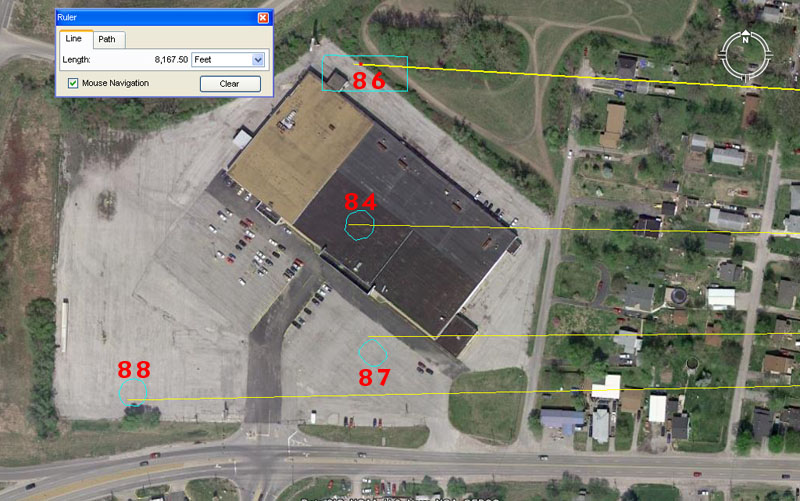
These 4 mounds, 84, 86, 87 & 88 have been hammered as bad or worse than any other grouping and entirely eradicated. The UWM map places them at the locations shown, so we’ll try to make sense of what their intended codes of position were originally meant to be.
Mound 84 sits 8164.8′ from the hub position atop Monk’s Mound at a return azimuth angle of 91.125-degrees. This same vector crosses mound 90 in its more extended journey to mound 84.
The 8164.8′ distance is coding the division of the 24883.2 Greek mile equatorial circumference into sixteenth parts and the sum of 8164800′ (1555.2 Greek miles) would be 22.5-degrees of arc for that circuit.
Mound 86 sits 8167.5′ from the Monk’s Mound hub @ a return angle of 93.312-degrees.
The 8167.5′ distance is coding the division of the 24750-mile (of 5280′) equatorial circumference into sixteenth parts and the sum of 8167500′ would be 22.5-degrees of arc for that circuit.
The degree angle @ 93.312-degrees is also navigational coding and divides the 24883.2 Greek mile equatorial circumference into fourteenth parts. The sum of 9331200′ would be 1/14th of the circuit. Note: Under the Babylonian-Sumerian weights system the Royal Double Standard Talent was 933120-grains. Their Royal Double Standard Mina was 15552-grains (the sum of 1555.2 miles is 1/16th of the 24883.2 mile circumference)and their Shekel was 259.2-grains (the Precession of the Equinoxes endures for 25920-years).
Mound 87 seems to be coded in a “13” progression that might have had some application to the 13, 26, 52 counts within the calendar. It appears to be situated out 8125′ at a return azimuth angle of 89.6-degrees and 1/75th of an ancient Irish mile was 89.6′.
Mound 88 was probably intended to sit 8640′ (a much used, dynamic ancient value) from the hub atop Monk’s Mound, but its marked position falls short of that by about 30′. The azimuth angle to the mound (268.8-degrees .. a much-used navigational value) works well in dividing up the Earth into Roman miles of 4860′ each. Therefore the 24883.2 Greek mile equatorial circumference in feet (130636800′) ÷ 26880 = 4860′.
We’ll now move to other mounds that have fared considerably better than this batch in West Collinsville.
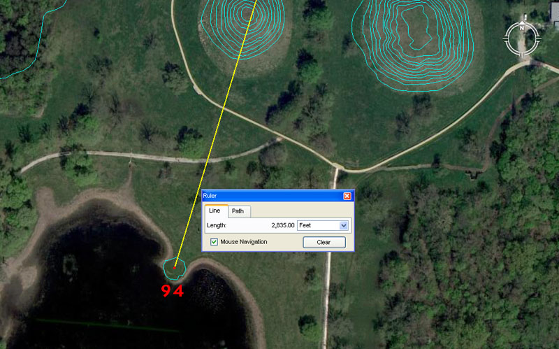
Tiny mound 94, situated south of mounds 59 & 60, contains dynamic lunar coding in both its distance and angle.
Mound 94 sits 2835′ from the hub on Monk’s Mound at a return angle of 17.01-degrees.
The Khafre Pyramid (Egypt’s pyramid of the Moon) @ 708.75′ per side (2 X 354.375 or, in days, the length of a lunar year) had a full perimeter value of 2835′. This distance at Cahokia Mounds is, therefore, a duplication of one circuit of the Khafre Pyramid. It is also the internal length of the Octagon geometric earthworks complex of Newark, Ohio (from the altar alcove SW to the outer line of the NE gate).
The return angle was intended to code 17.01-degrees in homage to the duration of the 6804-day lunar nutation cycle, the quarter period of which is 1701-days. The half value of that cycle is 3402-days and the 2835′ length out to mound 94 is 34020-inches.
ANOTHER TOUR EAST, THEN ON TO WOODHENGE ELEMENTARY SCHOOL.
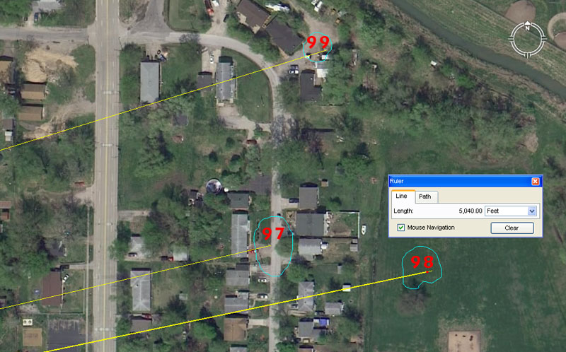
Mounds 97, 98 & 99 are situated in East Collinsville.
Mound 97 sits 4752′ out from the hub position atop Monk’s Mound at an azimuth angle of 76.8-degrees.
The sum of 47520′ would equate to 9-miles of 5280′, therefore this distance at Cahokia mounds complex is .9 of a mile.
The azimuth angle is navigational coding and part of the 11.52 mathematical progression. The sum of 76.8-miles would be 1/324th of the 24883.2-mile equatorial circumference.
Mound 98 sits 5040′ from the Monk’s Mound hub @ 78.125-degrees. The sum of 5040′ is 50 seconds of equatorial arc @ 100.8′ per second.
The azimuth angle value, used in a mathematical progression, generates many values useful to navigation and, essentially, divides base ten values into 32nd, 64th and 128th parts, etc. Therefore, 10000 ÷ 128 = 78.125.
Mound 99 sits 4950′ from Monk’s Mound hub @ 72.9-degrees. The 4950 value is an important within the “11” navigational system and 495 miles would equate to 1/16th of the 7920-mile diameter of the Earth. At the same time, 4950-miles would equate to 1/5th of the 24750-mile equatorial circumference.
The azimuth angle is both navigational and lunar coding simultaneously and 729′ would equate to 750 Roman feet or 150 Roman paces. There would be 35 intervals of 72.9-days in the 2551.5-day period (7.2 lunar years) monitored within the lunisolar Sabbatical calendar.
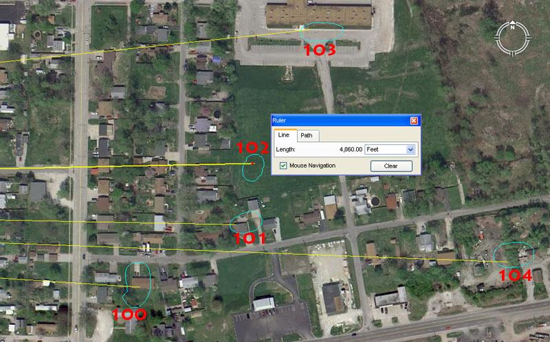
Mounds 100, 101, 102, 103 &104 complete the list of known or recorded mounds within the Cahokia complex. There are estimated to have been up to 120 mounds originally, but Melvin Fowler’s list stops at 104.
Mound 100 sits 4500′ from the Monk’s Mound hub @ 93.75-degrees. In the 360-degree compass the division of 45-degrees represents 1/8th part. This same mound would have carried a tutorial concerning the merits of 4536′, which is strong navigational coding found on the Great Pyramid. The length of the Great Pyramid in inches is 9072″ or 4536 X 2. The vertical height of the pyramid (to the top of its altar floor) was measured by Petrie to be very close to 453.6′ and in all recorded history the edifice has never been known to have a pointed top or capstone.
The degree angle is navigational coding and a mathematical progression based upon 93.75 generates both compass values and divisions related to the 24750-mile equatorial circumference. The sum of 93.75-miles would equate to 1/264th of the 24750-mile circumference (264 X 20 = 5280).
Mound 101 sits 4800′ from Monk’s Mound hub @ 91.125-degrees. The value 48, when used in a mathematical progression, generates very important navigational values and the sum of 480′ is 1/11th of a mile.
The 91.125-degree return angle is primarily lunar coding and there would be 28 intervals of 91.125-days (911/8th) in the 2551.5-day (7.2 lunar years) monitored within the ancient lunisolar calendar. This same angle coding was used for mound 90.
Mound 102 sits 4860′ from Monk’s Mound hub @ 268.8-degrees. This distance is 1 Roman mile. The value 486 provides powerful lunar and navigational numbers when placed into a mathematical progression. The sum of 48.6-miles would be 1/512nd of the 24883.2-mile equatorial circumference, which is, essentially, equivalent to dividing up the Earth by 2, 4, 8, 16, 32, 64, 128, 256, 512.
Likewise, the sum of 486-days would equate to 1/14th of the 6804-day lunar nutation cycle. The summer solstice sunrise at Stonehenge occurs at 48.6-degrees azimuth (first glint). The ancient Calendar of Coligny brass plaque (Druidic lunisolar Sabbatical calendar) is 4.86′ long or 58.32″ (1 Roman pace or 5 Roman feet of 11.664″ each), etc., etc.
The 268.8-degrees return azimuth angle was very deliberately incorporated into this mound to, again, accentuate the value 486. The 24883.2 Greek mile equatorial circumference equates to 130636800′ and 1/2688th of that circumference is 48600′ or 10 Roman miles.
Mound 103 sits 5062.5′ from Monk’s Mound hub @ 84-degrees or 264-degrees return angle. The 5062.5′ distance is, primarily, lunar coding and 50.625-days would be 1/7th of a lunar year of 354.375-days.
The value 84 (2 X 42) generates very important values in a mathematical progression that relate to the 24883.2 Greek mile equatorial circumference and 84′ is 1/72nd of 1-minute of equatorial arc.
The return angle @ 264-degrees is coding in homage to the 5280′ mile (2640′ X 2).
Mound 104 sits 5670′ from Monk’s Mound hub @ 92.16-degrees or 272.16-degrees return angle. The distance is lunar coding and there would be 12 intervals of 567-days in the 6804-day lunar nutation cycle.
The 92.16-degrees angle to mound 104 is strong navigational coding and the sum of 92.16-miles would be 1/270th of the 24883.2-mile equatorial circumference.
The return angle @ 272.16-degrees is both navigational and lunar coding and the 130636800′ equatorial circumference (24883.2 Greek miles) ÷ 27216 = 4800′ (remember mound 101 sits out 4800′ from the Monk’s Mound hub).
AND SO THE REASON FOR BUILDING THE HUGE COMPLEX BECOMES CLEAR.
One of the baffling questions that plagued the minds of generations of spectators is, why would anyone go to this much trouble to build huge mound complexes? To date, none of the reasons proffered by our archaeologist or historians are even marginally adequate to explain this degree of commitment. In reality, any egomaniac leader of old, who simply wanted mounds as status symbols (as has been suggested by our experts) would soon get the “short-sharp-shift” from the minions. There’s no way that individuals within a society would commit themselves to a lifetime of digging and hauling dirt, then curse their children and children’s children to the same plight, unless there was a very sound reason for doing so.
With regards to the Cahokia mounds complex, which also included yet another large and mathematically linked complex across the Mississippi River in what is now Old St. Louis, Missouri, it’s evident that the confederation of architects and builders entered into the project willingly and participated without reservation to see the work brought to a successful conclusion. The impetus to do so was a knowledge that they were encoding into the mounds all of the numbers of civilisation, such that the hard-won scientific knowledge could never be lost. As long as the mounds stood there as sentinels of the knowledge, generations of gifted children could be educated to become walking repositories of the ages-old sciences, and society could continue to be blessed with abundance accordingly.
Much of what is encoded into the mound positions relates to positional-plotting (dead-reckoning) methods for safe traversals of the world’s oceans. It’s very evident that many Bronze Age ships made the crossing from the Orkney and Shetland Islands, via Iceland and Greenland to the North America to mine copper. It’s estimated that as much as 500,000 tons of copper were removed at places like Isle Royale and all of it left American shores for places unknown. Thousand of ancient mines still exist on the Canadian North Shore of Lake Superior, Isle Royale and the Keweenaw Peninsula of Michigan, where copper that was 99% pure could be extracted and shipped without refinement. By consequence, the copper ore of the Mediterranean needed considerable refinement, which led to the denuding of whole countries of their forests to get the required firewood to feed the furnaces. See: http://www.philipcoppens.com/copper.html
ELEMENTARY SCHOOL.
What was happening at the Cahokia Mound’s complex is exactly the same thing as was happening at Avebury Henge and Durrington Wall’s Henge in Southern England or at Brodgar Ring in the Orkney Island … same methodology … same numbers … same everything. At each of these sites, student navigators were instructed by learned tutors or “Masters of the Craft”. The evidence shows that at grueling, hard schools like Brodgar Ring, the students were assigned quests to navigate out and about amongst the mounds, even to the extent of crossing bodies of water to mounds on outlying islands, then find their way home again. This was all excellent practice for following the distances and angles marked on sea charts that would later lead the qualified navigators across featureless oceans to other countries or islands. In essence, the Cahokia Mounds complex represented exactly that, artificial islands of land sporadically dotting a vast flat plain that symbolically represented the sea. Groups of students could be given a particular course to follow, marked only by distances and angles and then be required to find their way around the maze on their assigned quest. They had to stay constantly aware of the position of true North and from that calculate both the degree angle and distance to the objective.
But abilities had to be developed from raw to refined over time and competence gained by constant practice to hone navigational skills, until it all became second nature. Underlying everything was a knowledge of special, factorable numbers and these had to be memorised before there was any hope of fulfilling specific navigational assignments in & out & around the mounds . The basic parcel of astronomical-navigational numbers were first taught to the students at smaller sites, such as Woodhenge beside Durrington Walls Henge in Southern England … or Woodhenge near Monk’s Mound in Illinois, North America. It’s altogether possible that bright children, who had been recognised as gifted when still toddlers, were set aside for the purpose of learning the numbers and began doing so from a very young age, such that they were utterly conversant with the numbers as they entered adolescence.
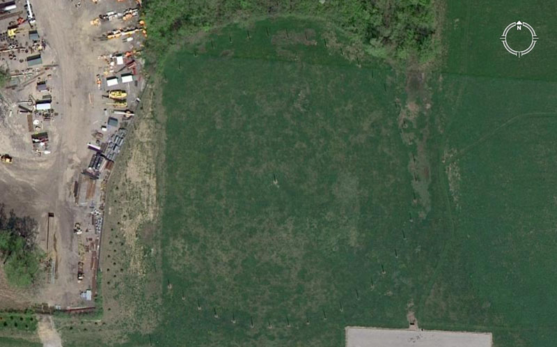
The main circle of posts at Woodhenge, Cahokia Mounds complex, are clearly seen in the above image. A discoloured scour or scar in the ground is seen to the left and this is where soil was appropriated for roading before it was realised that a post circle had existed at this position. Sadly, about 9 positions of former posts were obliterated permanently. However, another 39 positions on this ring are preserved and newly erected posts are in the ancient holes once again. Yet another Woodhenge site sat SSW of Monk’s Mound adjacent to Mound 72.
Our archaeologists have found other post holes in and around this site and have formulated a questionable notion that the ancient astronomers changed their minds a few times and moved the circle sideways every so often. This dubious hypothesis of an original circle, followed by 4 replacement circles, is based upon additional fans or arcs of former posts. It’s highly likely that these secondary arcs of posts simply provided extra distance & angle codes over and above what was available on the main circle. The on-site evidence suggests that the ancient astronomers weren’t the least bit fickle or indecisive about their preliminary choice and set out all the posts in exactly the right spots the first time, then left them there, only replacing rotten posts periodically by putting new wood into old holes. Let’s extract the surviving codes from the main ring seen above. To do this we’ll use our own numbering system.
Remember, all decimal tails seen tagged onto the ends of whole numbers are SIMPLE FRACTIONS, perfectly within the capabilities of ancient mathematicians to calculate and work fluidly with in mathematical progressions. This covers all numbers used by the ancient astronomer-navigator-surveyors, with the exception of the pure PI & PHI ratios.
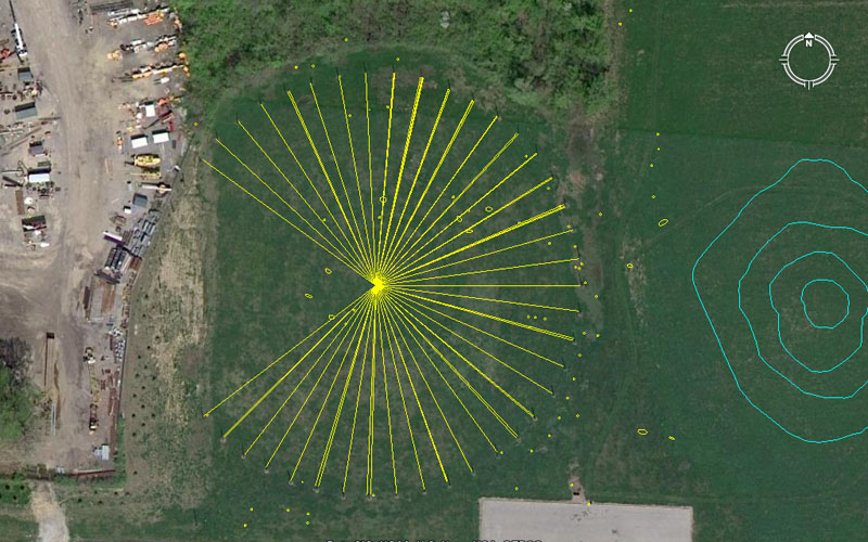
The centre post of Woodhenge sits 3652.5′ from the hub position atop Monk’s Mound at a return angle of 88-degrees. The distance relates to the 365.25-days in a solar year and the angle is navigational coding, within the 24750-mile equatorial circumference. The sum of 88′ is 1/60th of the 5280′ mile. Many small dots are seen within and outside the Woodhenge site and these are spots where other posts or markers have been found, leading to the improbable theory of 5 overlaying circles.
It’s important to realise that a post represented a prop for teaching several close proximity values simultaneously. The Masters of the Craft would not let any teaching opportunity bypass them and everything that could be extracted from a position would be exploited … which means that, not only a coded vector falling upon the centre of the post, but others falling to each side would be elucidated upon at length. An example of this is shown below in the position of post 5, where the actual code of the post relates to an outwards distance of 206.25′ (navigation by the “11” system) and a return angle of 155.52-degrees (equatorial circumference of the 24883.2-mile Earth). However, another tutorial could include the slightly offset, close proximity, outrunning angle of 336-degrees (navigation).
What’s seen here at the Cahokia Mounds Woodhenge is a modus operandi of teaching the numbers on a micro site, before the students moved to a macro site (the mounds complex). This same modus operandi is duplicated at Woodhenge in Southern England.

1. 207.36′ (Egyptian Royal Cubit devoted to the 24883.2 mile or “true” equatorial circumference) @ 126 (Greek foot, Hebrew reed, navigation)-degrees return.
2. 210′ (navigation, Greek stadia, Greek mile, multi-use)@ 312.5 (simple form of PI, conversion ratio)-degrees.
3. 207.36 @ 320-degrees (compass divisions, multi-use).
4. 207.36 @ 147.65625-degrees (14721/32nds … half a lunar month progression).
5. 206.25 (Egyptian Royal Cubit devoted to the 24750-mile equatorial circumference, also including the ERC @ 20.61818182) @ 155.52 (division of the 24883.2-mile Earth), 336 (navigation, Irish mile)-degrees respectively.
6. 206.25 @ 162-degrees (rounded PHI, pure PHI ratio @1: 1.6180339).
7. 206.25 @ 350-degrees (navigation, 7 progression).
8. 206.25 @ 177.1875-degrees (half a lunar year in days).
9. 206.25′ @ 4.725 (lunar, navigation), 4.8 (navigation, multi-use), 4.86 (lunar, navigation) & 5 (compass division, decimal progression)-degrees respectively.
10. 206.25 @ 12 (compass, multi-use), 12.375 (division of the 24750-mile equatorial circumference) 12.4416 (division of the 24883.2-mile equatorial circumference), 12.5 (multi-use), 12.6 (Greek foot, Hebrew reed, Greek mile),& 12.8 (compass divisions, navigation)-degrees respectively.
11. 202.5′ (seconds of arc under the “6&7” system, lunar counts) @ 20.16 (minutes of arc under the “6&7” system of navigation), 20.25 & 20.625 (divisions of the 24750-mile equatorial circumference)-degrees respectively.
12. 202.5′ @ 207.36 (largest Egyptian Royal cubit, navigation, true equatorial circumference), 27.5 (navigation by the “11” system) 28 (calendar, multi-use)-degrees respectively.
13. 201.6′ (divisions within minutes of arc under the “6&7” system of navigation) @ 35.4375 (lunar year), & 35.64 (equatorial circumference under the 24750-mile assignment)-degrees respectively.
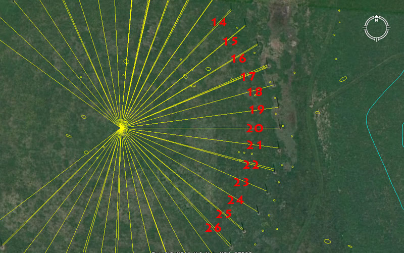
14. 201.6′ @ 42.75 (lunar coding) & 43.2 (navigation by the “6&7” method)-degrees respectively.
15. 201.6′ @ 50.4 (seconds of arc) & 50.625 (lunar cycle) -degrees respectively.
16. 200′ (decimal progression) @ 58.32 (navigation & Roman pace) & 58.66666 (navigation under the “11” system)-degrees respectively.
17. 198′ (diameter of the Earth) @ 66.66666 (division of a decimal progression), 67.2 (navigation & Irish mile) & 67.5 (navigation, lunar)-degrees respectively.
18. 198′ @ 74.25 (“11” system navigation, Scottish mile)-degrees.
19. 198′ @ 82.5 (“11” system equatorial circumference)-degrees.
20. 198′ @ 90 (compass, due East)-degrees.
21. 198′ @ 97.2 (division of the 24883.2-mile circumference)-degrees.
22. 198′ @ 105 (Greek mile & Hebrew reed) & 105.6 (English mile)-degrees respectively.
23. 198′ @ 113.4 (lunar cycle divisions)-degrees.
24. 200′ @ 121.5 (lunar cycle divisions)-degrees.
25. 198″ @ 129.6 (Precession of the equinoxes) & 130 (calendar)-degrees respectively.
26. 200′ @ 316.8 (navigation) & 137.5 (“11” system navigation)-degrees respectively.
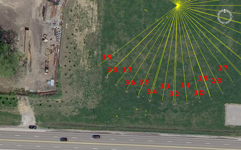
27. 200′ @ 144-degrees (navigation, multi-use).
28. 202.5′ @ 152.77777 (“11” system circumference divisions)-degrees.
29. 202.5′ @ 160 (divisions of the compass, multi-use) & 340.2 (lunar nutation cycle)-degrees respectively.
30. 202.5′ @ 166.66666-degrees (3,4,5, triangle, division within decimal progression).
31. 202.5′ @ 354.375 (lunar year)-degrees.
32. 202.5 @ 181.44 (divisions of 1-degree of arc under the “6&7” navigational system) & 182.625 (solar year)-degrees respectively.
33. 202.5 @ 189-degrees (navigation under the “6&7” system, Sabbatical Calendar).
34. 202.5 @ 16 (divisions of the compass, multi-use) & 196.875 (lunar year cycle, ancient beqa gold standard weight)-degrees respectively.
35. 206.25′ (Egyptian Royal Cubit devoted to the 24750-mile equatorial circumference) @ 26.25-degrees (Greek mile, lunar counts).
36. 206.25 @ 211.2-degrees (navigation by the “11” system).
37. 207.36′ (Egyptian Royal Cubit devoted to the 24883.2 mile or “true” equatorial circumference) @ 217.8-degrees (navigation, division within the feet value of the 24750-mile circumference).
38. 207.36′ @ 225 (360-degree compass divisions)& 45.36 (navigation under the “6 & 7” system, literal height and length of the Great Pyramid)-degrees.
39. 210′ @ 52.5 (Greek mile, Hebrew reed, lunar counts) & 52.8 (English mile)-degrees respectively.
THE MOUNDS OF OLD ST. LOUIS, MISSOURI, SITTING WITHIN VIEW OF MONK’S MOUND.
Old St. Louis, Missouri sits only 7-miles to the West of Monk’s Mound on the opposite bank of the very navigable and long Mississippi River. This grand river is estimated to stretch through middle North America for 2320-miles, from headwaters in Western Minnesota to its outflow into the Gulf of Mexico. Its multitude of tributaries provide waterway routes to many locations over a broad expanse of North America and river silts, periodically deposited over its flood-plain’s, ensured ongoing, very fertile areas for abundant agricultural returns.
One of the tributaries to the Mississippi River is the equally huge and long Missouri River, with its headwaters in Montana and joining the Mississippi River at St. Louis, Missouri. This confluence of two major, branching waterways at St. Louis, with links back through the Great Lakes and St. Lawrence Seaway to the Atlantic Ocean, made the geographical position a very important inland centre for the ancient civilisation that built the Cahokia Mound’s complex. To the South of St. Louis there is also the massive confluence of the Ohio River and Mississippi River, providing extensive waterway access to the East.
So, we’ve explored the surviving mounds or known former mound positions immediately around Monk’s Mound, but there was yet another “classroom” situated on high bluffs above the Mississippi River and dominated by one singularly huge mound called “Big Mound”, or as the early French founders of St. Louis named it, “La Grange de Terre” (The Barn of Earth). This massive mound, although no-where as big as Monk’s Mound, was the hub or fulcrum position for the Old St. Louis distribution of mounds and that grouping of satellites sat at coded distances and angles away from the hub position atop Big Mound.
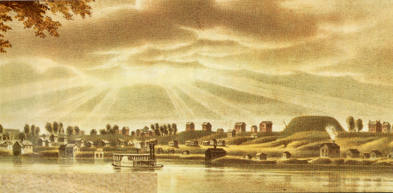
The beautifully symmetrical outline of Big Mound dominated the high bluffs above the Mississippi River when St. Louis was first settled and built. Directly South of Big Mound was a cluster of satellite mounds, including one visually spectacular structure in three tiers or levels. Picture: View of St Louis landscape from the northeast in 1840. Lithograph by John Caspar Wild (Missouri Historical Society collection).
Because of these multiple mounds, Old St. Louis was dubbed “Mound City” and the amazing visual spectacle drew many early visitors to the location, just to see the many mounds in all their splendour. Sadly, in the best traditions of “You don’t know what you’ve got until you lose it”, the main grouping of mounds was all but gone in only 25-years, with big mound fully leveled by 1869 (the railway needed fill-dirt). As a final indignity in the name of “progress”, the Missouri Department of Transportation is building a bridge right over the former site presently, thus obscuring the position of this vastly important landmark even more.
Now you see it … Now you don’t. The ancient, purpose-built hub position of Old St. Louis, out from which many satellite mounds (bearing special distance and angle tutorials) were precisely positioned. The hub atop Big Mound sat 35640′ (exactly 6.75-miles of 5280′ each or 6 Scottish miles of 5940′ each) from the hub position atop Monk’s Mound at a return azimuth angle of precisely 80-degrees. Pictures taken from a poster publication of the Missouri Archaeological Society, September 1998.
The distance of 6.75 miles is in homage to the 24750-mile equatorial circumference of the Earth, of which 675-miles would be 1/36.66666th part (362/3rds).
To recap a very important tutorial about mathematical techniques used in ancient navigation:
The 36.66666 value is simply 1/3rd of 110. The sum of 36.66666′ would equate to 1/144th of a 5280′ mile. This kind of incremental value was essential to know when doing positional plotting at sea.
If one uses Greek miles in sea legs of travel, the 5250′ converts to a circumference of 16500′ (1 English league) when 5250′ is multiplied by PI @ 22/7ths. This means that the circumference generated from a 5250′ diameter is in an “11” family of numbers and each degree of arc is 45.8333333′ or 550″. Therefore, if one chooses to divide the 16500′ circuit up into half, quarter, eighth, sixteenth and thirty-second parts, etc., to get the primary and secondary points of the compass, then an increment of 366.6666′ will divide the circle into 45 parts. Each 366.6666′ will then equate to 8-degrees of arc or 550″ X 8.
This kind of mental manipulation of, what is in reality, whole numbers and fractions, is exactly what the navigator had to be very adept at doing when calculating how far one had traveled in a straight line sea leg before a course change. Making one’s way across the vast featureless ocean depended upon both the wind’s direction and force, and voyages were made in a series of tacks on the breeze, zigzagging across a leyline towards a destination. Oftimes those angles of tack, back and forth, were quite severe. but the navigator had to stay constantly aware of exactly where the ship sat in the ocean at all times. Sea legs were completed to a whole value of, say, 5 Greek miles or 7 Greek miles (whatever was practicable and achievable without getting too far off course) before a new heading back across the leyline. The length of a leg (in whole Greek miles) was then used as a “diameter” on a plotting board, slate or papyrus map roll and turned into a calibrated “circle”. Because the very experienced navigator, knew the boat speed, distance traveled and angle, he was able to accurately plot the latest completed sea leg information in perfect scale, then work out the exact degree angle (using the calibrated circle generated) back to the point of departure and onwards to the destination.
With regards to the return angle from Big Mound to Monk’s Mound hub, there would be 4.5 intervals of 80-degrees in a 360-degree circuit or 1/8th of 360-degrees would be 45-degrees of arc. A major tutorial in ancient positional plotting techniques exists in the distance and angle relationship between Monk’s Mound and Big Mound.
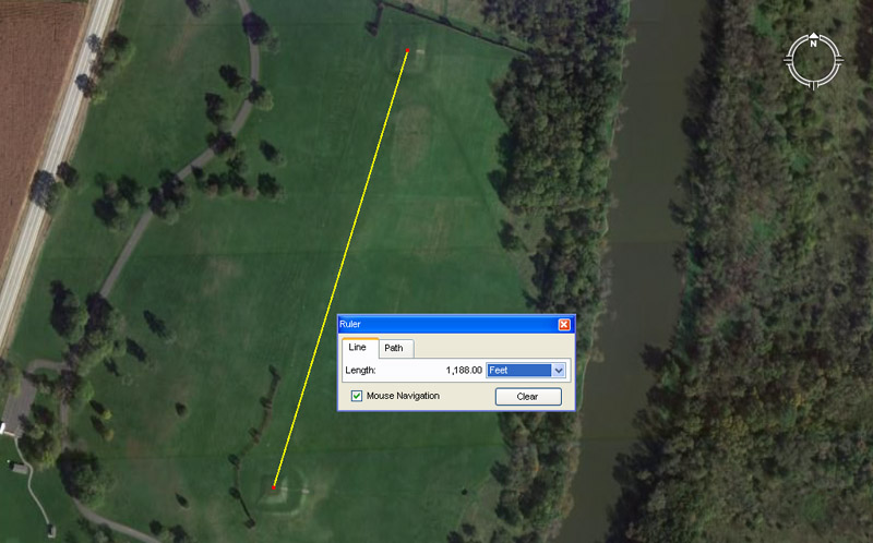
The Aztalan mound’s complex in Wisconsin uses the same distance coding, at much reduced ratio, as exists between Monk’s Mound and Big Mound. The distance between epicentre positions of the two largest platform mounds is 1188′ or 1/5th of a Scottish mile of 5940′. This distance at Aztalan would equate to 1/30th of the 35640′ (6.75 English miles of 5280′ each or 6 Scottish miles of 5940′ each) between Monk’s Mound and Big Mound in Illinois/ Missouri. On both sites the coding relates to the equatorial circumference of the Earth under the “11” system of navigation. At Aztalan, the North running azimuth angle is 17.01-degrees and is lunar coding relating to the 6804-day lunar nutation cycle.
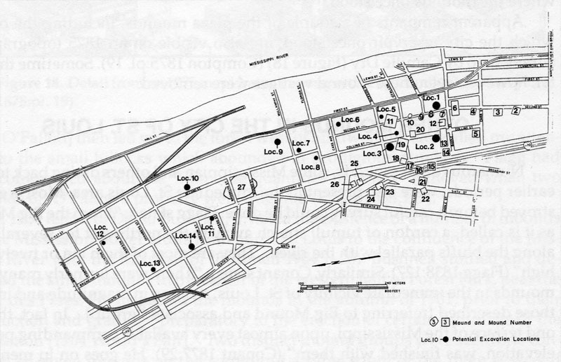
The 1987 Army Corps of Engineer’s Map of the St. Louis mound group (Rogers and Pulcher 1987-20) See: The St. Louis Mound Group: Historical Accounts and Pictorial Depictions, by John B. Marshall, The Missouri Archaeologist Vol. 53, 1992.
As a cautionary note, this comment appears on the Missouri Department of Transportation website:
An archaeological survey (Rogers and Pulcher 1987) conducted for the Army Corps of Engineers attempted to test the estimated locations of several mounds; the survey employed a map created for the Museum of Science and Natural History that attempted to place the various mounds within the city grid by simply superimposing Peale and Say’s survey map onto a modern city map. Using this map as reference, limited subsurface testing was conducted; however, no prehistoric deposits were identified. Marshall (1992) notes that the map used by Rogers and Pulcher, while providing a general location of the mound group, is not consistent with mound locations shown on other historical maps of St. Louis in the 19th century; consequently, testing was probably not done at any actual mound locations. With the exception of the Rogers and Pulcher’s survey and testing done for the Cochran Gardens site (Altizer et al. 2005), no professional testing has been done to identify either the mounds or the village associated with the mound group.
Having some faith in the professionalism of a body like the The Army Corps of Engineers and the in-depth historical research that would have accompanied their map-making incentive, let’s see what results we get. The locations of many mounds, especially Big Mound, have always been known within the city and the spot was even marked with a boulder monument and brass plaque.
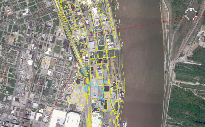
The 1987 Army Corps of Engineer’s Map, correctly orientated, showing the Old St Louis mound positions (blue). A red line is seen to come in from the right top of the picture and fall upon Big Mound, situated North of the main cluster. Another red line is seen to run out of frame to the NNW and that line resolves upon a mound position at O’Fallon Park. A red line is also seen to run out-of-frame to the SSW and that resolves onto the only surviving mound of the Old St. Louis group, which is Sugarloaf Mound (with its distance & angle codes still intact).
It’s quite obvious, in superimposing the 1987 map onto the Google Earth image, that substantial redevelopment has occurred in downtown St. Louis since 1987, but sufficient of the old streets are still in place and undisturbed to ensure a good fit.
We’ll start with the mounds closest to Big Mound and move outwards from there, so the numbering sequence will be a bit topsy-turvey. The position atop Big Mound chosen for the hub position is the spot where it sits exactly 6.75-miles and at 260-degrees azimuth (80-degrees return) from the hub position atop Monk’s Mound. On Big Mound, this position is well centred, but slightly South of centre. It is reasonable to assume that when Big Mound was in pristine, original condition that this hub position would have been at the epicentre of a domed or post-marked summit.
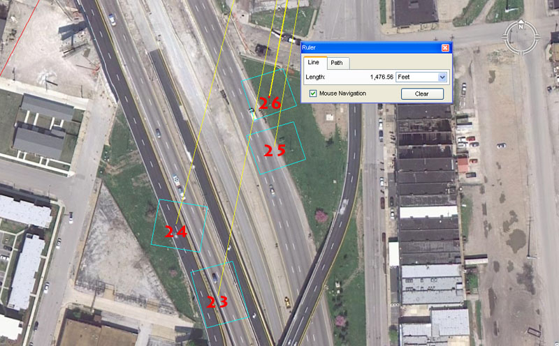
Mounds 23 to 26.
Mound 23 sits 1833.33333′ (navigation by the “11” system) from the hub atop Big Mound @ 11.25 (compass)-degrees return.
Mound 24 sits 1728′ (navigation, cubic foot in inches, very important multi-use number) from the Big Mound hub @ 14.4 (compass, navigation, multi-use)-degrees return.
Mound 25 sits 1562.5′ (navigation) from Big Mound hub @ 9.6 (compass, navigation, multi-use)-degrees return.
Mound 26 sits 1476.5625′ (coding half a lunar month) from Big Mound @ 10.5 (“6&” system of navigation, Hebrew reed)-degrees.
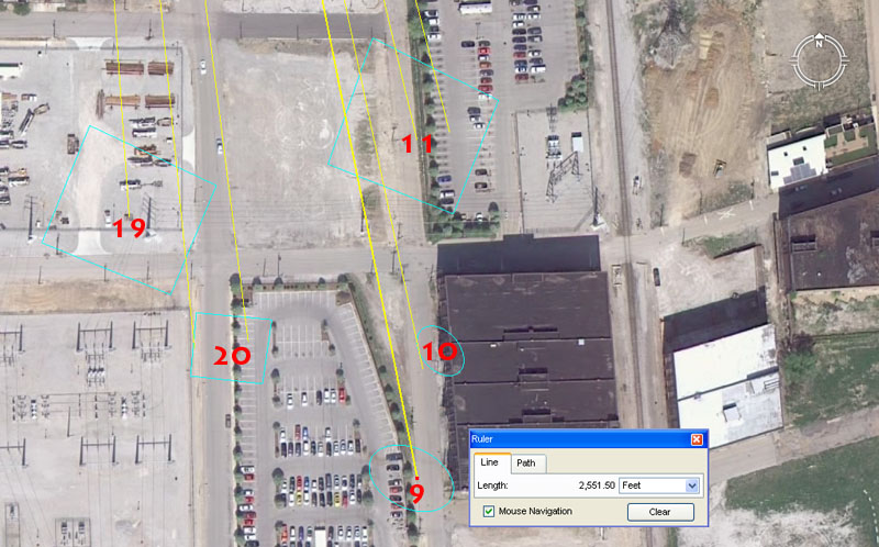
Mounds 9, 10, 11, 19 & 20.
Mound 9 sits 2551.5′ (7.2 lunar years, lunisolar calendar count) from the hub position atop Big Mound at an angle of 168.75 (lunar)-degrees.
Mound 10 complies closely to a distance of 2430′ (lunar, “6&7” navigation) @ 168 (“6&7” navigation)-degrees, which brushes its western side.
Mound 11 sits 2160′ (Precession of the Equinoxes, bushel volume) from the hub position atop Big Mound @ 345.6 (navigation, equatorial circumference)-degrees return. Another reading is an outrunning angle of 166.6666 (3,4,5, triangle, division within decimal progressions)-degrees.
Mound 19 sits 2200′ (“11” system of navigation) from the hub position atop Big Mound @ 176 (“11” system of navigation)-degrees.
Mound 20 sits 2362.5′ (lunar) from Big Mound hub @ 172.8-degrees (navigation). A return degree angle of 354.375 (lunar year)-degrees would touch its western edge.
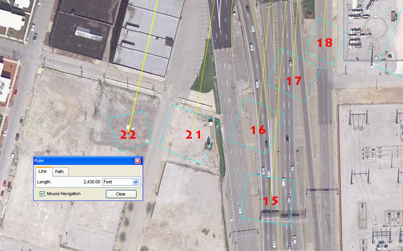
Mounds 15, 16, 17, 18, 21 & 22.
Mound 15 sits 2560′ (8 progression, compass) from Big Mound’s hub @ 4.5 (compass)-degrees return.
Mound 16 sits 2376′ (“11” system navigation, Scottish mile) from the Big Mound hub @ 5.5 (“11” system navigation)-degrees return.
Mound 17 sits 2250′ (compass) from the Big Mound hub @ 3.75 (compass)-degrees return.
Mound 18 sits 2178′ (“11” system equatorial circumference) from the Big Mound hub @ 2 (multi-use)-degrees return.
Mound 21 sits 2400′ (compass, multi-use) from Big Mound hub @ 9 (compass)-degrees return. Also, 180-degrees opposed the angle would be 189 (“6&7” navigation, equatorial circumference, lunisolar Sabbatical Calendar)-degrees).
Mound 22 sits 2430′ (lunar) from Big Mound’s hub @ 12.5 (compass)-degrees. The merits of 12.6 (Greek foot, Hebrew reed)-degrees would also have been taught.
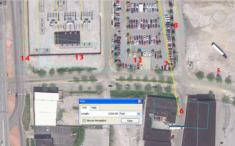
Mounds 6, 7, 8, 12, 13 &14.
Mound 6 sits 3024′ (half of 1-minute of arc under the “6&7” system, One perimeter circumnavigation of the Great Pyramid) out @ 350 (7 progression, navigation, calendar)-degrees return.
Mound 7 sits 2835′ (strong lunar coding, One perimeter circumnavigation of the Khafre Pyramid, internal length of the Octagon of Newark, Ohio) out @ 170.1(lunar nutation cycle count)-degrees .
Mound 8 sits 2688′ (“6&7” system navigation) out @ 168.75 (lunar)-degrees.
Mound 12 sits 2800′ (calendar) out @ 172.8-degrees (navigation).
Mound 13 was a special 3-tier mound, so undoubtedly had 3 main codes. It sits out (1) 2800′ (calendar) out @ 354.375 (number of days in a lunar year)-degrees, (2) 2750′ (“11” system navigation) @ 176 (“11” system navigation)-degrees, (3) 2750′ @ 1.1 (“11” system navigation)-degrees.
Mound 14 sits 2750 out @ 180-360 (true North- South) degrees onto one edge, also 1.1-degrees more centrally.
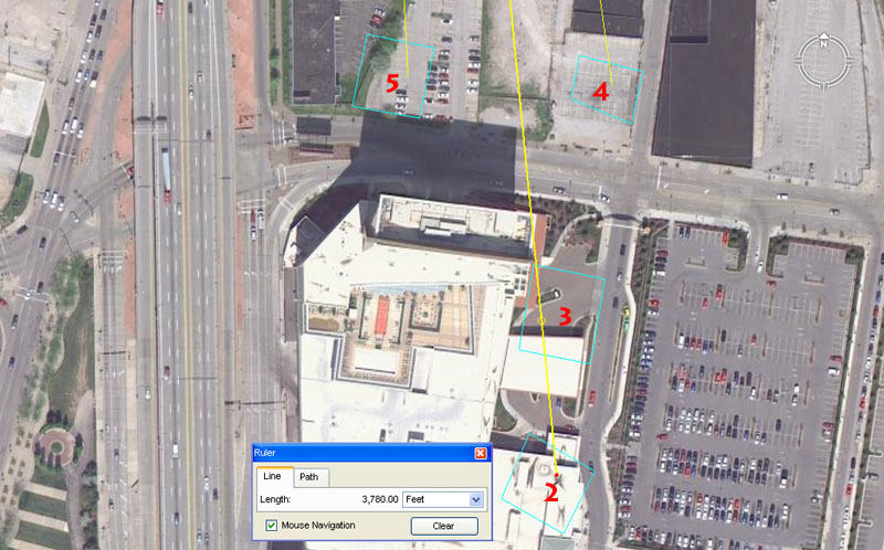
Mounds 2, 3, 4 & 5.
Mound 2 sits 3780′ (half the length of the Great Pyramid is 378′, “6&7” navigation) from the hub position atop Big Mound @ an azimuth angle of 354.375 (lunar year)-degrees return. Note: Mound 6 of the Cahokia group sits 3780′ out from Monk’s Mound, whereas mound 10 of that group sits out 3543.75′ @ 354.375-degrees.
Mound 3 sits 3564′ (“11” system navigation, the distance from Monk’s Mound Hub to Big Mound hub is 35640′ or 6.75-miles) from the hub on Big Mound @ 354.375 (lunar year)-degrees return.
Mound 4 sits 3240′ (navigation, Precession of the Equinoxes) from the hub atop Big Mound @ 352 (“11” system navigation)-degrees return.
Mound 5 sits 3200′ (compass) from the hub on Big Mound @ 177.1875 (half a lunar year is 177.1875-days)-degrees.
As more evidence comes in this analysis can be extended to the former mound positions of O’Fallon & Sherman Park’s, etc.
MOUND CITY’S LAST SURVIVOR.
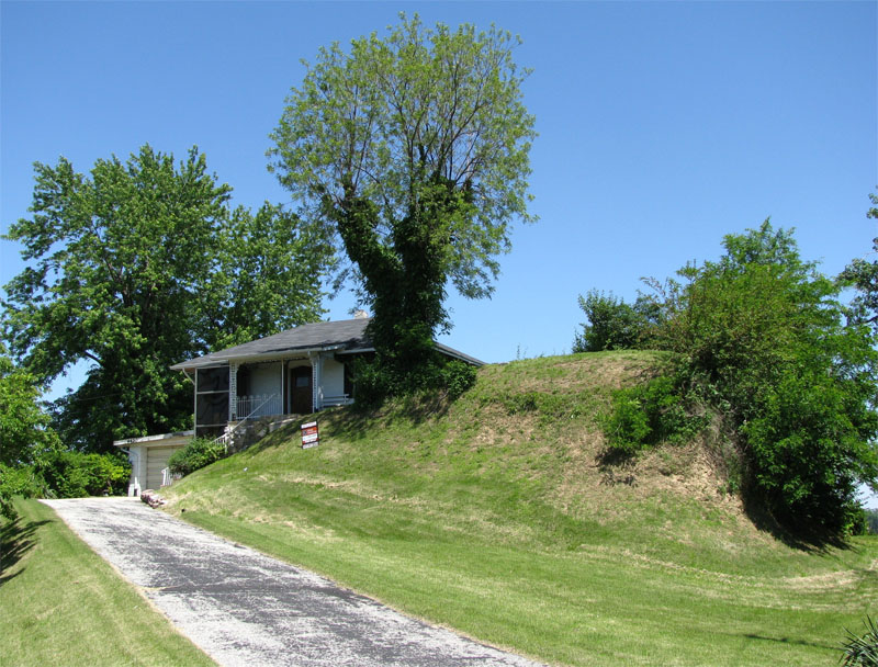
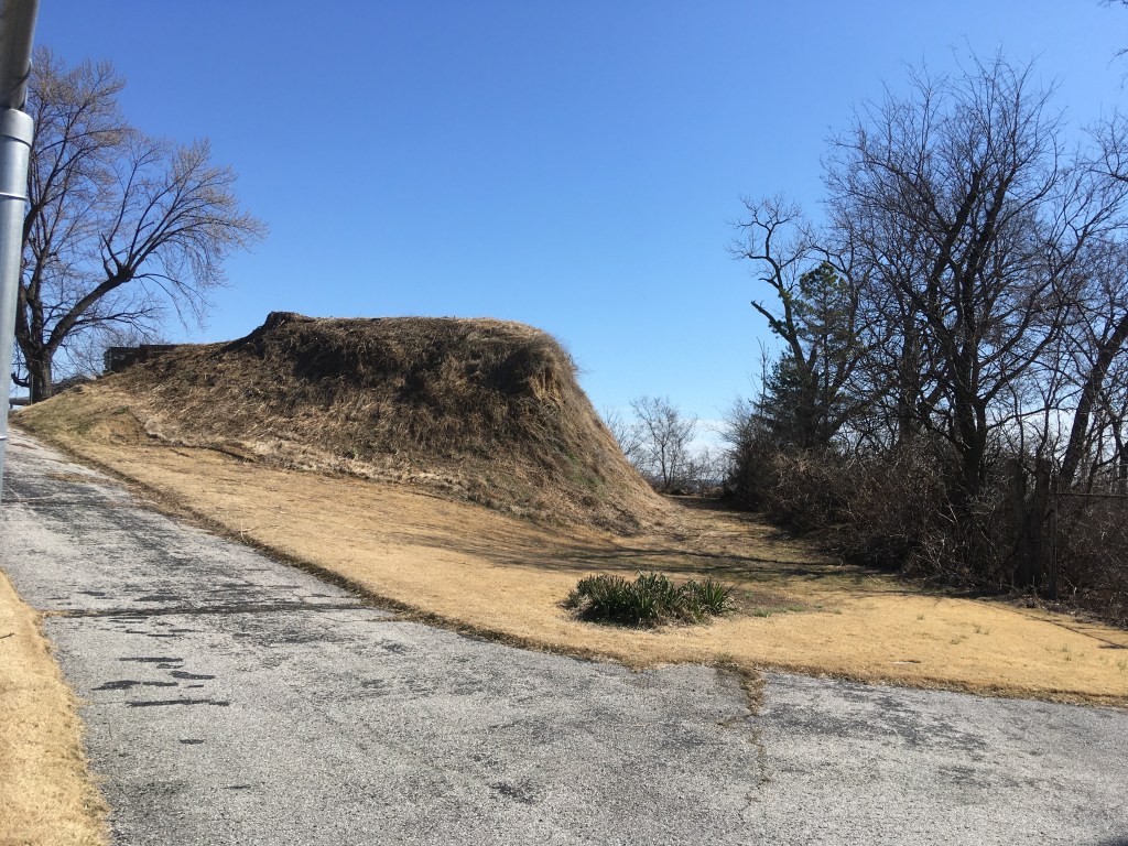
In the group of mounds that stood along the bluffs of the Mississippi River, Sugar Loaf Mound is the last survivor (presumably mound number 1). It sits a coded distance of 28125′ from the hub atop Big Mound at an azimuth angle of 207.36-degrees.
The 28125′ distance is navigational coding and relates to the 24750-mile equatorial circumference of which 281.25-miles would be 1/88th part.
The 207.36-degrees azimuth angle is also navigational and 2073.6-miles would be 1/12th of the 24883.2-mile circumference. The largest Egyptian Royal Cubit was 20.736″.
AUTHOR’S SUMMARY.
When I traveled around Middle America in the late 1960’s it was general knowledge that the “mounds” were built by the “mound builders” about 5000-years ago. However, in this new, enlightened age of political-correctness, the archaic concepts of “freedom of thought & expression” or “reason based on evidence” are past luxuries, pushed further & further into the background. Nowadays, there are other, more pressing considerations than “warts an’ all truth”, such as “racial sensitivity” issues and these determine what can and cannot be served up for public consumption. Out of this new, sensitive approach to the dissemination of information there are plenty of ego-stroking misattribution’s about history, which are tailored solely to bring pride to the local “indigenous populations”. Since the 1960’s we seem to have mislaid about 3500-4000 years of North American history and now our school-children are indoctrinated into believing that these great earth structures were put in place by local Indians less than one thousand years ago.
If one goes into the Cahokia Mounds State Historic Site and Cahokia Mounds Museum Society website this following statement appears relative to the mounds complex:
A great civilization of Mississippian peoples thrived at Cahokia long before European settlers came to America. A thousand years ago, this advanced society flourished in the fertile bottomland of the Mississippi River. From the earliest times Native North Americans gradually improved their lives. Each culture handed something of the old and new on to the next.
This is a deliberately vague, ambiguous and misleading statement, designed to draw all focus onto recent-era Indian people as the mound builders (without actually saying it).
Consider the statement: A great civilization of Mississippian peoples thrived at Cahokia long before European settlers came to America …Well yes, but could you please be a bit more specific? … Do you mean five thousand years ago?
Then we suddenly jump to: A thousand years ago, this advanced society flourished in the fertile bottomland of the Mississippi River … Well, that’s nice. Glad to know they were enjoying life, but are you saying that’s when the mounds were built or are you only inferring that by innuendo?
Then we get: From the earliest times Native North Americans gradually improved their lives. Each culture handed something of the old and new on to the next … Lovely, heart-rending stuff, but I’m a little lost here. When you say the earliest times, do you mean five thousand years ago when the mounds were built? Are you inferring that there’s an unbroken family link, stemming from the present, back to blood ancestors who built the mounds?
Moreover, the Timeline within the website starts in 700AD … and it looks like the other 3300-years or so got canned for the purposes of the Museum’s “political-correctness” & “racial sensitivity” obligations.
Beyond isolationist-dogma, control-freak interference & agendas, vested-interests pushing dumb-down history, lack-lustre scholarship, political-expediency & all that jazz, is there really any valid reason why we’re not allowed to know who built the mounds?
So, in consideration of what mainstream-academia is representing as North America’s long-term history, based upon archaeological evidence, my final question would be:
How did (circa) 1000 A.D. Indians lay out these giant structures, using known distance and angle codes found on mound complexes of Great Britain, Continental Europe or code-bearing sites around the Mediterranean … and built 5000 years ago?
Martin Doutré, July 16th, 2011©
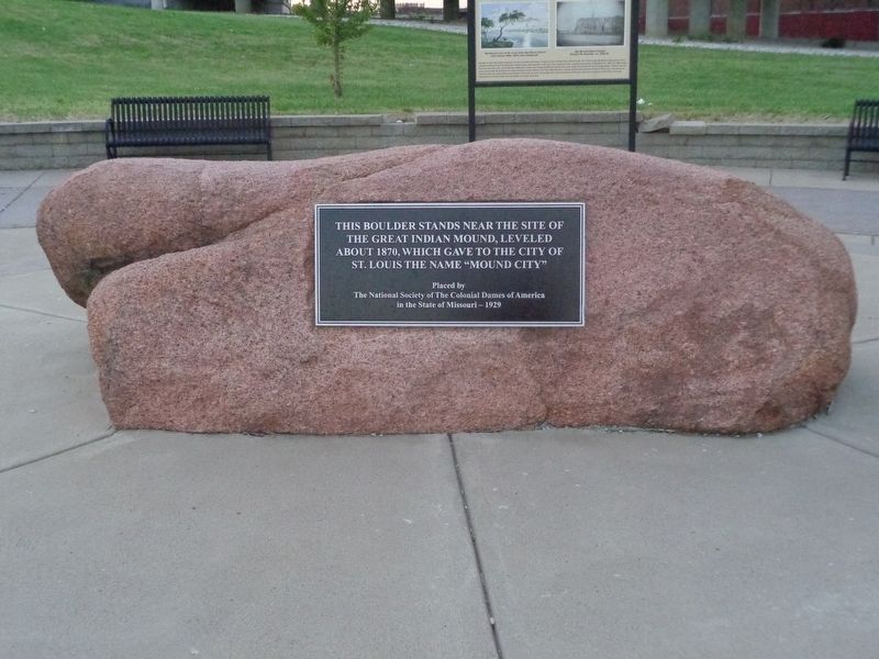
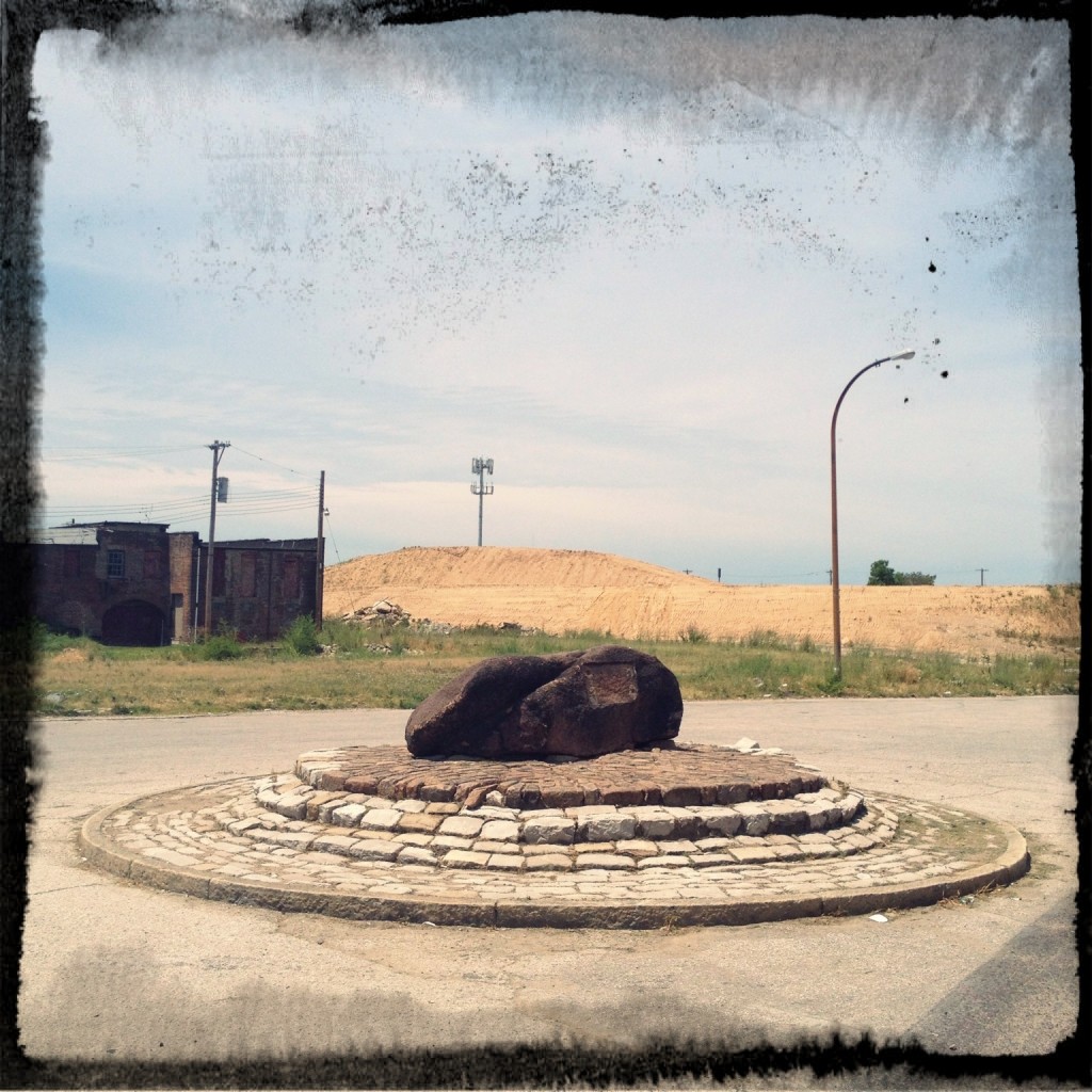
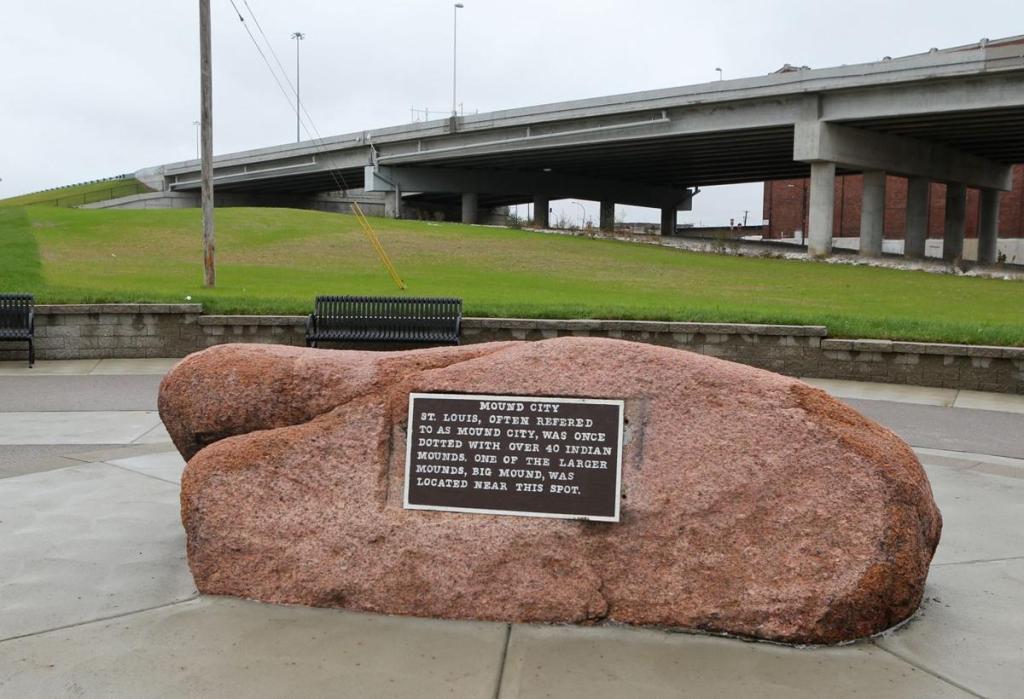
Additional resources for ancient global geomantic precession, encoding and symbology:
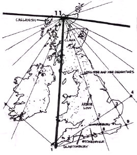
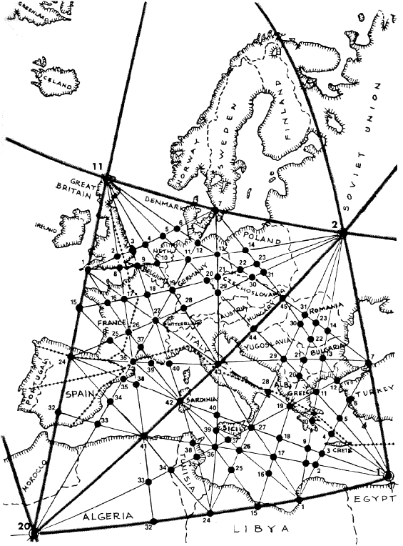
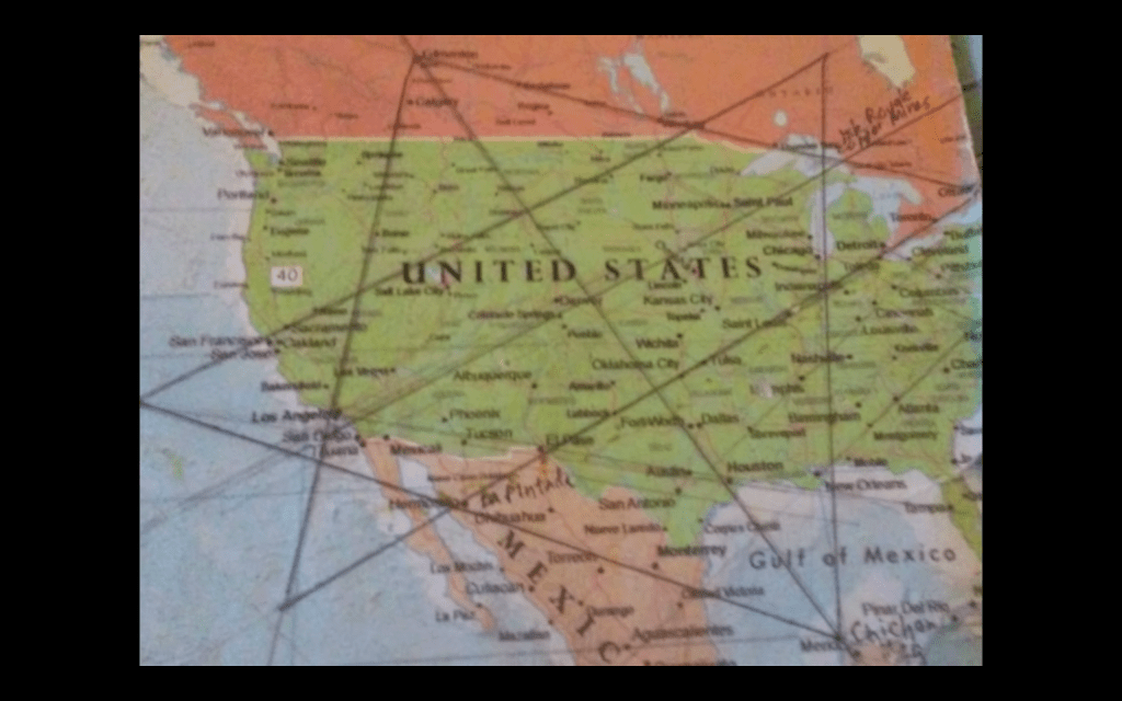
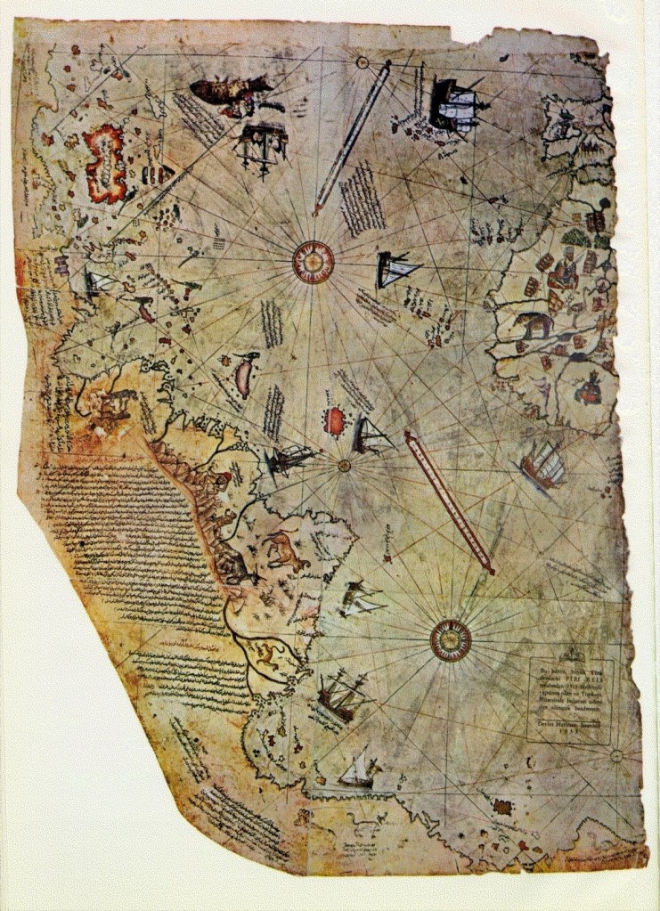
And my wonderings about a local site that could maybe fit in here too:
(Mostly minute & unanswerable) questions about Meramec Highlands Quarry aka Quarry Park aka Dee Koestering Park https://goo.gl/maps/7sVdztNgKrLTNPzv7
Why the interest in this Meramec blue limestone over other limestone in the area?
Why stack huge stones on top of each other in the woods?

Some are at strange angles. Others look like they have tumbled down. Did they tumble? If so, how? If not, why and how were they placed the way they were? How (and why) did each stone get to its (current) position?
Why don’t the little stones propping up the bigger stones crush?
Is there evidence of these stones being sawed? If so is it reproducible? How long would it have taken to cut all these?
Why was the site abandoned?
What’s underneath the big stones?
What are all the kinds of fossils in the rock? Have these been studied and recorded?
How was this particular Meramec blue limestone formed and why at this location?
How were the massive table top portions of stone extracted from the sides of the hill? Why were certain areas of the (bed)rock cut into diagonally while other rock areas close by appear not cut into?
Why do some stone slabs have mini drill holes close together while others don’t seem to?
Why is one section of rocks spaced apart in 2 to 3 major piles?
Who all has inhabited & owned this land over time? What groups & companies were involved and their histories & backgrounds?
Is all the stone accounted for, as in do quarry records say how much stone was extracted; who bought it; where it went (& is it still there now); and how much stone was left unsold or unsellable?
[While taking notes at site iPhone froze & needed hard reset: power + home buttons]
Originally tweeted by j dippold (@JJDippold) on March 3, 2020.

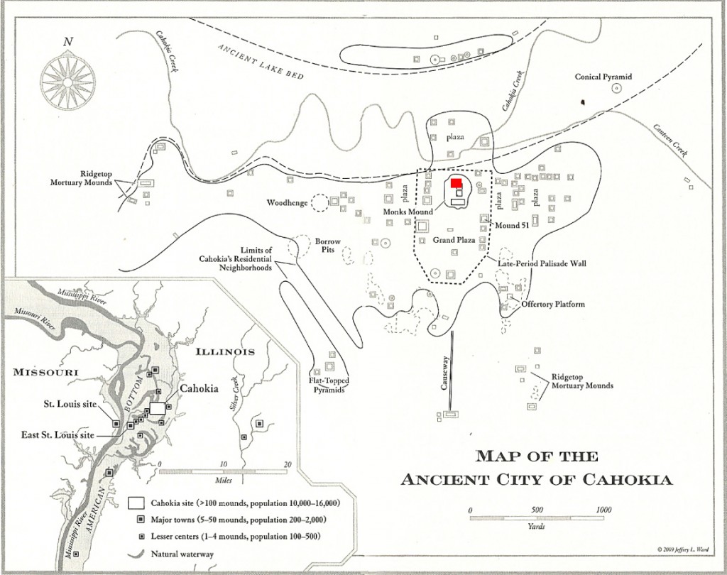
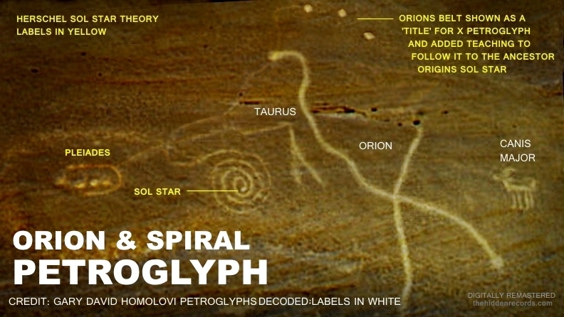
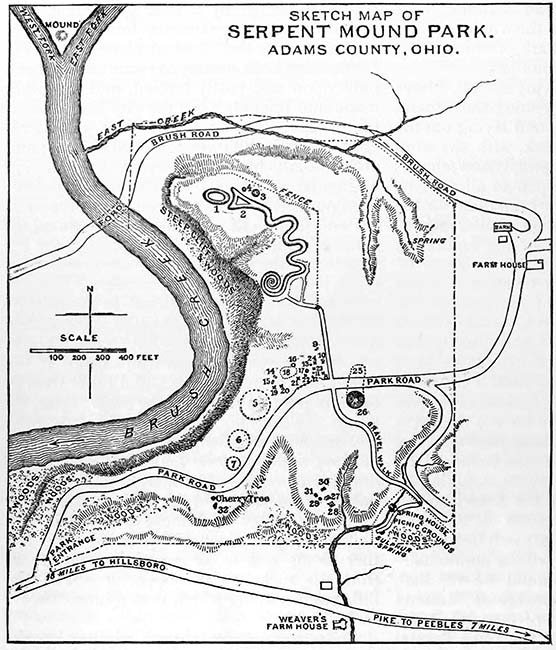
2 thoughts on “Cahokia Mounds: Star Map Of The Pleiades And University For Navigation And Astronomy?”